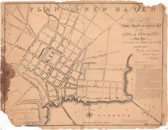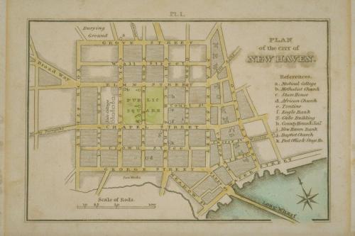
Plan of the city of New Haven.
ArtistDrawn by
John Warner Barber
(American, 1798 - 1885)
Date1825
MediumWood engraving; printer's ink and watercolor on paper
DimensionsPrimary Dimensions (overall height x width): 4 3/4 x 6 5/16in. (12 x 16cm)
ClassificationsGraphics
Credit LineConnecticut Museum of Culture and History collection
Object number1950.575.5
DescriptionPlan of the city of New Haven showing its layout in squares. The names of the streets are inscribed and the locations of the following buildings are indicated: a. Medical College, b. Methodist Church, c. State House, d. African Church, e. Tontine [Hotel], f. Eagle Bank, g. Glebe Building, h. County House & Jail, i. New Haven Bank, j. Baptist Church, k. Post Office. The Burying Ground , Tan Works and Long Wharf are also labeled.
NotesSubject Note: Wood engraving from Views in New Haven and its Vicinity, New Haven, 1825.Status
Not on view