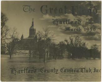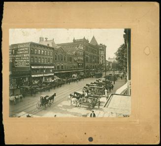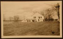


1936 Flood, Hartford
PhotographerPhotographed by
John Thibault
DateMarch 1936
MediumPhotography; gelatin silver prints on paper
DimensionsPrimary Dimensions (image height x width, and smaller): 2 3/8 x 4 1/4in. (6 x 10.8cm)
Sheet (height x width ): 2 3/4 x 4 1/2in. (7 x 11.4cm)
ClassificationsGraphics
Credit LineGift of Cathy Del Bianco
Object number2001.137.1-.69
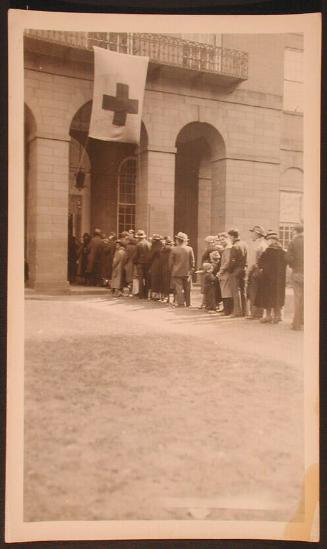
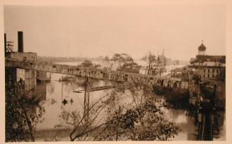
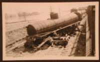
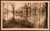
DescriptionViews of floodwaters and wreckage of the March 1936 flood in Hartford, East Hartford, and South Glastonbury areas. Photographs include automobiles, commercial buildings, gas stations, houses, oil tanks, railroad tracks, streets, tobacco barns and fields, trains, and trolley tracks.
Locations in East Hartford include South Main Street, Willow Brook near Pratt & Whitney, Scott Street, Darling Street, Pleasant Street, the tobacco lots behind High Street, the East Hartford meadows, tobacco lots near Naubec Avenue, Pitcain Street, the Brewer house, and church corner on the Boulevard. Locations in South Glastonbury show the Kellem place. Locations in Hartford include State Street, Front Street, the Hotel Bond on Asylum Street, the Soldiers and Sailors Memorial, and Village Street from the State Theater.
Other locations or businesses shown are O'Meara's, Cox's gas station, the Oasis club, Benn's house, and Merrill's house.
Some aerial views show the Connecticut River, Hartford including Travelers Tower, and the Colt Factory. Some images show men in rowboats and canoes, a man with a rifle standing near a sawhorse, a derailed train, and a car getting gas at the edge of the floodwaters.
Status
Not on view