Map Showing the Glacial Geography of Connecticut
SurveyorGeology by
Richard Foster Flint
(American, 1901 - 1976)
PublisherUnder the supervision of
Wilton Everett Britton
(American, 1868 - 1939)
After a work byAfter a work by
United States Geological Survey
(American, founded 1879)
PrinterPrinted by
A. Hoen & Company
(American, founded 1848)
PublisherPublished by
State Geological and Natural History Survey of Connecticut
(American, founded 1903)
Date1930
MediumLithography; black and colored printer's inks on wove paper
DimensionsPrimary Dimensions (image height x width): 38 3/4 x 53 1/2in. (98.4 x 135.9cm)
Sheet (height x width): 41 1/8 x 55 1/2in. (104.5 x 141cm)
ClassificationsGraphics
Credit LineGift of the Plumb Memorial Library
Object number2003.340.1
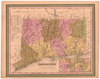
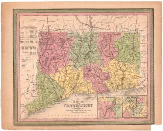
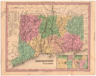
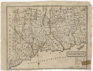
DescriptionMap of the state of Connecticut, including the Long Island Sound, showing the different landforms in the state in the recent and Pleistocene eras using colors and lines are used to depict them. Elevation is conveyed with contour lines, and rivers, lakes and ponds are also shown. Roads and city streets are shown, with dots probably indicating the locations of buildings.
Label TextRichard Foster Flint was a young geology professor at Yale when he conducted a survey of Connecticut's glacial features for the State Geological and Natural History Survey, recording the results both in a published bulletin and in this large 1930 map. The map locates geological features associated with glaciation, most of which can still be seen in the Connecticut landscape. These include eskers, drumlins, spillways, glaciofluvial deposits, and sand and gravel deposits left in temporary lakes formed as the glaciers retreated.
NotesCartographic Note: Scale: 1:125,000Status
Not on view