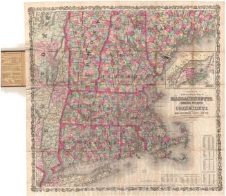
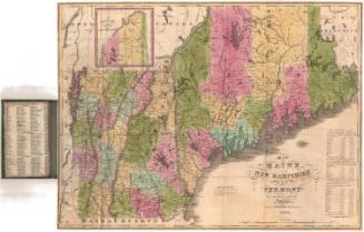
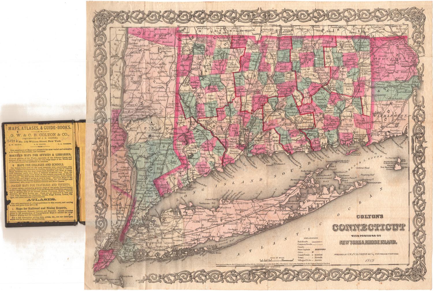
A Map of the New England States: Maine, New Hampshire, Vermont, Massachusetts, Rhode Island and Connecticut
PrintmakerEngraved by
John Peter Van Ness Throop
(American, 1794 - 1860)
PublisherPublished by
Nathan Hale
(American, 1784 - 1863)
Date1826
MediumEngraving; black printer's ink on wove paper, lined with linen, with paper covers, in paper-covered cardboard box
DimensionsPrimary Dimensions (image height x width): 44 5/8 x 38 5/8in. (113.3 x 98.1cm)
Sheet (height x width): 45 1/2 x 39 5/8in. (115.6 x 100.6cm)
Mount (height x width): 46 x 40in. (116.8 x 101.6cm)
ClassificationsGraphics
Credit LineMuseum purchase
Object number2007.86.0
DescriptionFolding map of the New England states, the eastern portion of New York, and Lower Canada. The states are divided into counties and towns, both of which are labeled. Roads, turnpike roads, churches, towns and villages are shown. On the right side is an inset map of northeastern Maine. Physical features depicted include elevation, conveyed with hachure marks; rivers; lakes; and islands.
Label TextThe Nathan Hale who published this map of New England was the nephew of the Revolutionary War hero from Coventry, Connecticut, who was hanged as a spy by the British. The publisher Nathan Hale was born in Westhampton, Massachusetts, and spent most of his life in Boston. He is best known as a publisher of periodicals, notably the North American Review, but he was also very interested in maps. In the 1830s, he would develop a method of printing maps from stereotype plates using actual type for the inscriptions. His map of the New England States predates those experiments; all of the lettering was done by hand. The calligraphic title is especially fancy and very finely engraved.
NotesCartographic Note: Scale: 1 inch equals 8 milesStatus
Not on view