The "Good Roads" Survey of New England
PrinterPrinted by
F. S. Blanchard and Company
(American, founded before 1841)
PublisherPublished by
F. S. Blanchard and Company
(American, founded before 1841)
Date1905
MediumLithography; black and red printer's ink on wove paper, lined with linen, in cloth-bound cardboard covers
DimensionsPrimary Dimensions (image height x width): 35 x 31 1/2in. (88.9 x 80cm)
Sheet (height x width): 36 x 31 3/4in. (91.4 x 80.6cm)
Mount (height x width): 36 x 31 3/4in. (91.4 x 80.6cm)
ClassificationsGraphics
Credit LineGift of Richard Malley
Object number2005.201.0
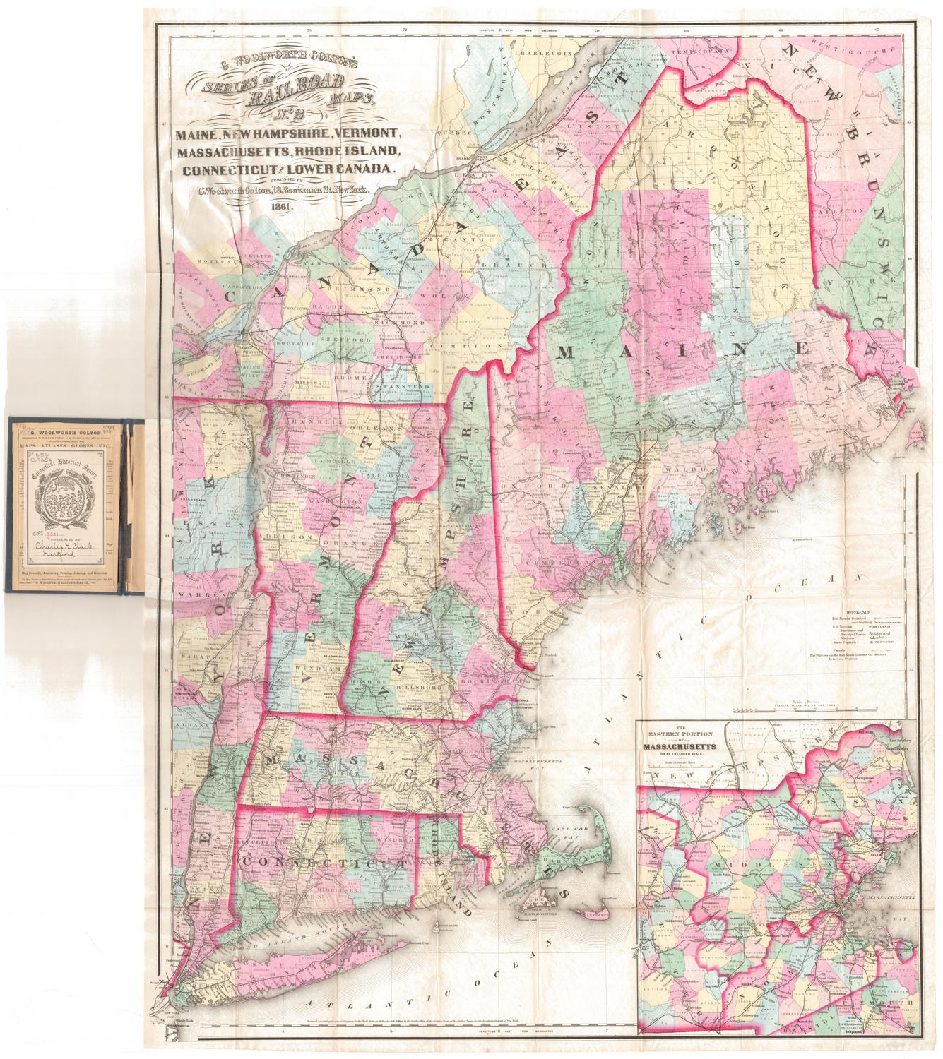
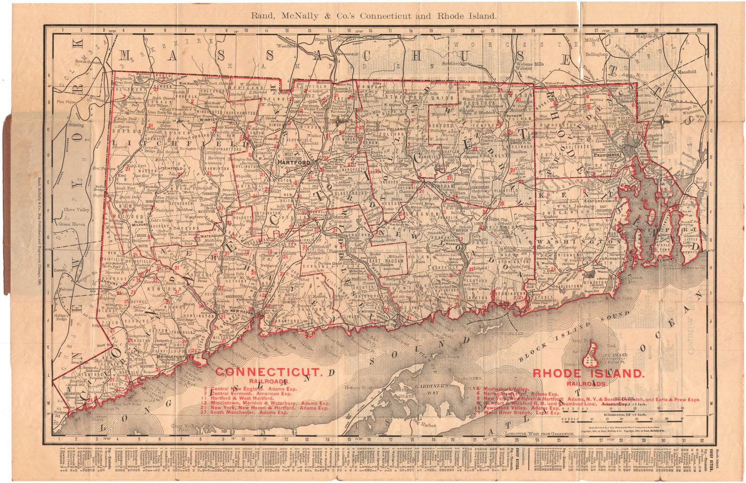
DescriptionFolding map of New England and part of eastern New York, showing the "good roads" in the region. Railroads and electric railroad lines are also shown. In Connecticut, the New York, New Haven and Hartford Railroad is dominant, with Central New England Railroad and Vermont Central Railroad lines also appearing. Post offices are marked with open circles, and state capitals with stars. In the top left corner is a distance table by rail for the region. On the right side are population tables for Connecticut, Maine, Massachusetts, New Hampshire, Rhode Island, and Vermont, listed by town.
Label TextThe "good roads" movement began in the late nineteenth century, as bicyclists found that existing roads were often unsuitable for bicycle travel. In the early twentieth century, automobile clubs were quick to pick up the cause. In Connecticut, as elsewhere, active lobbying by these groups resulted in state funding being made available for road improvements. By the 1920s, New England boasted some of the best roads in the nation. The fact that this map includes extensive information on public transportation by railroad and trolley suggests that it may have been intended primarily for bicyclists rather than for drivers of automobiles. Bicyclists would have used railroads and trolleys to transport their wheels to areas that had good roads for bicycle trips.
NotesCartographic Note: Scale: 1 inch equals 8 1/2 milesStatus
Not on view
Matthews-Northrup Company
1913