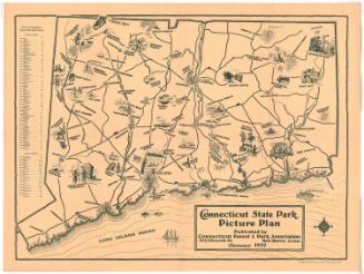
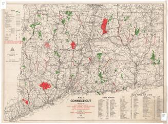
Connecticut Recreational Areas and Facilites
MakerCopyrighted by
National Survey Co.
(American, founded 1912)
PublisherPublished by
State Park and Forest Commission
(American, 1921 - 1971)
PublisherPublished by
State Board of Fisheries and Game
(American, 1913 - 1971)
PhotographerPhotographs by
Josef Scalyea
(Italian-American, 1913 - 2004)
Date1945
MediumOffset lithography; black and colored printer's inks on wove paper
DimensionsPrimary Dimensions (image height x width): 19 3/8 x 27in. (49.2 x 68.6cm)
Sheet (height x width): 20 x 31 1/2in. (50.8 x 80cm)
ClassificationsGraphics
Credit LineConnecticut Museum of Culture and History collection
Object number2004.162.0
DescriptionFolding map of the state of Connecticut, including the Long Island Sound. The map shows state parks, colored red, and state forests, colored green, both of which are also listed in the key on the left side. Cities are labeled and denoted with circles of varying sizes according to population. Regulated streams are marked with broken red lines, regulated hunting grounds with yellow stars, and regulated lakes and ponds in brown. Highways, local roads and railroads are shown. Highway picnic areas and monuments are marked with red symbols. Also on the left side of the sheet are drawings of of the outdoor activities Connecticut offers: boat, camping, visiting historic sites, picnicking, swimming, hiking trails, visiting view points, and participating in winter sports.
On the back, there are black-and-white photographs of the state's parks and forests, a map of Connecticut with parks marked with circles and forests marked with triangles, a mileage chart listing towns and their distances from the parks and forests, and information about hunting and fishing.
On the back, there are black-and-white photographs of the state's parks and forests, a map of Connecticut with parks marked with circles and forests marked with triangles, a mileage chart listing towns and their distances from the parks and forests, and information about hunting and fishing.
Label TextVarious forms of outdoor recreation, ranging from hiking and picknicking through horseback riding and fishing are promoted on this 1945 recreational map. The photographs on the back of the map were taken by Sergeant Josef Scalyea, who immigrated from Italy as a boy and grew up working on a peach farm in South Glastonbury. The fact that Scalyea's military rank is included in the credit line, suggests that he was still in active service when he took the photographs. Scalyea served as a photographer with the Army Air Corps during World War II. Following the war, he settled in the Pacific Northwest, where he had a distinguished career as a photographer.
NotesCartographic Note: Scale: 13/16 inch equals 4 milesStatus
Not on view

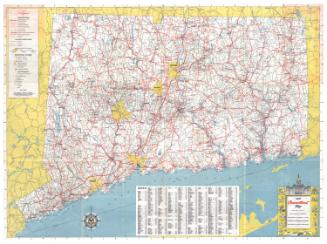

Connecticut State Highway Department
1934