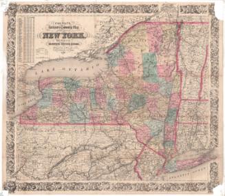
The National Publishing Company's Railroad, Post Office, Township and County Map
PublisherPublished by the
National Publishing Company
(American, before 1873 - after 1919)
Date1902
MediumLithography; colored printer's inks on wove paper mounted on fabric
DimensionsPrimary Dimensions (image height x width): 35 1/4 x 37 1/4in. (89.5 x 94.6cm)
Sheet (height x width): 38 x 39in. (96.5 x 99.1cm)
ClassificationsGraphics
Credit LineConnecticut Museum of Culture and History collection
Object number2012.312.302
DescriptionMap of Massachusetts, Connecticut, and Rhode Island, with Vermont, New Hampshire, and Maine to the north, the Atlantic Ocean to the east, Long Island Sound and part of Long Island to the south, and New York State to the west. Counties are shown in different colors and the same colors are used to outline the townships within each county. Many hills, mountains, rivers, streams and other geographical features are shown and named. Elevation is indicated by hachure marks. Railroads, steamship lines and mailboat routes are clearly shown, but highways and other roads are not included. A small map of the United States showing political divisions is at lower right. Tables list travel distances between major cities; counties and county seats; and population in each census between 1800 and 1900. An index to cities and towns is at upper right with coordinates corresponding to letters in the upper and lower margins and numbers in the left and right margins.
Label TextIt's hard to imagine a map with no roads on it. Even very early maps usually show at least some roads linking the early towns. This 1902 map of southern New England was apparently intended for use by the general public, but it includes no roads at all, just railroad and steamship lines. This clearly demonstrates just how important these means of public transportation were during this period. This situation was about to change as more and more Americans took to the road, first on bicycles and then in their own private automobiles.
NotesCartographic Note: Approximately five miles to one inchStatus
Not on view


