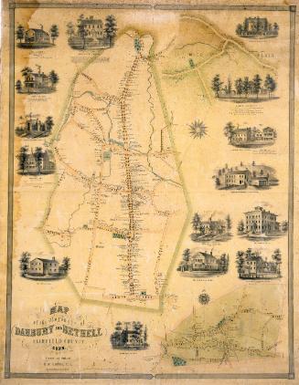
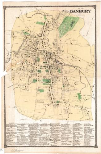
Map of Danbury Connecticut
SurveyorSurveyed by
E. C. Smith
(American)
SurveyorSurveyed by
Edward Van Zandt
(American, born 1804)
DraftsmanVignettes drawn by
George Hayward
(Anglo-American, 1800 - 1872)
PrintmakerLithographed by
George Hayward
(Anglo-American, 1800 - 1872)
PublisherPublished by
E. C. Smith
(American)
PublisherPublished by
Edward Van Zandt
(American, born 1804)
Dateprobably 1858
MediumLithography; printer's ink and watercolor on wove paper mounted on fabric
DimensionsPrimary Dimensions (image height x width): 49 1/2 x 40in. (125.7 x 101.6cm)
Sheet (height x width): 52 x 42 3/4in. (132.1 x 108.6cm)
ClassificationsGraphics
Credit LineConnecticut Museum of Culture and History collection
Object number2012.312.301
DescriptionMap of Danbury, Connecticut. The central area, probably representing the borough of Danbury, is surrounded by a red line. All streets are named and footprints of buildings are shown with names of property owners. Rivers and ponds are colored blue but are not named. Parks and cemeteries are colored green. The Danbury & Norwalk Railroad terminates in the town. The map is surrounded by nine large vignettes depicting Danbury from Hayes Hill; Sturdevant's Wool Hat Factory; Tweedy, White & Co. Fur Hat Manufactory; the residence of A. E. Tweedy; E.S. Davis Paper Box Manufactory; the Methodist Church and parsonage; Tweedy Brothers Fur Hat Manufactory; the new Congregational Church; and Wooster House."
Label TextMost large town maps of the 1850s were printed and published in Philadelphia, and most were produced during the early part of the decade. Such maps probably served as the inspiration for E.C. Smith and Edward Van Zandt, two civil engineers who conducted the surveys on which this map of Danbury, Connecticut is based and published the map in New York City towards the end of the decade. It is an especially attractive example of the genre, large in scale and clear and simple in its presentation. The unusually large and attractive vignettes are the work of George Hayward, an English-born artist known for his lithographic views. The large vignette showing Danbury from Hayes Hill was also published as a separate print by Smith & Van Zandt.
NotesCartographic Note: One inch equals 200 feetDate Note: George Hayward view of Danbury from Hayes Hill was published by Smith and van Zandt about 1858. The map probably dates from about the same time.
Status
Not on view