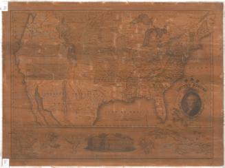
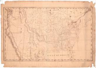
Map of the United States with its Territories.including also a part of Upper and Lower Canada and Mexico.
PublisherPublished by
Reed & Barber
(American, founded 1837)
Date1854
MediumEngraving; black printer's ink and watercolor on wove paper mounted on fabric
DimensionsPrimary Dimensions (image height x width): 28 1/4 x 42 1/4in. (71.8 x 107.3cm)
Sheet (height x width): 31 x 45 1/2in. (78.7 x 115.6cm)
ClassificationsGraphics
Credit LineMuseum purchase
Object number2012.312.299
DescriptionMap of the United States with part of Canada to the north, the Atlantic Ocean to the east, the Gulf of Mexico and part of Mexico to the south, and the Pacific Ocean to the west. Territories include Nebraska Territory, Indian Territory, and Oregon Territory. Minnesota, Utah and Washington are not identified as territories, though they had not yet achieved statehood. The gold region of California is clearly indicated. Larger states are subdivided into counties. Names of major Indian tribes are shown. Rivers and mountains are shown; elevation is indicated by hachure marks. A vignette of the the United States Capitol appears beneath the title. A vignette showing the White House appears at lower center.
Label TextThe Connecticut Historical Society has two maps of the United States published by Reed & Barber in Hartford, Connecticut. The earlier one was published in 1842, when Texas was not yet a state, and gold had not yet been discovered in California. This later map, published in 1854, shows the great changes that had taken place in just twelve years. Vast new territories had been acquired from Mexico following the Mexican War, and five large new states had been added to the Union: Florida, Texas, Iowa, Wisconsin, and California. 1854 was the year of the Kansas-Nebraska Act, but this map was evidently published before the act went into effect, since it shows both future states--and most of the northern plains--as Nebraska Territory. The Kansas-Nebraska Act let settlers decide whether slavery would be allowed within each territory, and quickly led to armed conflict between supporters of slavery and its opponents.
NotesCartographic Note:One and one half inches equals 100 milesStatus
Not on view
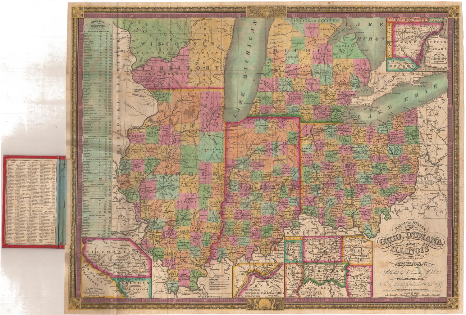
Samuel Augustus Mitchell
1834
Samuel Augustus Mitchell
1835