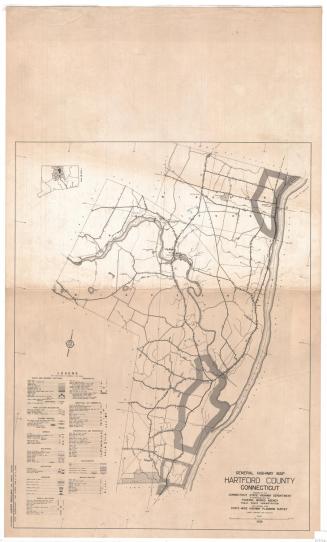
Hartford County, Connecticut
SurveyorSurveyed by
United States Geological Survey
(American, founded 1879)
MakerEdited by
United States Geological Survey
(American, founded 1879)
PublisherPublished by
United States Geological Survey
(American, founded 1879)
RetailerSold by
United States Geological Survey
(American, founded 1879)
DistributorDistributed by
Connecticut Department of Environmental Protection
(American, founded 1971)
Date1974
MediumOffset lithography; black and colored printer's inks on wove paper
DimensionsPrimary Dimensions (image height x width): 43 1/2 x 41in. (110.5 x 104.1cm)
Sheet (height x width): 50 x 43 1/2in. (127 x 110.5cm)
ClassificationsGraphics
Credit LineGift of Jack E. Kuras
Object number1994.250.0
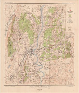
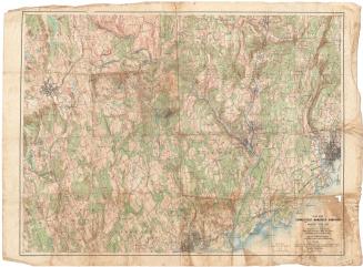
DescriptionTopographical map of Hartford County, Connecticut, showing elevation, wooded and urban areas, highways, local roads, parks, and water. The Connecticut and Farmington Rivers are shown, as are ponds and reservoirs. Shaded and open black squares are presumably used to denote buildings.
Label TextGeological survey maps provide a detailed and largely accurate view of the shape of the land and what is on it, the hills and valleys, rivers and ponds, swamps and cities. In the twentieth century these maps were used by everyone from students to scientists for a wide variety of purposes, ranging from finding a good place to take a weekend hike, to providing a basis on which other scientific data could be superimposed. The information on the maps can be helpful for modern scholars who study changing ecosystems and track the impact of urbanization and climate change. In the twentieth-first century, the traditional work of the surveyors who created these geological survey maps and other earlier maps has been largely superceded by geospatial technology using global satellite systems which facilitate the creation of digital maps that are much more accurate than any previous maps.
NotesCartographic Note: Scale: 1:50,000Status
Not on view