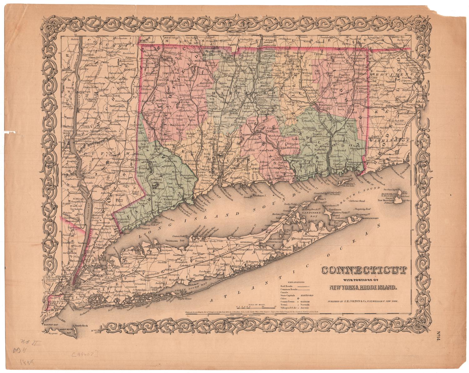
Map of the State of Connecticut
MakerMade by
J. B. Beers & Co.
(American, founded 1870)
Date1884
MediumLithography; black printer's ink and watercolor on wove paper, lined with linen, in cardboard covers
DimensionsPrimary Dimensions (image height x width): 35 5/8 x 46 1/4in. (90.5 x 117.5cm)
Sheet (height x width): 49 x 47 1/2in. (124.5 x 120.7cm)
Mount (height x width): 49 x 47 1/2in. (124.5 x 120.7cm)
ClassificationsGraphics
Credit LineGift of Frank Howard
Object number1975.104.3
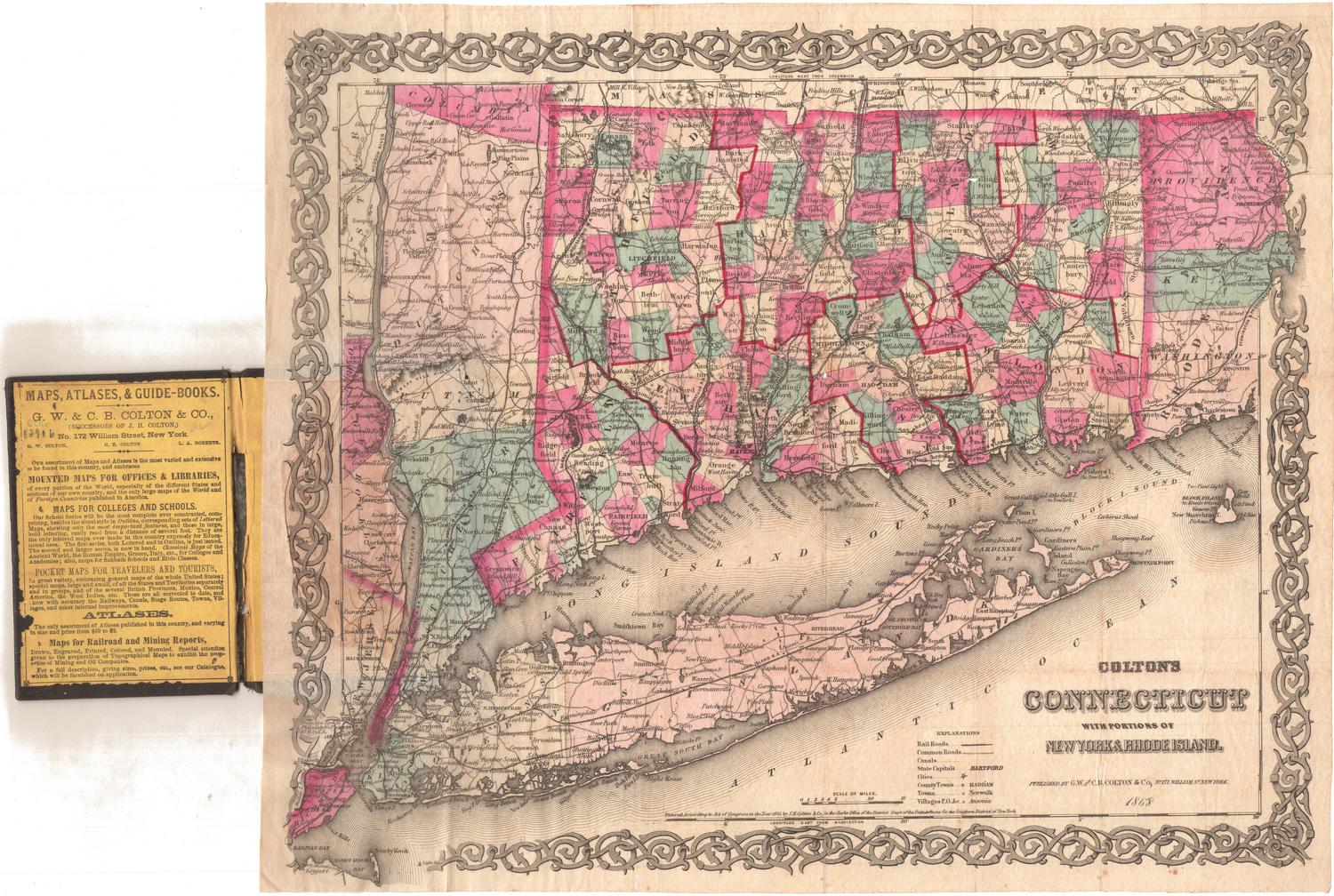
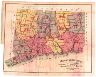
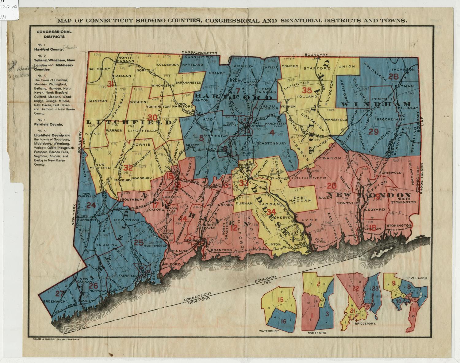
DescriptionMap of the state of Connecticut, with the border of Massachusetts to the north, the border of Rhode Island to the east, part of Long Island and the Long Island Sound to the south, and the border of New York to the west. The state is divided into counties, outlined in dark pink, and towns, colored pink, yellow, or green. Dark green and dark pink are used to denote cities, possibly showing cities of different sizes. Shading is used for natural oyster beds. Physical features depicted include elevation, conveyed with hachure marks; rivers; and lakes. Railroad lines shown include the New York, New Haven and Hartford; New Haven and Northampton; Housatonic; Danbury and Norwalk; New York and New England; Naugatuck; Boston and New York Air Line; Hartford and Connecticut Western; Connecticut Central; Connecticut Valley; New London Northern; and Norwich and Worcester Railroads. The decorative cartouche features Hartford's capitol building. To the left of the map is an index of places in the state, and at the bottom is a list of the congressional and senatorial districts. Below this are business notices for Bridgeport, Norwalk and South Norwalk.
Label TextJames Botsford Beers was the patriarch of the Beers family of map publishers. He was born in Newtown, Connecticut on October 16, 1811. He lived in Maryland before settling in New York in the 1840s. J. B. Beers & Co. began publishing maps and county atlases about 1870, and an 1878 catalog lists more than 150 county and city atlases and about sixty maps offered for sale by the firm. Beers's son, Frederick W. Beers, also published maps and atlases under his own name, and a distant cousin, John Hobart Beers, had a map publishing firm in Chicago. Nevertheless, the family retained close connections with Connecticut. J. B. Beers died in Brooklyn in 1901 at the age of ninety, but he is buried in Newtown, the little Connecticut town where he was born.
NotesCartographic Note: Scale: 1 inch equals 2 1/2 milesStatus
Not on view
Kellogg & Bulkeley
1910-1915