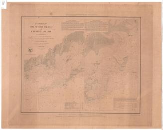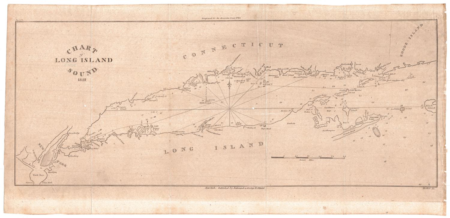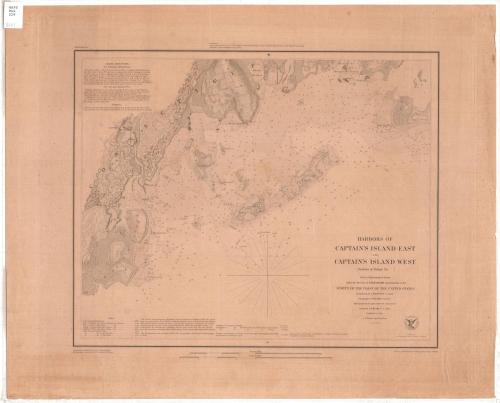
Harbors of Captain's Island East and Captain's Island West
PublisherPublished by
United States Coast Survey
(American, founded 1807)
SurveyorUnder the direction of
Ferdinand Rudolph Hassler
(American, 1770 - 1843)
SurveyorTriangulation by
James Ferguson
(American, 1797 - 1867)
SurveyorTopography by
Constant M. Eakin
(French-American, 1794 - 1870)
SurveyorHydrography by
George S. Blake
(American, 1802 - 1871)
DraftsmanDrawn by
William Luce
(American, 1825 - 1863)
PrintmakerEngraved by
Albert Rolle
(German-American)
Date1849
MediumEngraving; printer's ink on wove paper
DimensionsPrimary Dimensions (image height x width): 14 x 17 1/4in. (35.6 x 43.8cm)
Platemark (height x width): 17 3/4 x 21 1/4in. (45.1 x 54cm)
Sheet (height x width): 18 3/4 x 23in. (47.6 x 58.4cm)
ClassificationsGraphics
Credit LineGift of the Charleston Library Society
Object number1995.205.2
DescriptionChart of the coast of Greenwich, Connecticut from Minursen Island to Flat Neck Point, including the Byram River, Byram's Point, Horseneck Point, Bush's Harbor, Chimney Corner, and the mouth of Mannock's River. The nature of the terrain is indicated; elevation is indicated by hachure marks. Roads and buildings are shown, with a cluster of buildings in the village of Saw-Pits. Islands include Captain's Island East (Little Captain's Island) and Captain's Island West (Great Captain's Island), and Calf Island. Soundings are in feet, up to eighteen feet. Sailing directions are at upper left and an explanation of tides is at lower left.
Label TextA harbor of refuge is a port, harbor, inlet, or other body of water sheltered from heavy seas by land and in which a vessel can navigate and safely moor. While Greenwich, Connecticut was not a major port in the nineteenth century, its offshore islands provided protection from most winds and a place where vessels could anchor to wait for daylight or to ride out a storm. This 1849 chart provides detailed sailing instructions for how to reach the anchorages behind the two islands, which today are known as Great Captain's Island and Little Captain's Island.
NotesCartographic Note: Scale 1/20,000Status
Not on view