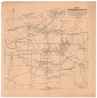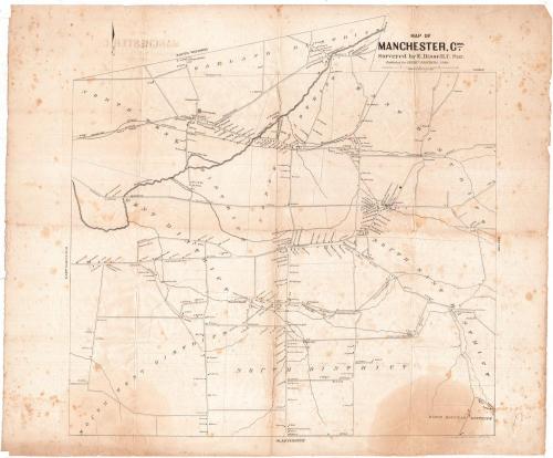
Map of Manchester, Conn.
SurveyorSurveyed by
Eli Bissell
(American, 1786 - 1866)
PrinterPrinted by
Kelloggs & Comstock
(American, 1848 - 1850)
PublisherPublished for
Cheney Brothers Silk Manufacturing Company
(American)
Date1849
MediumLithography; black printer's ink on wove paper
DimensionsPrimary Dimensions (image height x width): 22 x 22in. (55.9 x 55.9cm)
Sheet (height x width): 23 1/2 x 28in. (59.7 x 71.1cm)
Sheet (height x width): 23 1/2 x 28in. (59.7 x 71.1cm)
ClassificationsGraphics
Credit LineGift of John Hall Sage
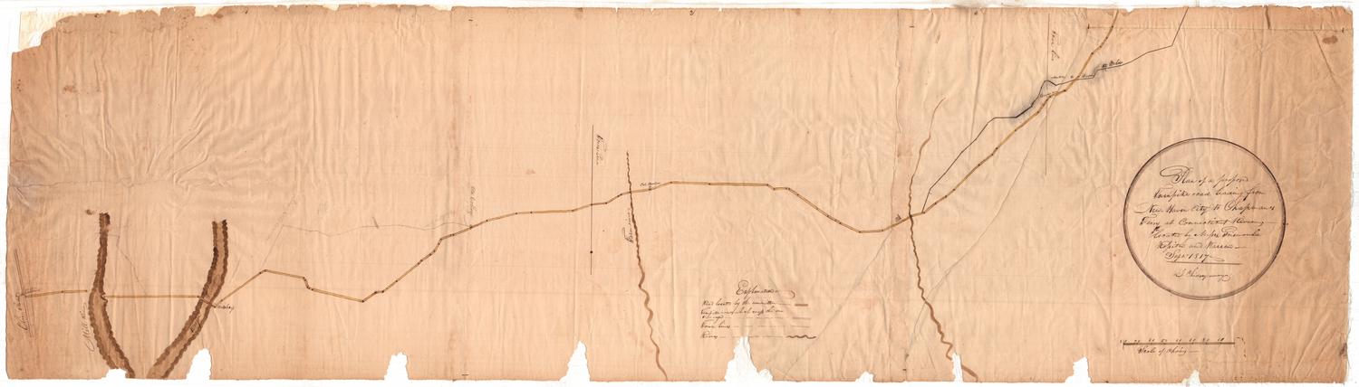
DescriptionMap of Manchester, Connecticut, with South Windsor and Vernon to the north, Bolton to the east, Glastonbury to the south, and East Hartford to the east. The town is divided into nine districts. The Hockanum River and its tributaries are shown. Elevation is not indicated. The Hartford and Providence Railroad runs through the northern part of town. Major roads include the Tolland Turnpike and the Providence Turnpike, each with its turnpike gate. Churches, cemeteries, factories, post offices, schools, and stores are shown. Locations of houses are shown with names of property owners. Two stone quarries are located in the northwest part of town. The Wyllys Copper Mine is located in the southeast part of town. Businesses include the Cheney Brothers Silk Mills, Bunce's Woolen Mill, Eagle Hills Woolen Mill, Bunce's Machine Shop, T. Keeney's Paper Mill, Hemingway's Store, Jones Store and Post Office, Keeney and Fitzgerald's Paper Mill, Risley's Store, Hudson's Oakland Mill, and Buckland's Tavern.
Object number1905.9.1
NotesCartographic Note: One inch equals one-quarter mileOn View
Not on view