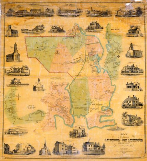
Map of the Towns of Saybrook and Old Saybrook, Middlesex County, Connecticut
SurveyorSurveyed by
E. M. Woodford
(American, 1824 - 1862)
PrintmakerLithographed by
Friend & Aub
(American, founded 1852)
DraftsmanDrawn by
E. M. Woodford
(American, 1824 - 1862)
PrinterPrinted by
Wagner & McGuigan
(American, 1845 - 1859)
PublisherPublished by
Richard Clark
(American)
Date1853
MediumLithography; black printer's ink and watercolor on wove paper mounted on fabric
DimensionsPrimary Dimensions (image height x width): 46 3/4 x 42 1/2in. (118.7 x 108cm)
Sheet (height x width): 48 3/4 x 45in. (123.8 x 114.3cm)
ClassificationsGraphics
Credit LineConnecticut Museum of Culture and History collection
Object number2012.312.294
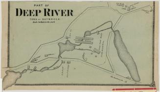
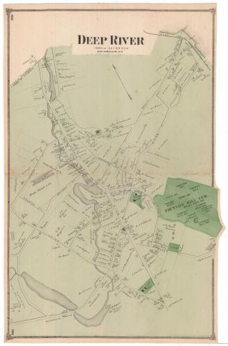
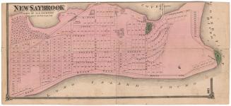
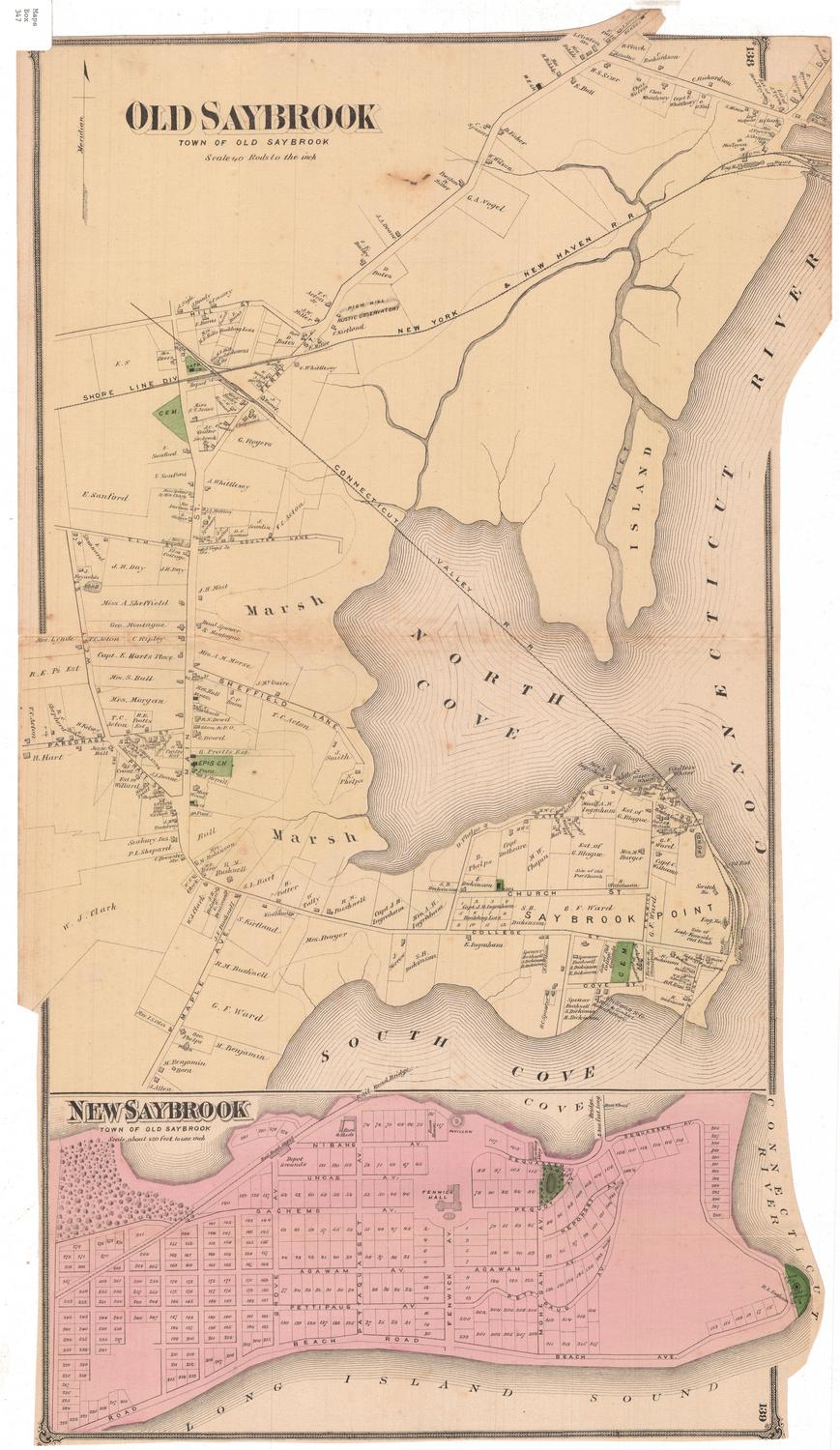
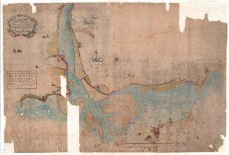
DescriptionMap of the towns of Saybrook and Old Saybrook, Connecticut, with Chester to the north, the Connecticut River to the east, Long Island Sound to the south, and Westbrook and Killingworth to the west. The locations of streams, forests, and marshes are indicated. Some roads are named and buildings are labelled with names of property owners. The New Haven and New London Railroad and the railroad ferry and a steam ferry across the Connecticut River are shown. Separate detailed map show the villages of Old Saybrook and Deep River and the borough of Essex. Saybrook Fort appears on both the main map and the detailed map of Old Saybrook. Vignettes surrounding the maps depict Saybrook Point Lighthouse, Saybrook Bank in Essex, Grace Church in Old Saybrook, College Place at Saybrook Point, Deep River Bank, the Baptist Church in Essex, Union House in Essex (a hotel with a tavern sign), the Methodist Episcopal Church in Essex, the First Congregational Church in Old Saybrook, Pratt Brothers Ivory Works, S. M. Comstock and Company's Comb Manufactory, Jennings and Company's Manufactory of Augurs, Gimblets, etc., N. B. Pratt's Factory, R. S. Williams's Pump Machinery, George Read and Company's Ivory Comb Manufactory, and the residences of Ulysses Pratt, E. S. Williams, Rev. H. Wooster, O. Cobb, W. P. Vinal, R. E. Pratt, A. Sheffield, and Captain E. E. Morgan.
Label TextThis 1853 map is confusing to modern viewers for two reasons. First, the overall layout is cramped and crowded. The detailed maps of the villages are arranged around the main map of the towns with no regard for their actual geographical relationship, like the pieces of a jigsaw puzzle. The detailed map of Deep River is placed on the east side of the Connecticut River, though it is actually located on the west side, and the detailed map of Essex is positioned immediately to the west of Old Saybrook. Further confusing matters, Essex would become a separate town in 1854, a part of Chester would be added to Saybrook in 1856, and Centerbrook and Ivoryton would become part of Essex in 1859. Finally, in 1947, Saybrook would take the name of Deep River, its most important community, in order to avoid ongoing confusion with Old Saybrook. Ironically, all these towns, and Chester, Old Lyme, Lyme, and Westbrook as well, were originally part of the town of Saybrook. This map records a very specific moment in time, when the lower Connecticut River Valley was very different from today.
NotesCartographic Note: One inch equals 100 rods (main map); one inch equals 20 rods (village maps)Status
Not on view