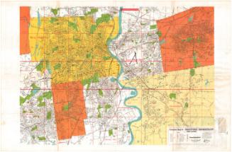
Pitner's Map of Greater Hartford and New Britain
PublisherPublished by
Carl Pitner
(American, 1877 - 1944)
DatePossibly 1937
MediumLithography; black printer's ink on wove paper on fabric attached to wooden rollers
DimensionsPrimary Dimensions (image height x width): 48 1/4 x 34 1/4in. (122.6 x 87cm)
Sheet (height x width): 50 x 35 1/4in. (127 x 89.5cm)
Sheet (height x width): 50 x 35 1/4in. (127 x 89.5cm)
ClassificationsGraphics
Credit LineConnecticut Museum of Culture and History collection
DescriptionMap of Hartford and New Britain, Connecticut, with parts of surrounding towns, including Simsbury, Bloomfield, Windsor, and East Windsor to the north; South Windsor, East Hartford, and Glastonbury to the east; Wethersfield, Rocky Hill, and Newington to the south; and Farmington and Avon to the west. Local roads, streets, main highways, parks, cemeteries, schools, and firestations are shown. The Valley Division of the New York, New Haven, and Hartford Railroad is at the right. Concentric circles indicate distances from the center of Hartford. Major waterways, including the Connecticut River and the West Hartford reservoirs, are shown and named; lesser streams are shown but not names. No elevation is indicated. A street index to Hartford, East Hartford, West Hartford, and New Britain is at the bottom of the map. The map is mounted on fabric attached to wooden rollers.
Object number2012.312.293
NotesCartographic Note: 1 3/8 inches equals 1/2 mileOn View
Not on view