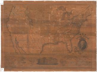
Map of the United States
DraftsmanDrawn by
James H. Young
(American, active 1817 - 1866)
PrintmakerEngraved by
James H. Young
(American, active 1817 - 1866)
PublisherPublished by
Samuel Augustus Mitchell
(1792 - 1868)
Dateafter 1840
MediumEngraving; black printer's ink on wove paper mounted on fabric
DimensionsPrimary Dimensions (image height x width): 44 x 35in. (111.8 x 88.9cm)
Sheet (height x width): 47 1/4 x 38 1/4in. (120 x 97.2cm)
ClassificationsGraphics
Credit LineConnecticut Museum of Culture and History collection
Object number2012.312.291
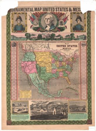
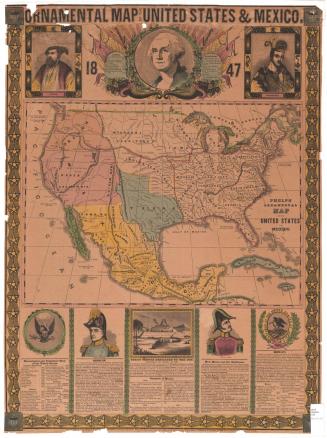
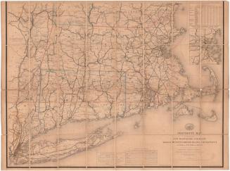
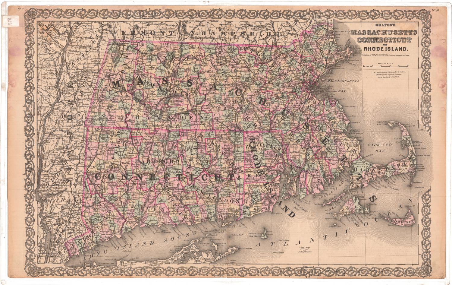
DescriptionMap of the United States with Canada to the north, the Atlantic Ocean to east, the Gulf of Mexico to the south, and Texas and the Missouri Territory to the west. Rivers, swamps, and mountains are shown and geographical features such as bays and islands are identified. Elevation is indicated by hachure marks. Cities and major towns are shown. An index to counties of the United States is at upper left. A decorative cartouche and a table of distances are at upper right. The cartouche features an eagle on a rock, steamboat, a steam locomotive, a man with a canoe, and a waterfall. An inset map of North America at lower right includes a table of statistics of North America. At lower right, tables show the comparative heights of principle mountains and hills of the United States, comparative lengths of principle rivers, and statistics, including the square miles in each state and its population in each census between 1790 and 1840. In the left margin, an early owner has computed the population per square mile of each state.
Label TextS. Augustus Mitchell was born in Bristol, Connecticut, but early in his career he moved to Philadelphia, which was rapidly becoming the center of American map publishing. Mitchell's special interest was in maps for educational purposes, and that interest is fully evident in this 1842 map of the United States, which manages to incorporate an amazing amount of highly specific information regarding the important geographical features and population of the United States, including the numbers of whites, free blacks, and slaves in each state in 1840. It is also one of the most accurate maps of the United States from this period.
NotesCartographic Note: One inch equals fifty statute milesDate Note: Map has copyright date of 1836 but includes data from the 1840 census and therefore must be later than 1840.
Status
Not on view