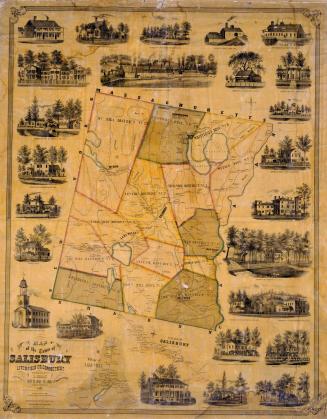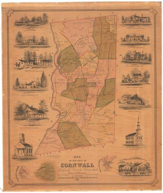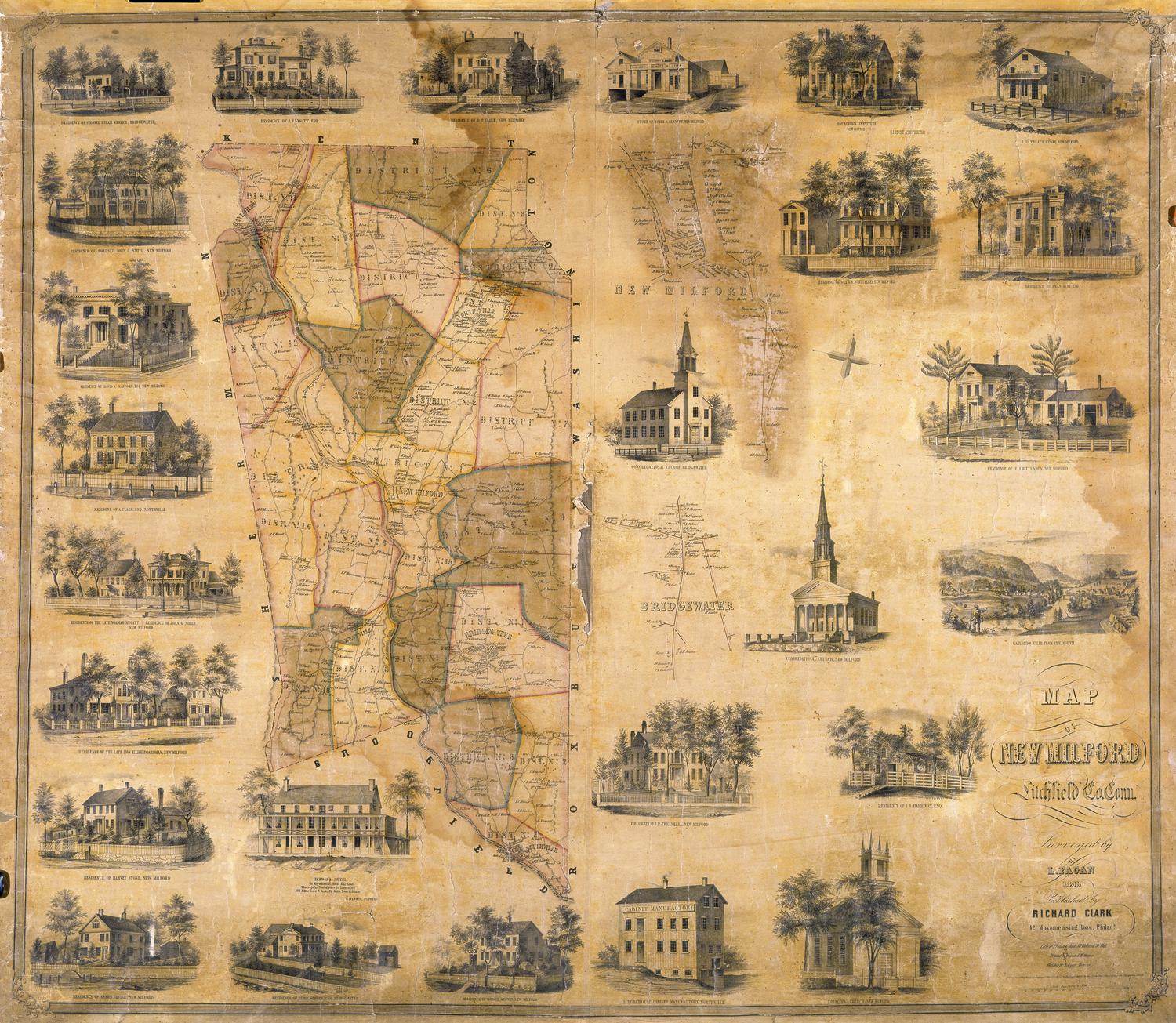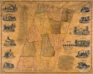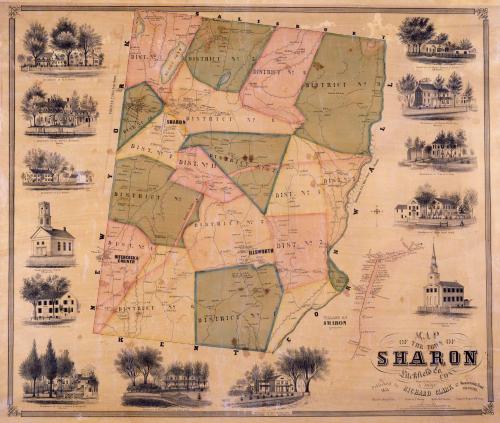
Map of the Town of Sharon, Litchfield Co. Conn.
SurveyorSurveyed by
Lawrence Fagan
(American, born about 1825)
DraftsmanDrawn by
Lawrence Fagan
(American, born about 1825)
DraftsmanVignettes drawn by
Edgar C. Beman
PrintmakerViews drawn on stone by
T. Watson
(American, active 1853)
PrintmakerLithographed by
Friend & Aub
(American, founded 1852)
PrinterPrinted by
Wagner & McGuigan
(American, 1845 - 1859)
PublisherPublished by
Richard Clark
(American)
Date1853
MediumLithography; black printer's ink and watercolor on wove paper mounted on fabric
DimensionsPrimary Dimensions (image height x width): 34 3/8 x 40 5/8in. (87.3 x 103.2cm)
Sheet (height x width): 37 x 43in. (94 x 109.2cm)
ClassificationsGraphics
Credit LineConnecticut Museum of Culture and History collection
Object number2012.312.289
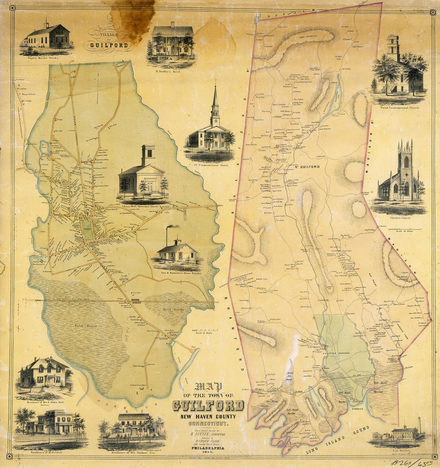
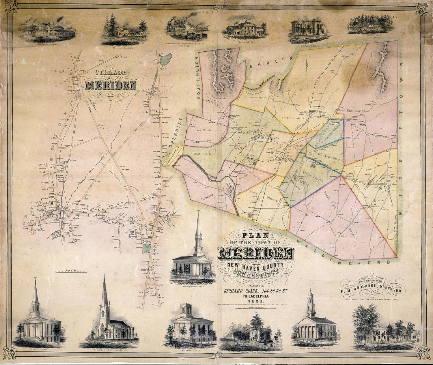
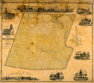
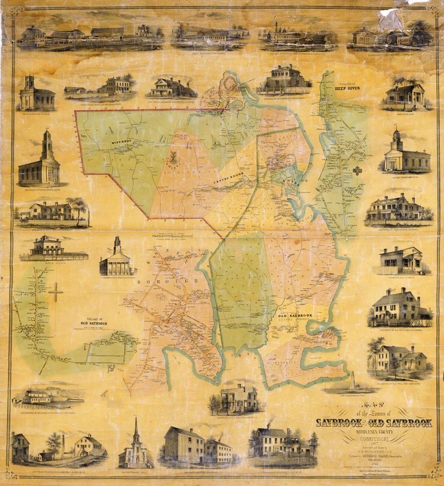
DescriptionMap of the town of Sharon, Connecticut, with Salisbury to the north, the Housatonic River and Cornwall to the east, Kent to the south, and New York State to the west. The town is divided into eleven districts. Three distinct villages are shown: Sharon, Hitchcock's Corner, and Ellsworth. Much of the terrain is hilly; elevation is conveyed by hachure marks. Roads and buildings are shown, with names of property owners. An inscription at the far right states "Housatonic R.R. 7 Miles from Sharon." A detailed map at lower right shows the village of Sharon with the names of property owners. Vignettes at left, right, and bottom include C. Sears' Harness and Trunk Manufactory, the Store and residence of S. J. Prindle, the Congregational Church in Sharon, the Congregational Church in Ellsworth, and the residences of R. S. Noyes, the Reverend G. L. Brownell, General Charles F. Sedgwick, the late John Cotton Smith, Ansel Sterling, Major David Gould, C. and R. B. Cole, Hiram Weed, and Samuel E. Everett.
Label TextThe mapmaking business had become highly complex by the 1850s, with many different individuals involved with making of a large decorative map such as this one. Lawrence Fagan drew the map, based on his own surveys; the map was transferred to the lithographic stone by Friend & Aub. The little views surrounding the map were drawn by E.C. Beman; they were apparently drawn on the lithographic stone by T. Watson. The stone was then printed by Wagner & McGuigan and published by Richard Clark. Though the lithographers, printer, and publisher were all located in Philadelphia, Fagan was more or less itinerant, and Beman may have been a Connecticut resident. Hitchcock's Corners, which appears at the far western edge of this 1853 map was the subject of a boundary dispute between Connecticut and New York. When the boundary between the two states was resurveyed in 1855, Hitchcock's Corners became part of Amenia, New York.
NotesCartographic Note: Three inches equal one mileStatus
Not on view