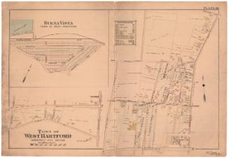
Map of West Middle School District
MakerMade by
Unknown
DatePossibly 1871
MediumLithography; black printer's ink on wove paper
DimensionsPrimary Dimensions (image height x width): 11 1/8 x 10 1/2in. (28.3 x 26.7cm)
Sheet (height x width): 13 7/8 x 12 3/8in. (35.2 x 31.4cm)
Sheet (height x width): 13 7/8 x 12 3/8in. (35.2 x 31.4cm)
ClassificationsGraphics
Credit LineConnecticut Museum of Culture and History collection
DescriptionStreet map of the West Middle School District of Hartford, Connecticut, from Albany Avenue and the city line to the north, the rail road station (Union Station) to the east, the Little River to the south, and Prospect Hill Road to the west. The Hartford and Fishkill and Hartford & New Haven Rail Roads run through the map at the bottom. Several buildings are marked, including the almshouse, Trinity Church, the location of the public school on Flower Street between Asylum and Farmington Avenues, and the proposed site on Sigourney Street between Collins Street and Asylum Avenue.
Object number2004.155.0
NotesCartographic Note: No scaleOn View
Not on view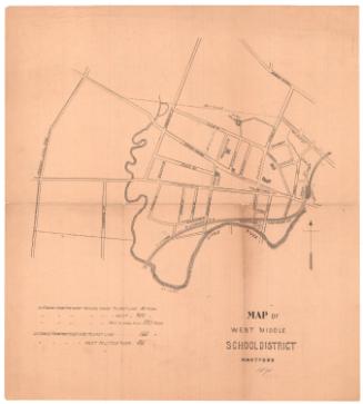
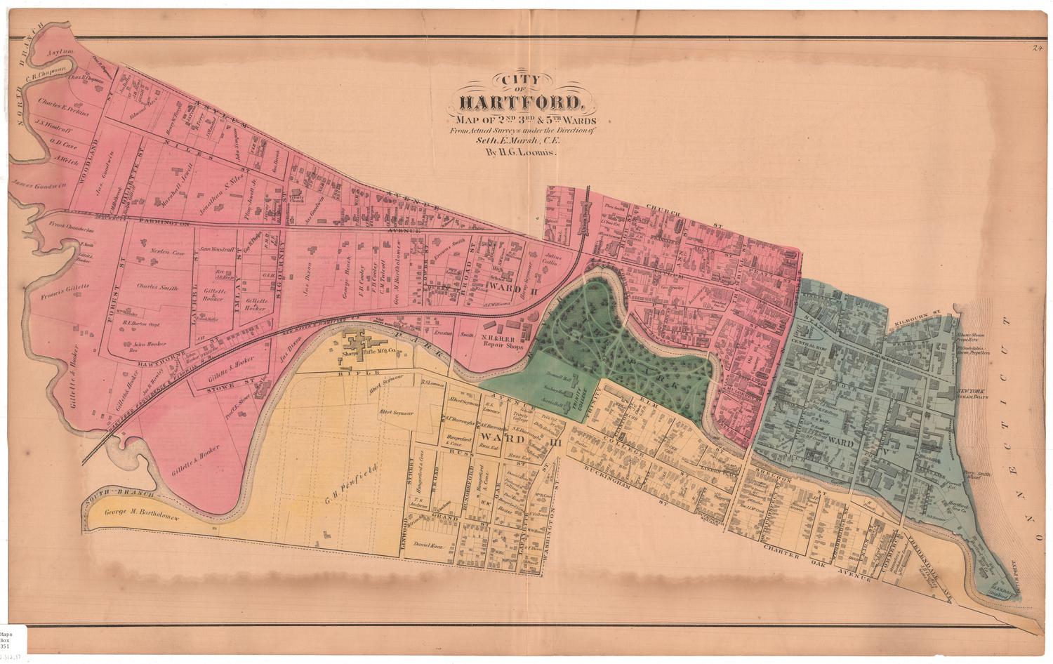
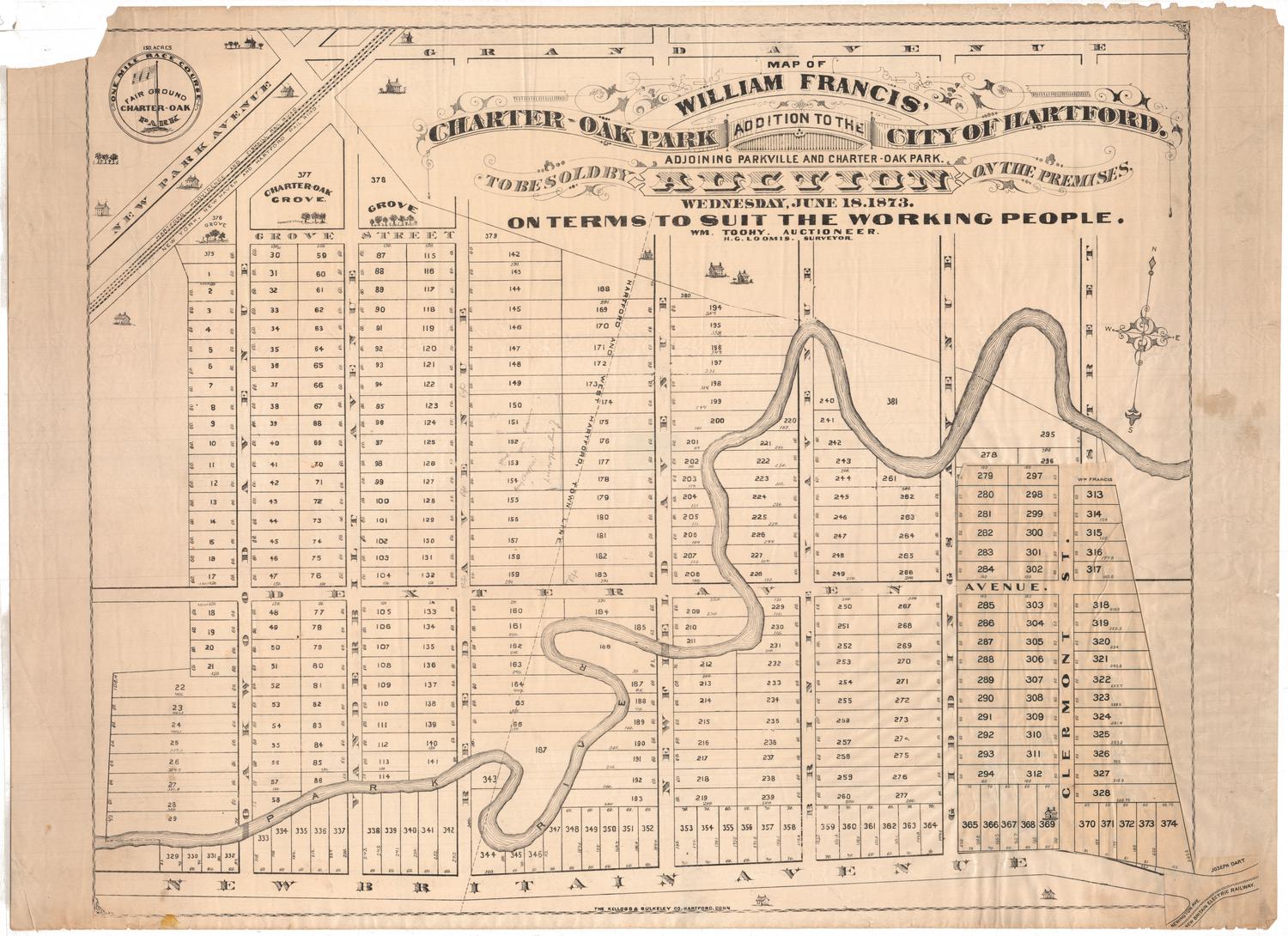

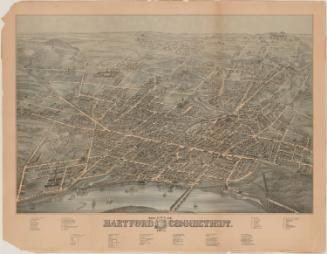
O.H. Bailey and Company