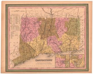
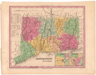
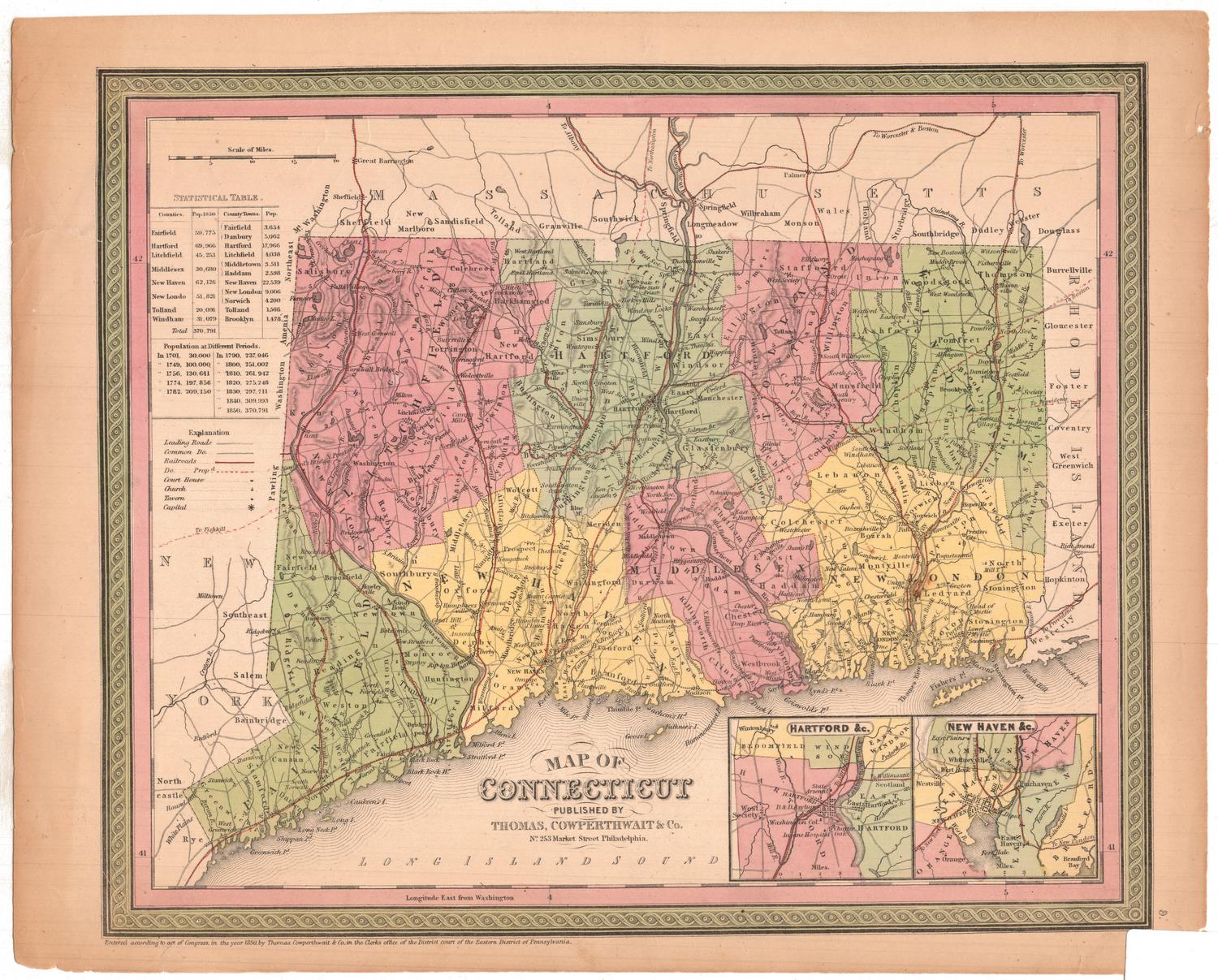
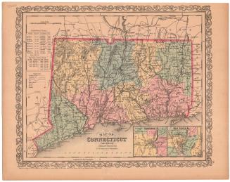
Map of Connecticut
MakerCopyrighted by
Connecticut Department of Transportation
(American, founded 1969)
PublisherPublished by
Connecticut Development Commission
(American, founded 1939)
PublisherPublished by
State Park and Forest Commission
(American, 1921 - 1971)
PublisherPublished by
State Board of Fisheries and Game
(American, 1913 - 1971)
Date1971
MediumOffset lithography; black and colored printer's inks on wove paper
DimensionsPrimary Dimensions (image height x width): 23 1/8 x 35 1/4in. (58.7 x 89.5cm)
Sheet (height x width): 23 7/8 x 36in. (60.6 x 91.4cm)
ClassificationsGraphics
Credit LineConnecticut Museum of Culture and History collection
Object number2004.154.0
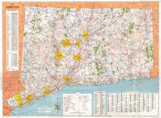
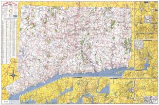
DescriptionRoad map of the state of Connecticut, including the Long Island Sound, with grid letters at the top and bottom and numbers on both sides. Degrees of longitude and latitude are provided, as well. The legend at the bottom of the sheet provides information about the types of roads marked on the map; interstates, US routes and state routes and their symbols; the political boundary lines for states, towns and counties; symbols marking yacht clubs, airports, heliports and boat launching sites; circles of varying sizes for cities of differing populations; and the scale. There is also a list of public boat launching sites, and an index of cities, towns and places, with their grid coordinates provided. The compass rose, located to the left of the legend, features a shield with three grapevines in it and the Latin phrase "Qui Transtulit Sustinet," which means "He who transplanted still sustains." To the right and at the bottom are inset maps of Waterbury/Naugatuck, Torrington, Ansonia/Derby/Shelton, Meriden, Middletown, Wallingford, Willimantic, New Haven, Bristol/New Britain, Hartford, Norwich, New London/Groton, Bridgeport, Danbury, Stamford/Norwalk, and Greenwich.
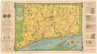
On the back are photographs illustrating seasonal activities, scenery, history, fun activities, state parks, and hunting and fishing. The Charter Oak Trail is depicted on an outline map of the state. Information about public recreation areas and their features, toll roads, ferries, rest areas, signage, highway safety and emergencies is provided on the right, along with a distance table.
On the back are photographs illustrating seasonal activities, scenery, history, fun activities, state parks, and hunting and fishing. The Charter Oak Trail is depicted on an outline map of the state. Information about public recreation areas and their features, toll roads, ferries, rest areas, signage, highway safety and emergencies is provided on the right, along with a distance table.
Label TextIn 1969, the Connecticut State Highway Department, the Connecticut State Department of Aeronautics, the Connecticut Transportation Authority, and the Commissioners of Steamship Terminals were combined to form the Connecticut Department of Transportation. The Department of Transportation--or the D. O.T., as it is popularly known--continued to issue Connecticut road maps, adding to the long sequence begun by the State Highway Department in the early twentieth century. Maps from the 1970s reflect the development of the interstate highway system and continue promote the state as a tourist destination offering "scenery, history, and fun." In one of the pictures on the back of the map, a "timeless scene" on the Connecticut River "gets a new backdrop" from the nuclear power station at Haddam Neck..
NotesCartographic Note: Scale: 1 inch equals 1 1/2 milesStatus
Not on view