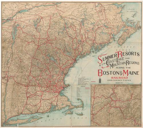
Summer Resorts of the Coast, Lake and Mountain Regions along the Boston & Maine Railroad and Connections
PublisherPublished by
Matthews-Northrup Company
(American)
Date1913
MediumOffset lithography; black and colored printer's inks on wove paper
DimensionsPrimary Dimensions (image height x width): 25 1/2 x 28 3/8in. (64.8 x 72.1cm)
Sheet (height x width): 25 7/8 x 29in. (65.7 x 73.7cm)
ClassificationsGraphics
Credit LineConnecticut Museum of Culture and History collection
Object number2004.151.0
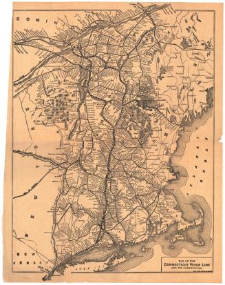
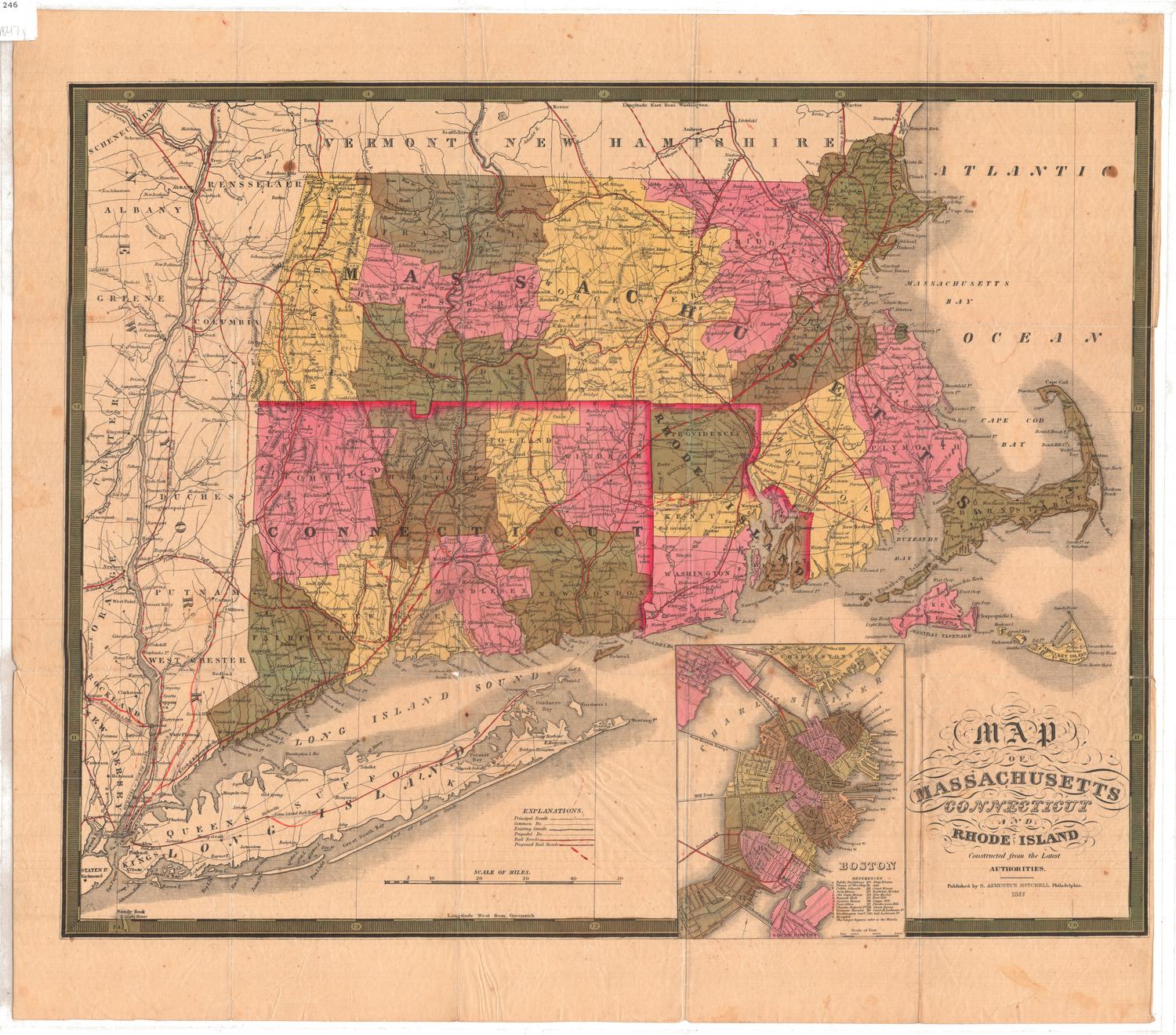
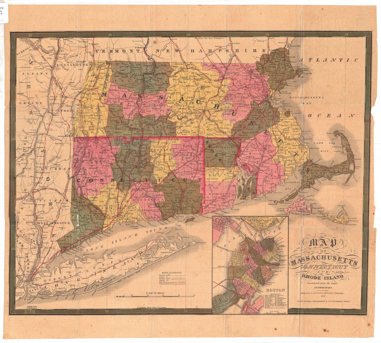
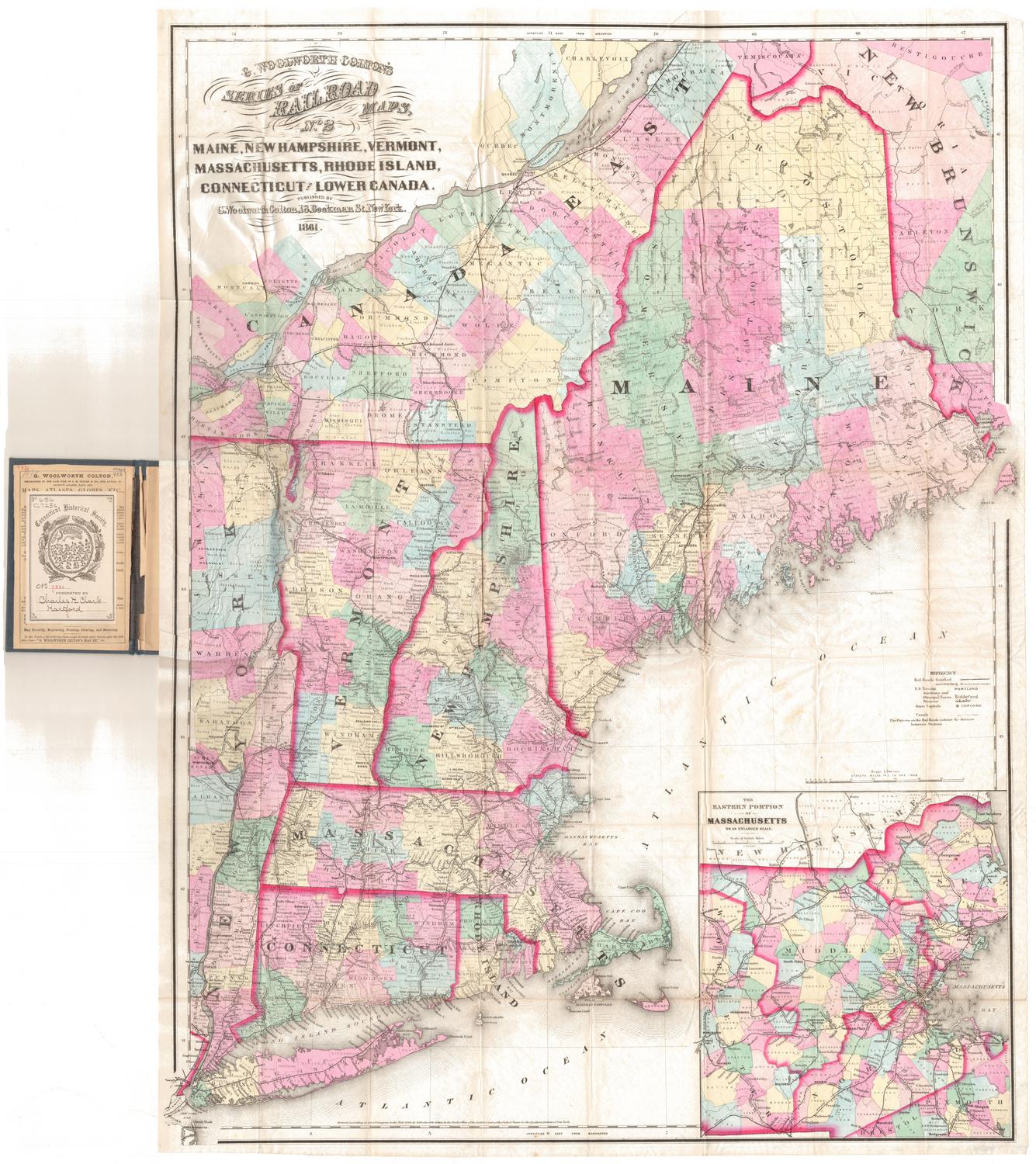
DescriptionMap of the New England states, part of Quebec, New Brunswick, Nova Scotia and part of New York. The Boston and Maine; St. Johnsbury and Lake Champlain; York Harbor and Beach; Maine Central; New York, New Haven and Hartford; Boston and Albany; Montpelier and Wells River; Sandy River and Rangeley Lakes; and Bridgton and Saco River Railroads are all shown in red, with stations depicted as open circles. Connecting lines are shown in thinner red lines, and other railroads in black. An inset map in the bottom right corner shows the "American Switzerland" region, which encompasses parts of Vermont and New Hampshire. Physical features depicted include elevation, conveyed with shading; rivers; lakes; and islands.
Label TextIn the golden age before World War I, grand hotels and modest boarding houses were strategically positioned along New England's coasts and dotted New England's hills and mountains, appealing to anyone who could get away from their jobs for a month or a week or even just a few days. Though private automobiles were becoming more common, this map still stresses travel by railroad and steamship lines and shows the extent of the networks that still served the New England states and eastern Canada. Few roads are shown at all. Within ten years, the situation would change drastically as more and more people preferred to travel at their own pace in their own cars. With the coming of the Great Depression in the 1930s, many of the hotels would go into a decline from which they would never recover.
NotesCartographic Note: Scale, inset map: 1 3/4 inches equals 10 milesStatus
Not on view