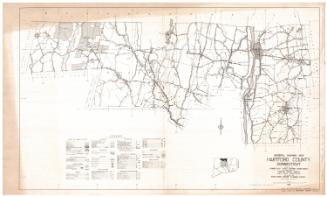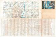
Champion Map of Hartford, Connecticut and vicinity
DraftsmanDrawn by
David J. Bennett
(American, born 1942)
PublisherPublished by the
Champion Map Corporation
(American, 1959 - 1988)
Date1972-1975
MediumOffset lithography; black and colored printer's inks on wove paper
DimensionsPrimary Dimensions (image height x width): 22 7/8 x 32in. (58.1 x 81.3cm)
Sheet (height x width): 25 x 38in. (63.5 x 96.5cm)
ClassificationsGraphics
Credit LineMuseum purchase
Object number2000.182.1
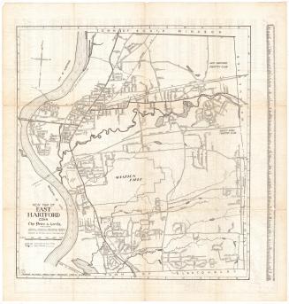
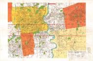
DescriptionMap of Hartford, Connecticut, and some of the surrounding towns, including West Hartford, East Hartford, Manchester, New Britain, Newington, Wethersfield, and Glastobury, with parts of Avon, Farmington, Berlin, Rock Hill. The map continues on the back of the sheet, with the towns of Simsbury, Bloomfield, Windsor, East Windsor and South Windsor depicted, with parts of Granby, East Granby, Windsor Locks, Ellington and Vernon. This portion of the map contains less detail than the main one. Both show local roads and highways, but there are more features on the primary map than on the secondary one. Parks, cemeteries and other open spaces are colored green, and schools, hospitals, colleges, points of interest, post offices and shopping centers are marked with red symbols. Water is colored blue. A street index appears on the back of the sheet.
Label TextBy the early 1970s, Connecticut's interstate highway system was beginning to take shape, but there were still many missing links. Interstate 291 was under construction but only a short stretch from Interstate 91 in Windsor to Route 5 in East Windsor was complete. The main highway connecting Hartford to the Massachusetts Turnpike was known as Interstate 86; another highway, supposed to connect Hartford and Providence, and still in the planning stages, was known as Interstate 84. While residents of the greater Hartford area supported the completion of these roads in the hope that they would ease congestion and improve highway conditions around the capital, residnets of outlying towns were often bitterly opposed. Construction on I-291 and I-84 would drag on for years. Neither road would be completed as originally projected. In December 1984, the highway that appears as I-86 on this map would be renamed I-84 and I-84 would become I-384.
NotesCartographic Note: Scale: 1 3/4 inch equals 4000 feetStatus
Not on view