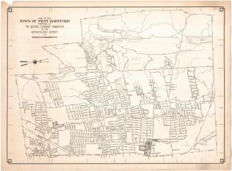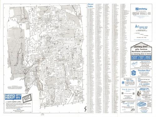
West Hartford, Connecticut, Town Map
PublisherPublished by
West Hartford Chamber of Commerce
(American, founded 1913)
After a work byAfter a work by
Metropolitan District Commission
(American, founded 1929)
DistributorDistributed by
Society for Savings
(American, founded 1819)
Date1976
MediumOffset lithography; black and blue printer's ink on wove paper
DimensionsPrimary Dimensions (image height x width): 17 5/8 x 13 3/8in. (44.8 x 34cm)
Sheet (height x width): 19 1/8 x 25in. (48.6 x 63.5cm)
ClassificationsGraphics
Credit LineGift of the estate of Grace Knox
Object number1999.165.1
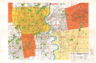
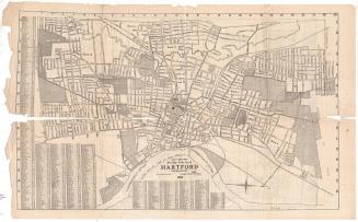
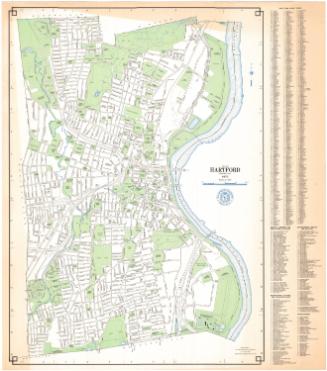
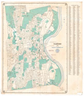
DescriptionFolding map of the town of West Hartford, Connecticut, with the town lines of Bloomfield to the north, Hartford to the east, Newington to the south, and Farmington and Avon to the west. Local roads and highways are shown and labeled. Schools, parks, country clubscolleges and schools are represented with shaded gray areas and are also labeled. Physical features depicted include reservoirs and the Park River. To the right is a street index. Advertisements for local businesses appear on both sides of the sheet. On the back are a history of West Hartford, a map of the greater Hartford area, and a map of the Park Road area of West Hartford.
Label TextWhen the West Hartford Chamber of Commerce decided to issue a map of their town in conjunction with the United States Bicentennial celebration in 1976, they based it directly on a map prepared by the Metropolitan District Commission. Although the MDC map included a street index, the index on the Chamber of Commerce's map is larger and easier to use. And while the MDC maps are large and often unwieldy, this map was issued folded, making it easy to carry and consult, though much more subject to wear. The map was distributed free of charge by the Chamber of Commerce and by participating businesses.
NotesCartographic Note: No scaleStatus
Not on view