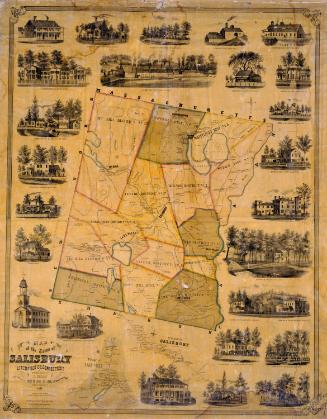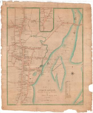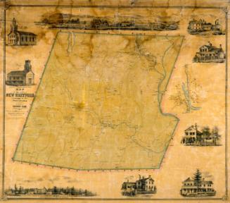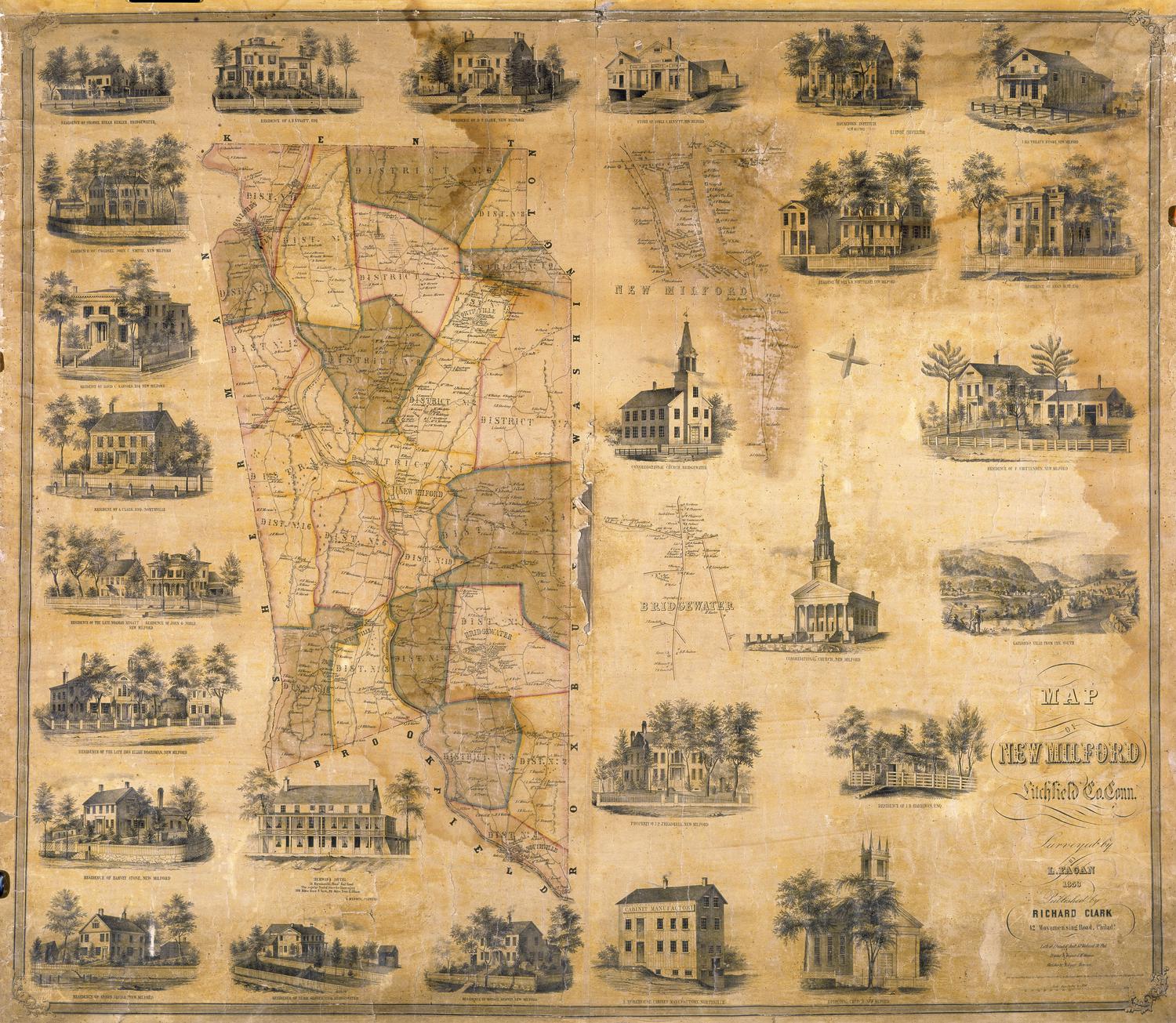
Map of New Milford, Litchfield, County, Connecticut
DraftsmanSketches by
Lawrence Fagan
(American, born about 1825)
PrintmakerLithographed by
Friend & Aub
(American, founded 1852)
PrinterPrinted by
Wagner & McGuigan
(American, 1845 - 1859)
PublisherPublished by
Richard Clark
(American)
Date1853
MediumLithography; black printer's ink and watercolor on wove paper mounted on fabric
DimensionsPrimary Dimensions (image height x width): 40 x 45 1/2in. (101.6 x 115.6cm)
Sheet (height x width): 41 x 47 1/4in. (104.1 x 120cm)
Sheet (height x width): 41 x 47 1/4in. (104.1 x 120cm)
ClassificationsGraphics
Credit LineMuseum purchase
DescriptionMap of the town of New Milford, Connecticut, with Kent to the north, Washington and Roxbury to the east, Brookfield to the south, and Sherman to the west. The town is divided into sixteen districts. The Housatonic River and the Housatonic Railroad run north and south through the town. Elevation is indicated by hachure marks. Roads are shown but not named. Names of property owners are indicated. Separate small maps show the villages of New Milford and Bridgewater. Vignettes depict the Housatonic Institute, S. Morehouse's Cabinet Manufactory in Northville, Merwin's Hotel, Gaylordsville from the south, J. Eli Treat's Store, the store of Noble and Bennett, the Congregational Church in Bridgewater, and the Congregational Church and the Episcopal Church in New Milford. Also shown are the residences of Horace Merwin, Burr Glover, Anson Squier, Harvey Stone, Elijah Boardman, Noabiah Mygatt, John G. Noble, A. Clark, David C. Sanford, Colonel John C. Smith, Colonel Hiram Keeler, A. B. Mygatt, D. P. Clark, Anan Hine, G. W. Whittelsey, J. B. Harrison, and J. P. Treadwell.
Object number1949.21.0
NotesCartographic Note: Five inches equals one mileOn View
Not on view