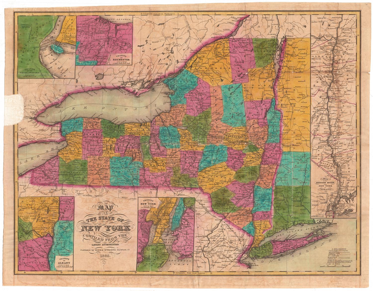
Smith's Railroad, Steamboat & Stage Route Map of New England, New-York and Canada
PublisherPublished by
John Calvin Smith
(American, 1810 - 1890)
Date1858
MediumEngraving; black printer's ink and watercolor on wove paper, in cardboard covers
DimensionsPrimary Dimensions (image height x width): 21 1/4 x 26 7/8in. (54 x 68.3cm)
Sheet (height x width): 21 7/8 x 27 3/8in. (55.6 x 69.5cm)
Sheet (height x width): 21 7/8 x 27 3/8in. (55.6 x 69.5cm)
ClassificationsGraphics
Credit LineConnecticut Museum of Culture and History collection
DescriptionPocket map of the New England states, New York, and Upper and Lower Canada (present-day Ontario and Quebec), depicting the transportation options of the area. None of the routes shown are named. Physical features depicted include elevation, conveyed with hachure marks; rivers; and lakes. On the right side are inset maps of the greater Boston and New York City areas. Around the map are vignettes showing Niagara Falls, Notch White Mountains, Mont Morenci Falls, ships at sea, and the view from Mount Holyoke.
Object number1988.231.0
NotesCartographic Note: Scale: 1 inch equals about 25 milesOn View
Not on view