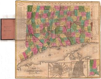
Map of Maryland, Virginia, and Delaware
PublisherPublished by
Brown and Parsons
(American, 1838 - 1851)
Date1838
MediumEngraving; black printer's ink and watercolor on wove paper, in cardboard covers
DimensionsPrimary Dimensions (image height x width): 14 x 17 1/4in. (35.6 x 43.8cm)
Sheet (height x width): 14 1/8 x 17 3/8in. (35.9 x 44.1cm)
ClassificationsGraphics
Credit LineConnecticut Museum of Culture and History collection
Object number1984.141.0
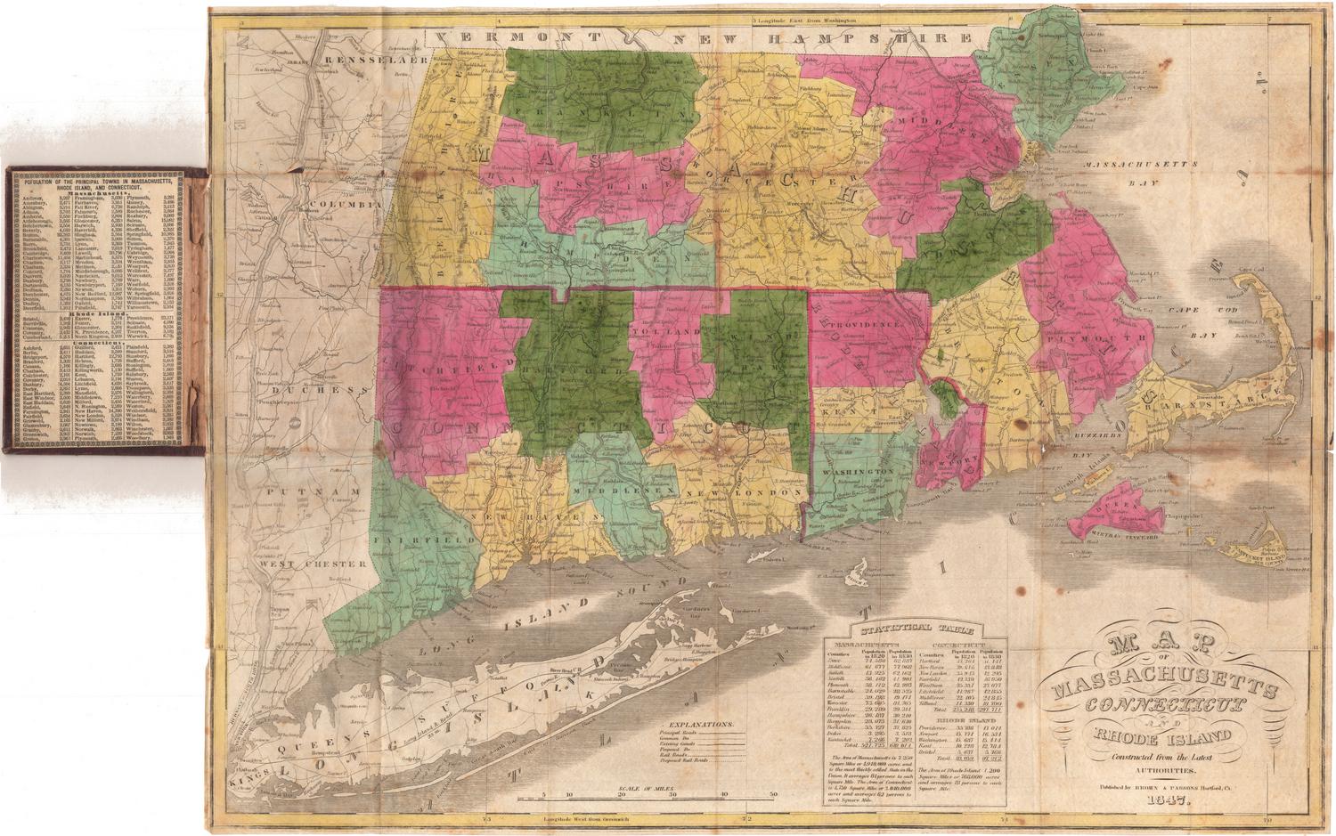
DescriptionPocket map of the states of Maryland, Virginia and Delaware, with Pennsylvania to the north, the Atlantic Ocean to the east, and Ohio to the west. The states are divided into counties, colored blue, pink, green, yellow or lavender. Principal and local roads are shown, as is the Ohio and Chesapeake Canal, part of what is probably the James River and Kanawha Canal, and the Junction Canal. The Ohio Railroad and an unnamed proposed railroad between Washington, D.C. and Hartford, Maryland, are also depicted. Physical features shown include elevation, conveyed with hachure marks; rivers, and lakes. In the top left is an inset map of the southwest part of Virginia, and in the top right is an inset map of Washington, D.C. and Georgetown. On the inside cover is a population table for the counties in each state.
Label TextSince the collection of the Connecticut Historical Society focuses on maps of Connecticut and to a lesser extent on maps of the other New England states, one tends to assume that Connecticu map publishers also focused on this area. This isn't necessarily true. Considering Connecticut's strong historical associations with Ohio, it is not surprising that Brown and Parsons, booksellers in Hartford, Connecticut, published a map of that state. It is much more surprising that they should have published a map of Maryland, Virginia, and Delaware. This suggests that these Hartford booksellers sought a wider market for their wares outside of the New England area.
NotesCartographic Note: Scale: 1 inch equals about 25 milesStatus
Not on view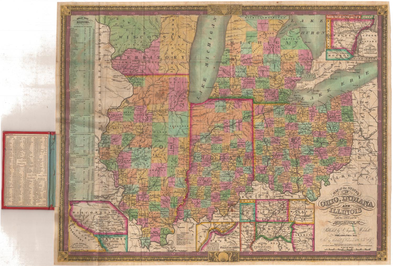
Samuel Augustus Mitchell
1834
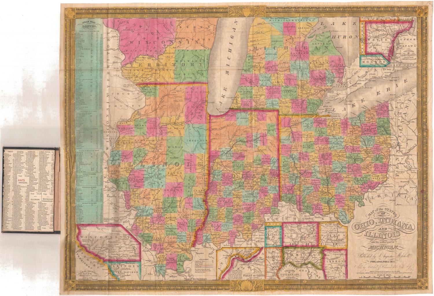
Samuel Augustus Mitchell
1835