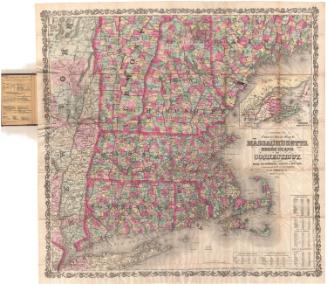
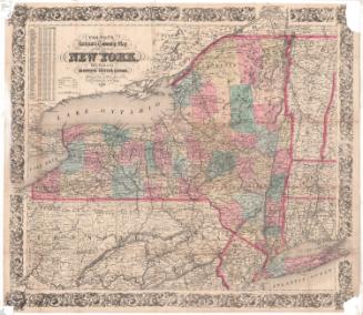
Colton's Railroad and Township Map of Massachusetts, Rhode Island and Connecticut
PublisherPublished by
J. H. Colton & Co.
(American, founded 1831)
PrinterPrinted by
David McLellan
(Scottish-American, active 1851 - 1867)
Date1854
MediumLithography; black printer's ink and watercolor on wove paper, in cardboard covers
DimensionsPrimary Dimensions (image height x width): 24 1/4 x 28 1/8in. (61.6 x 71.4cm)
Sheet (height x width): 25 5/8 x 29 5/8in. (65.1 x 75.2cm)
ClassificationsGraphics
Credit LineMuseum purchase
Object number1985.213.0
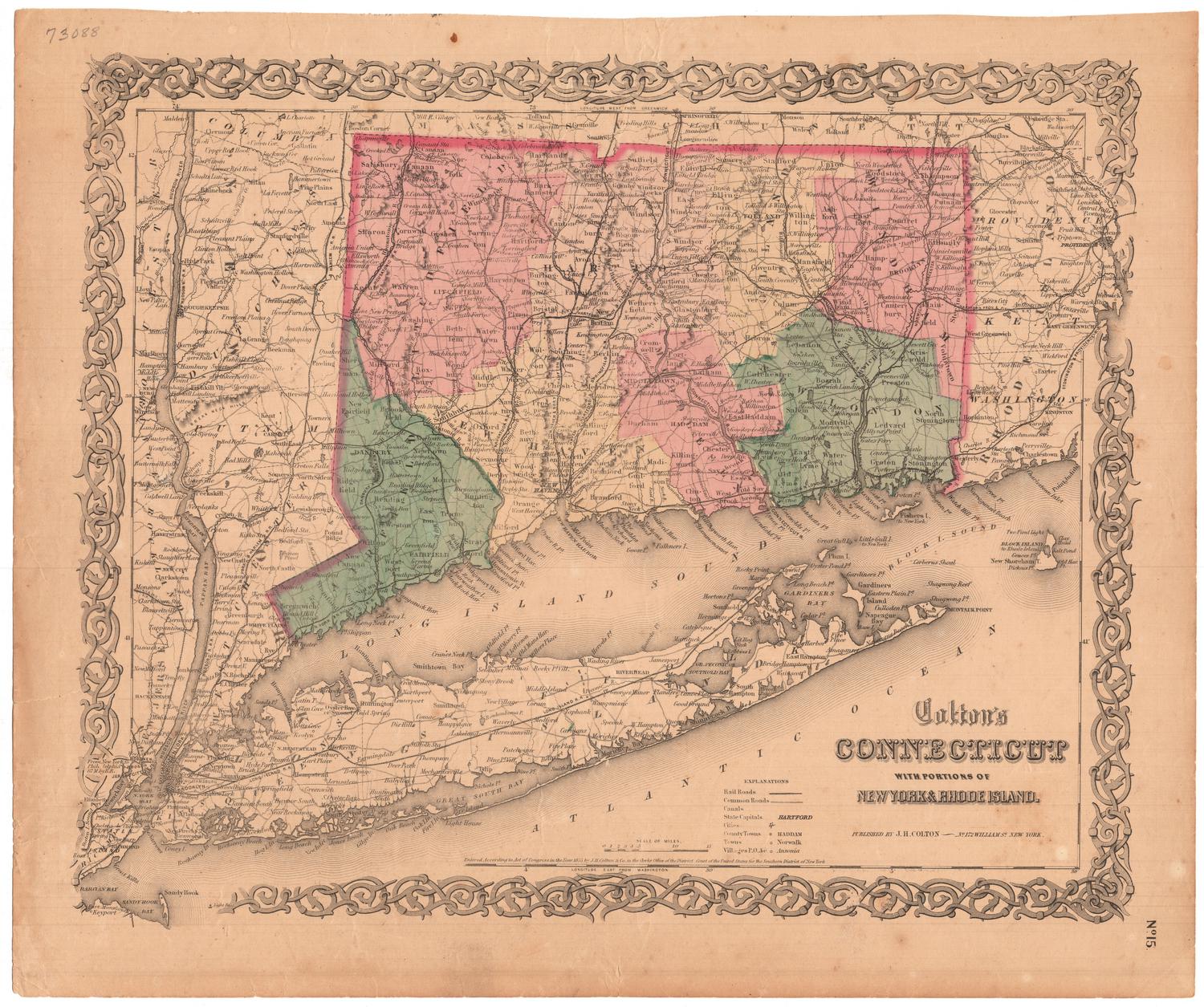
DescriptionPocket map of Massachusetts, Connecticut and Rhode Island, with parts of Vermont, New Hampshire and Maine to the north, the Atlantic Ocean to the east, part of Long Island and the Long Island Sound to the south, and eastern New York to the west. The states are divided into counties, colored pink, green, blue and yellow. Finished and proposed railroads are shown, including New York and New Haven; Housatonic; Naugatuck; New Haven, Hartford and Springfield; New London, Willimantic and Palmer; Norwich and Worcester; Stonington; and Western. Common roads are also shown. Physical features depicted include elevation, conveyed with hachure marks; rivers; and lakes/ponds. At the bottom are population tables for Connecticut, Rhode Island and Massachusetts for 1840 and 1850. The inside front cover contains an advertisement for the publisher.
Label TextThe prolific Colton map publishing firm was quick to recognize a market for maps of railroad lines. Railroads were the primary means of long-distance transportation for both people and goods in nineteenth century America, and as the railroad network expanded, there was a constant demand for new and up-to-date railroad maps. Railroads were, in fact, included in all of Colton's maps of Connecticut, but with the word "Railroad" featured prominently in the title, this map was sure to appeal to travelers and tourists. Pocket maps were especially popular with travelers and tourists because they could be easily carried in a pocket and unfolded only when they were needed. They were the precursors of twentieth-century road maps.
NotesCartographic Note: Scale: 1 1/8 inch equals 10 milesStatus
Not on view