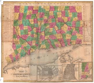
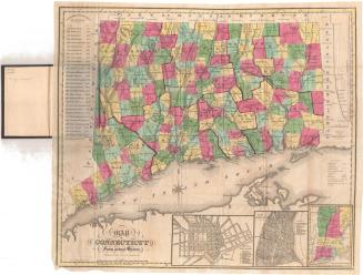
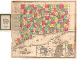
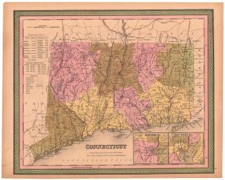
Map of Connecticut from actual Survey
PublisherPublished by
Brown and Parsons
(American, 1838 - 1851)
PrintmakerEngraved by
Daggett & Ely
(American, 1831 - 1836)
Date1848
MediumEngraving; black printer's ink and watercolor on wove paper, with cardboard covers
DimensionsPrimary Dimensions (image height x width): 19 1/8 x 21 1/2in. (48.6 x 54.6cm)
Sheet (height x width): 19 1/4 x 21 5/8in. (48.9 x 54.9cm)
ClassificationsGraphics
Credit LineMuseum purchase
Object number1983.194.0
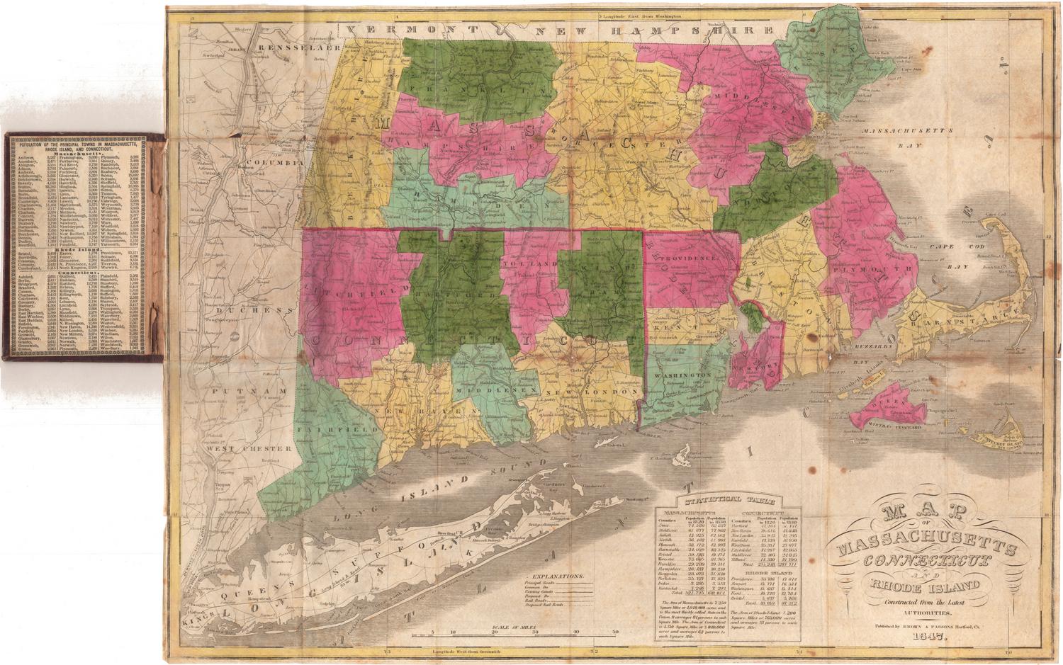
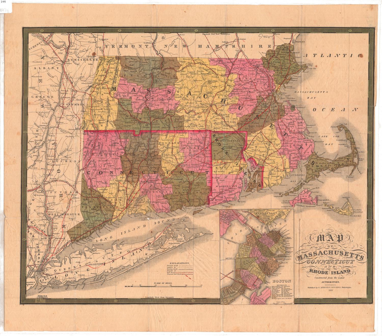
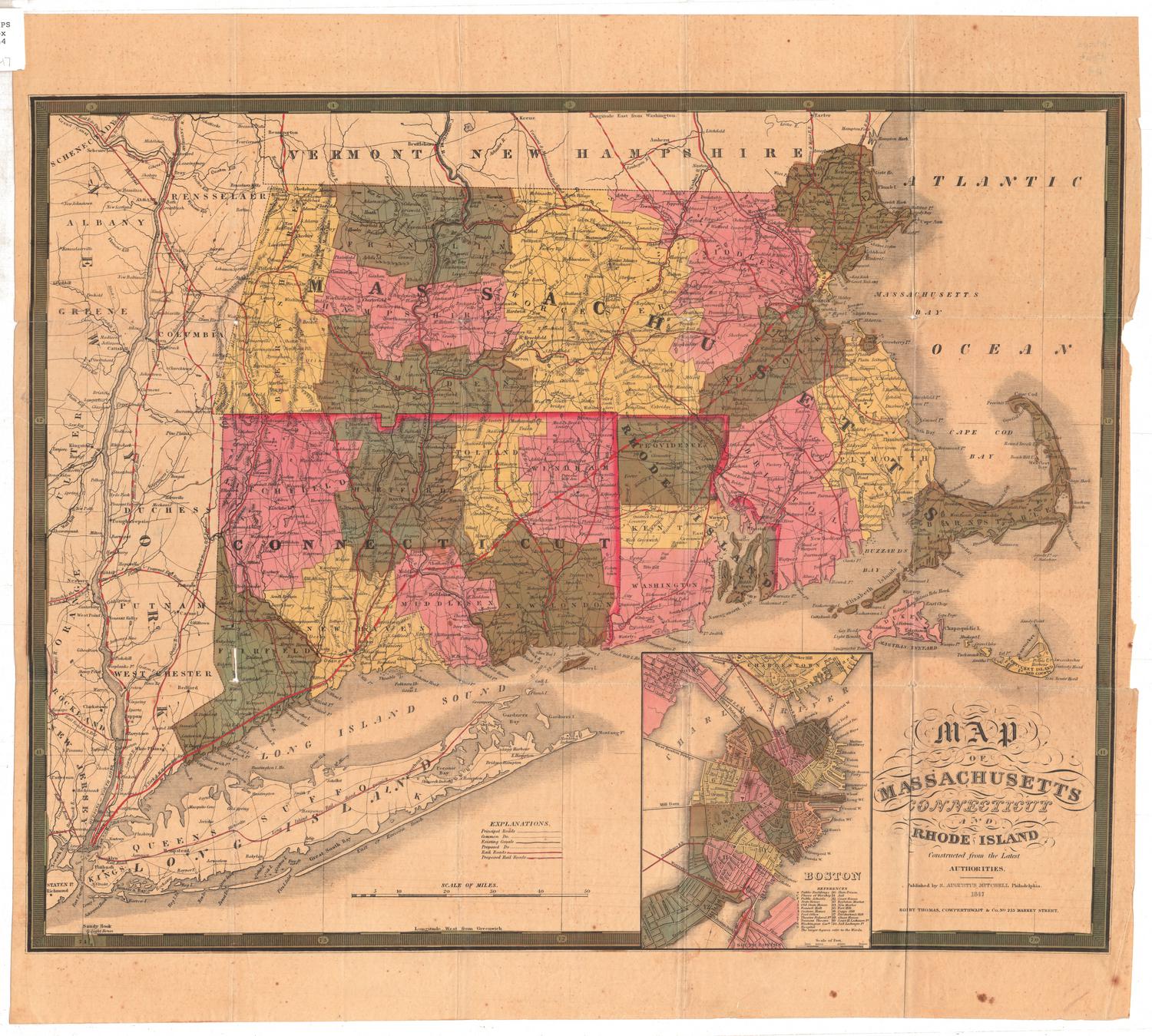
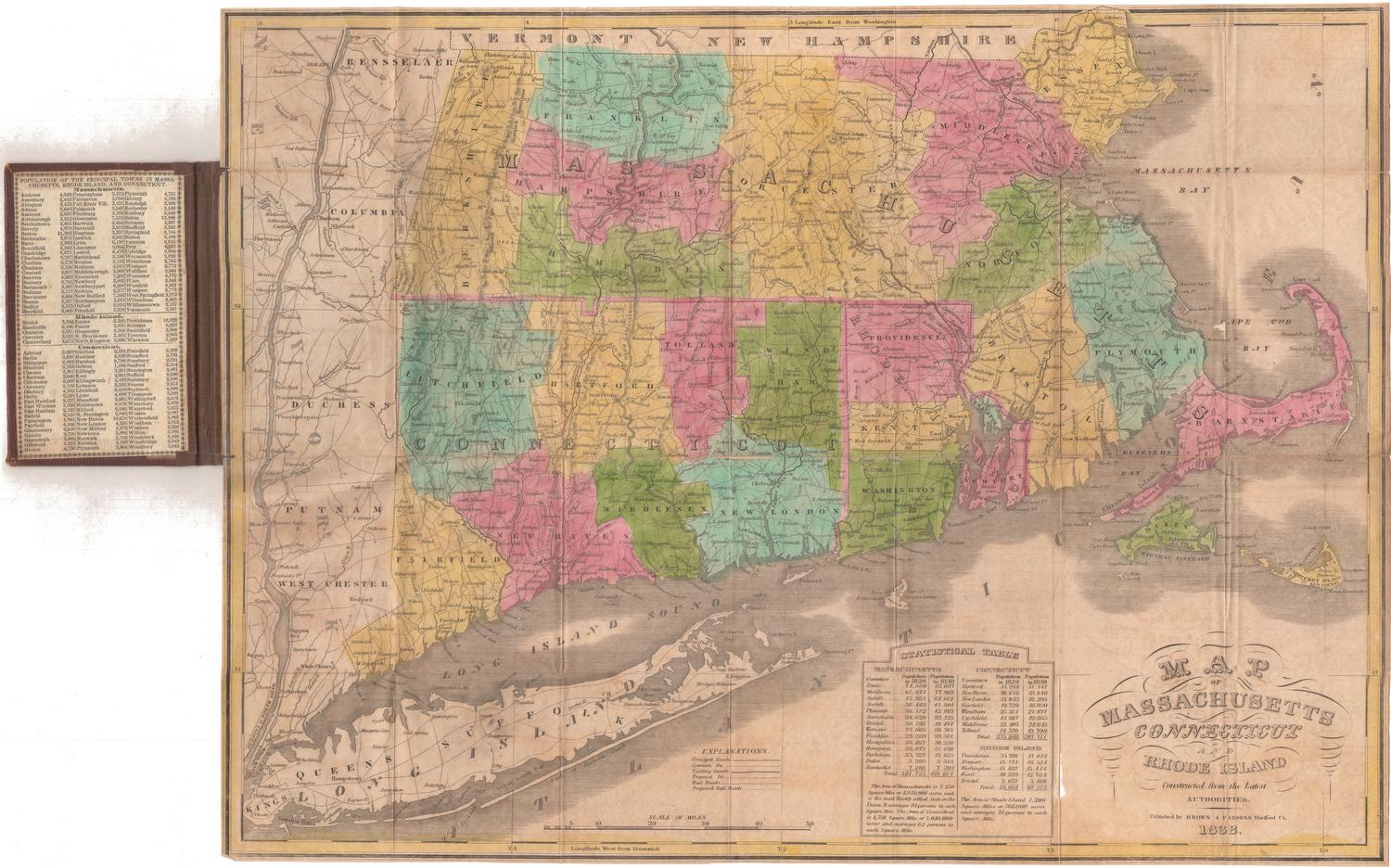
DescriptionPocket map of Connecticut, with Massachusetts to the north, Rhode Island to the east, the Long Island Sound to the south, and New York to the west. All of the towns in the state are bounded by solid black lines, and are colored blue, yellow, green, brown or pink, and the counties are bounded by broken solid and dotted lines that are colored dark pink. Turnpikes, "common" roads, places of public worship, courthouses, canals and railroads are depicted on the map with lines and symbols. The New York and New Haven, Housatonic, Hartford and Springfield and the Norwich and Worcester Railroads are marks in red. Four vignettes, one to the right of the map and three below it, show a "Profile of the Farmington Canal," plans of New Haven and Hartford, and the New England states, respectively. To the left of the map is a list of the governors of Connecticut since the charter.
Label TextThe Hartford publisher Brown & Parsons took over Daggett & Ely's engraved map of Connecticut from its original publisher, Eleazer Huntington. Huntington first published the map in 1836, including the list of Connecticut Governors, the inset maps of Hartford and New Haven, and the profile of the Farmington Canal. When they republished the map in the 1840s, Brown & Parsons updated the list of Governors and updated the map to show new towns that had been incorporated since earlier editions. This map is right up-to-date and includes the town of Easton, incorporated in 1847, the year before it was published. It still includes the profile of the Farmington Canal, however, and the canal itself still appears on the map, even though by 1848, when this edition of the map was published, the canal had largely been replaced by a railroad that utilized the former towpath as its roadbed
NotesCartographic Note: Scale: 1 inch equals about 5 1/2 milesStatus
Not on view