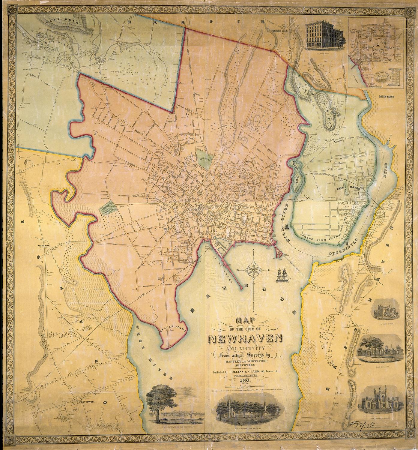
Map of the City of New Haven and Vicinity
SurveyorSurveyed by
Hartley and Whiteford
(American, active 1851)
PrinterPrinted by
Rosenthal & Kraemer
(American, active 1851)
PublisherPublished by
Collins & Clark
(American, active 1850 - 1851)
PublisherCopyrighted by
Richard Clark
(American)
Date1851
MediumLithography; black printer's ink and watercolor on wove paper mounted on fabric
DimensionsPrimary Dimensions (height x width): 44 x 41in. (111.8 x 104.1cm)
Sheet (height x width): 46 x 42in. (116.8 x 106.7cm)
Sheet (height x width): 46 x 42in. (116.8 x 106.7cm)
ClassificationsGraphics
Credit LineConnecticut Museum of Culture and History collection
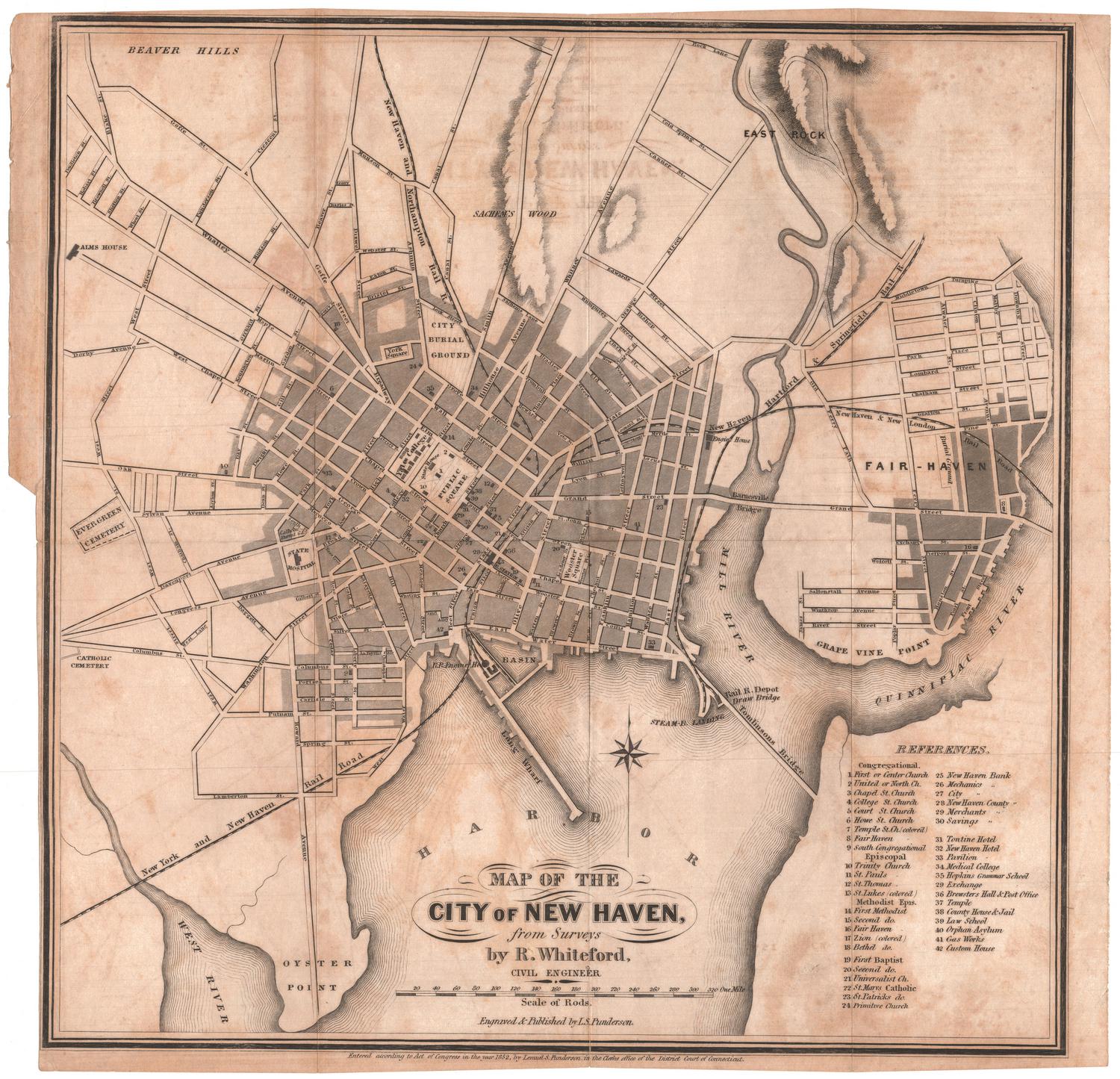
DescriptionMap of New Haven, Connecticut, with West Rock, Westville, and the town of Hamden to the north, North Haven, Fair Haven, and East Haven to the east, New Haven Harbor to the south, and Orange to the west. The West River, the Mill River, and the Quinnipiac River are colored blue. Cemeteries are colored green. Small trees appear to indicate the location of wooded areas. Clumps of grass indicate the presence of extensive salt marshes. Elevation is depicted graphically as lines of ridges, with hachure marks. Within the center of New Haven, streets are named and the names of some property owners are indicated. Outside the center of New Haven, most roads are unnamed but the names of most property owners are indicated. Railroads include the New York and New Haven Railroad, the New Haven and New London Railroad, the New Haven and Northampton Railroad, and the New Haven, Hartford, and Springfield Railroad. A sailing ship is shown in the harbor between Long Wharf and the steamboat wharf. Vignettes at upper and lower right include a view of New Haven from the southeast, the Public Square (Green), Yale College, Yale College Library, Pavilion House, the New Haven Hotel, and a reduced reproduction of Wadsworth's 1748 Plan of the City of New Haven.
Object number2012.312.286
NotesCartographic Note: One inch equals six hundred feetOn View
Not on view