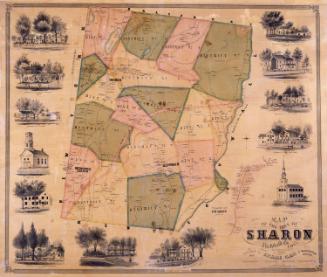
Map of the Town of Salisbury, Litchfield, Co., Connecticut
SurveyorSurveyed by
Lawrence Fagan
(American, born about 1825)
DraftsmanMap drawn by
Lawrence Fagan
(American, born about 1825)
DraftsmanSketches drawn by
Edgar C. Beman
PrintmakerLithographed by
Friend & Aub
(American, founded 1852)
PrinterPrinted by
Wagner & McGuigan
(American, 1845 - 1859)
PublisherPublished by
Richard Clark
(American)
Date1853
MediumLithography; black printer's ink and watercolor on wove paper mounted on fabric
DimensionsPrimary Dimensions (image height x width): 50 3/4 x 39 1/8in. (128.9 x 99.4cm)
Sheet (height x width): 53 x 42in. (134.6 x 106.7cm)
ClassificationsGraphics
Credit LineConnecticut Museum of Culture and History collection
Object number1952.102.0
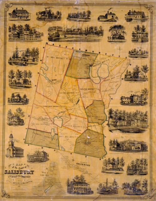
DescriptionMap of Salisbury, Connecticut with the state of Massachusetts to the north, the town of Canaan to the east, the town of Sharon to the south, and the state of New York to the west. The Housatonic River forms Salisbury's eastern boundary. The town is divided into thirteen districts. Roads, rivers, ponds, and mountains are indicated. Elevation is shown by hachure marks. Villages include Chapinville, Falls Village, LIme Rock, and Mount Riga. Separate inset maps at the bottom provide greater detail for the villages of Lakeville and Salisbury. All maps include the names of property owners and businesses. Vignettes surrounding the maps depict the Congregational Church and parsonage, William Bushnell's Hotel, A. J. Wardwell's Hotel, Ames Iron Works, the Landon Company Furnace, the Barnum Richardson and Company Iron Foundry, D. Clapp's Buildings, and the residences of H. Ames, R. Bostwick, Messrs. Read and Woodworth, Horace Landon, A. H. Holley, William H. Barnum, Leonard Richardson, M. B. Coffing, S. C. Scoville, Dea. Chittenden, J. H. Hubbard, Mrs. M. A. Holley, Walter F. Whittlesey, and John Adams.
Label TextThe town of Salisbury, in the far northwest corner of Connecticut, was long the center of state's iron industry. Iron from Salisbury was used in armaments during both the American Revolution and the Civil War. The vignettes surrounding this map depict several of these businesses, including the Ames Iron Works, located at the Great Falls of the Housatonic, the Landon Company Furnace, and the Barnum, Richardson and Company Iron Foundry, but other ore beds, furnaces, and forges are shown on the map itself. Salisbury's iron industry would flourish throughout the nineteenth century, goinig into decline in the early twentieth century, and shutting down after World War I.
NotesCartographic Note: Three inches equals one mileStatus
Not on view