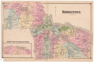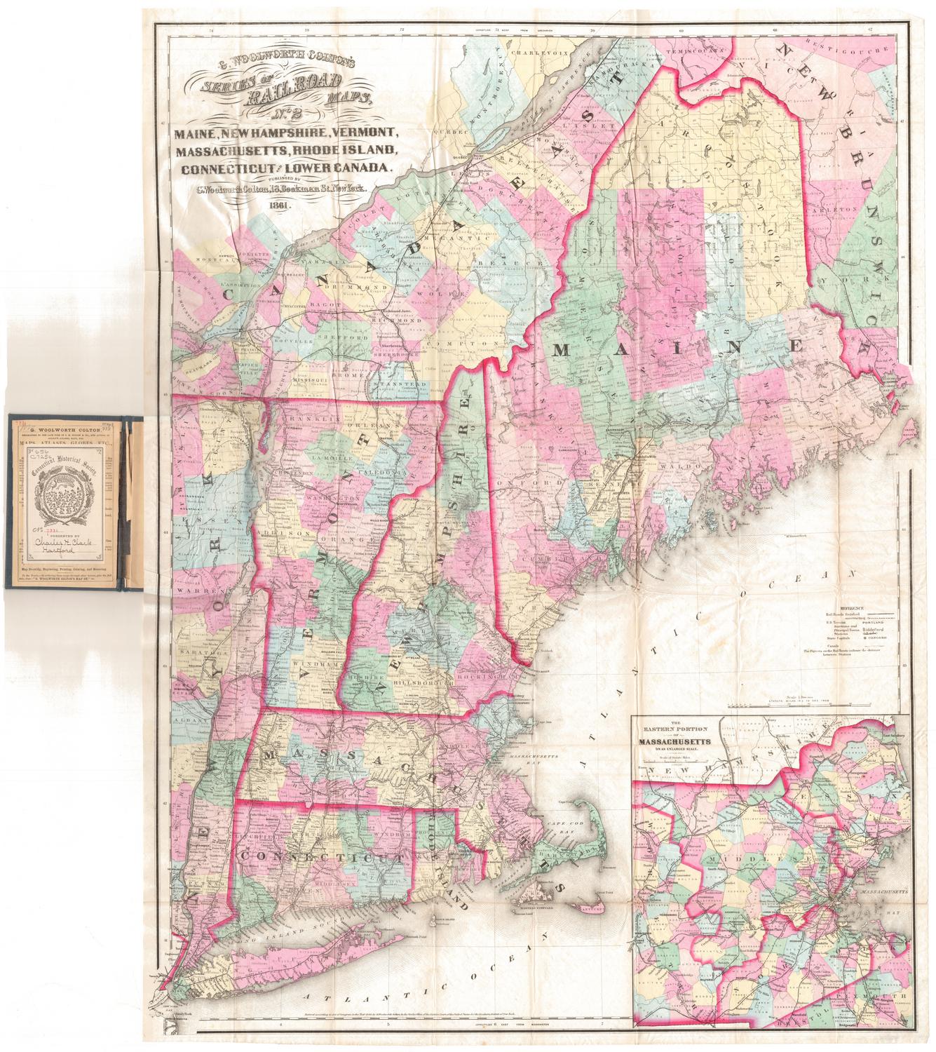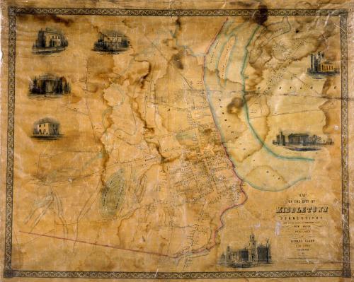
Map of the City of Middletown, Connecticut
SurveyorSurveyed by
R. Whiteford
(American)
PrintmakerLithographed by
John F. Watson
(American, active 1835 - 1861)
PublisherPublished by
Richard Clark
(American)
Date1851
MediumLithography; black printer's ink and watercolor on wove paper mounted on fabric
DimensionsPrimary Dimensions (image height x width): 35 1/2 x 45 1/4in. (90.2 x 114.9cm)
Sheet (height x width): 38 1/4 x 46 1/2in. (97.2 x 118.1cm)
ClassificationsGraphics
Credit LineConnecticut Museum of Culture and History collection
Object number2012.312.282
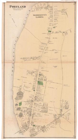
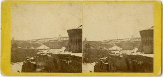
DescriptionMap of the city of Middletown on the west side of the Connecticut River and part of the town of Portland on the east side of the river. Willow island, the navigation channel, the Little River, and another unnamed river are shown. Elevation is indicated by hachure marks and many hills are named. Streets and roads are named and buildings are accompanied by the names of their owners. The Middletown and Berlin Railroad and its depot are at upper center. Indian Hill Cemetery and other burial grounds are colored green. In Portland, the brownstone quarries figure prominently, and districts near the river are identified as Belfast, Cork, and Dublin. Vignettes at left and right, based on daguerreotypes by Samuel Brewer, depicta view on Main Street, Wesleyan University, the Episcopal Church in Portland, and the residences of Nathan Starr, Mrs. R. Alsop, Samuel Russell, and William Cooley, Jr.
Label TextIt's unusual for a town or city map to include part of another town or city, but this 1851 map of the city of Middletown includes a section of the town of Portland, on the other side of the Connecticut River. Portland was originally part of Middletown, but had been separated from it since 1767. The relationship between the two communities remained close, however. Income from the brownstone quarries in Portland was deeded to Wesleyan University in Middletown from 1833 to 1884. The working class community of Portland, with its Irish districts down by the river, contrasted with the prosperous little city of Middletown with its gracious mansions and stately buildings along Main Street and on the college campus, many of them built of Portland brownstone. In the nineteenth century, the "city of Middletown" which appears on this map, was only a portion of the much larger town of Middletown, which in 1851 still included the future towns of Cromwell and Middlefield. The remainder of the town of Middletown (minus Cromwell and Middlefield) and the city of Middletown would be consolidated into one political entity in 1923.
NotesCartographic Note: 2 1/2 inches equals approximately 700 feetConstituent Note: Samuel Brewer was a daguerreotypist who appears in the Hartford city directory for 1847.
Status
Not on view