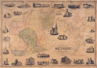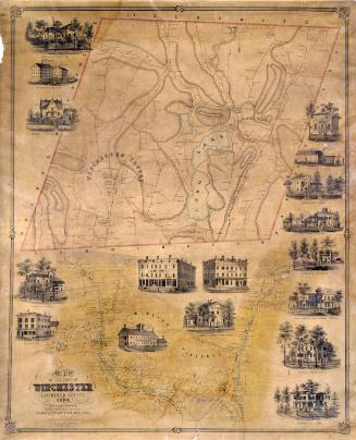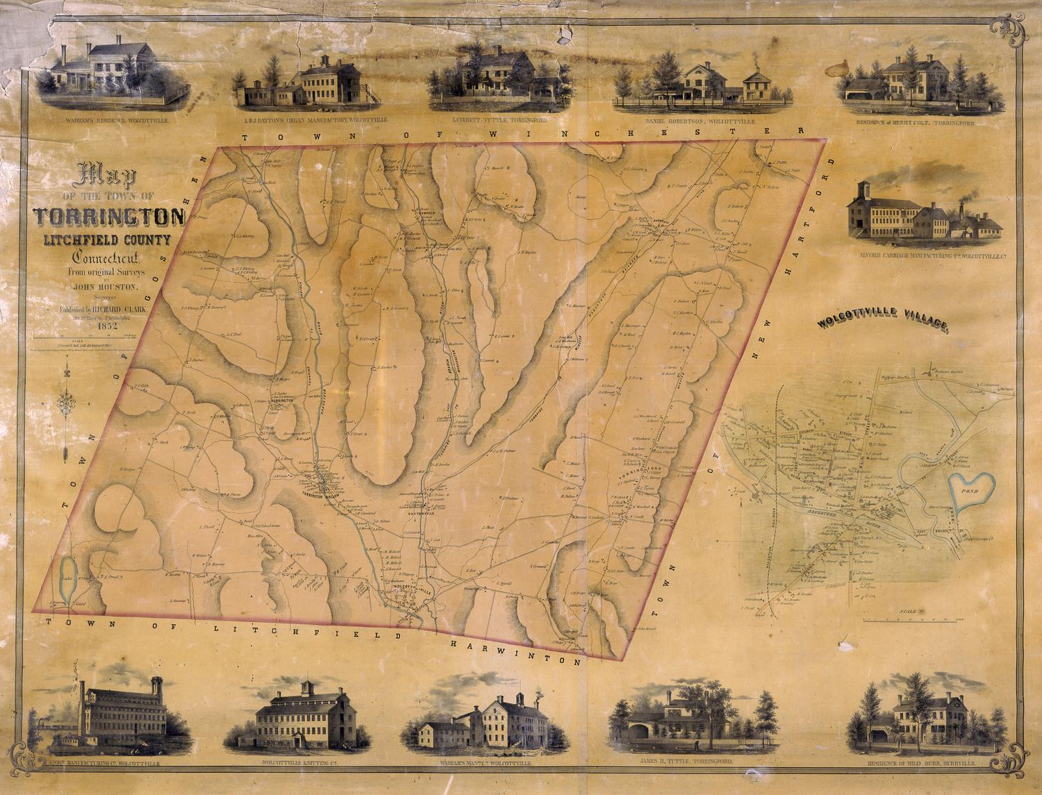
Map of the Town of Torrington, Litchfield, County, Connecticut
SurveyorSurveyed by
John Houston
PrintmakerLithographed by
Friend & Aub
(American, founded 1852)
PublisherPublished by
Richard Clark
(American)
Date1852
MediumLithography; black printer's ink and watercolor on wove paper mounted on fabric
DimensionsPrimary Dimensions (image height x width): 32 5/8 x 43 3/8in. (82.9 x 110.2cm)
Sheet (height x width): 35 1/4 x 46 1/4in. (89.5 x 117.5cm)
Sheet (height x width): 35 1/4 x 46 1/4in. (89.5 x 117.5cm)
ClassificationsGraphics
Credit LineConnecticut Museum of Culture and History collection
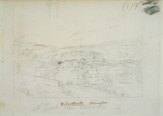
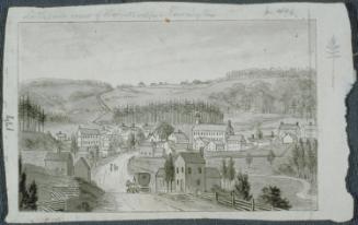
DescriptionMap of Torrington, Connecticut, with Winchester to the north, New Hartford to the east, Harwinton and Litchfield to the south, and Goshen to the west. The Naugatuck River, the East Branch River, and an unnamed lake are colored blue. Other rivers and streams are shown. Elevation is indicated by hachure marks. Roads, including turnpikes and turnpike gates are shown and locations of buildings are indicated with names of property owners. The villages of Wolcottville, Torrington, Torrington Hollow, Torringford, Newfield, Daytonville, and Burrville are shown. The Naugatuck Railroad runs through Wolcottville, Daytonville, and Burrville. A separate inset map provides additional detail for Wolcottville village. Vignettes at top and bottom depict the Union Manufacturing Company, Wolcottville Knitting Company, Wadham's Manufacturing Company, Alvord Carriage Manufacturing Company, A. & J. Dayton's Organ Manufactory, and the residences of Wadhams, James H. Tuttle, Milo Burr, Henry Colt, Daniel Robertson, and Leverett Tuttle.
Object number2012.312.281
NotesCartographic Note: 3 1/2 inches equals 70 rodsOn View
Not on view