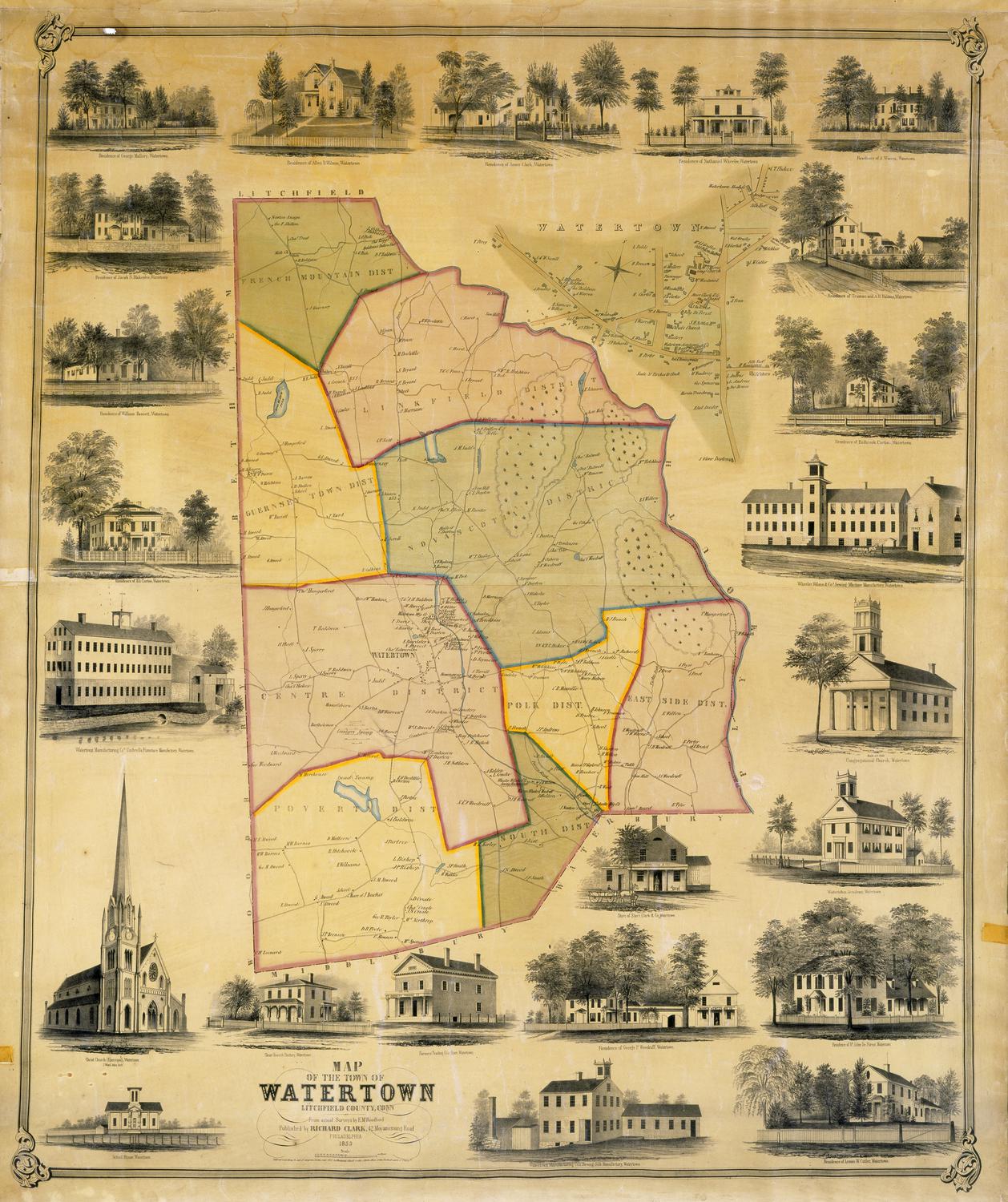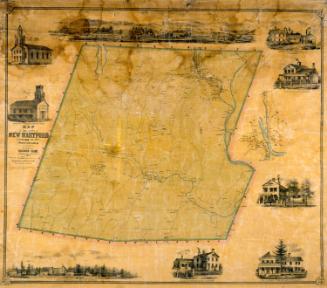
Map of the Town of Waterbury, New Haven County, Connecticut
SurveyorSurveyed by
H. Irvine
(American)
PrinterPrinted by
John F. Watson
(American, active 1835 - 1861)
PublisherPublished by
Richard Clark
(American)
Date1852
MediumLithography; black printer's ink and watercolor on wove paper mounted on fabric
DimensionsPrimary Dimensions (image height x width): 35 1/4 x 51in. (89.5 x 129.5cm)
Sheet (height x width): 39 5/8 x 53 1/4in. (100.6 x 135.3cm)
ClassificationsGraphics
Credit LineMuseum purchase
Object number1956.95.5
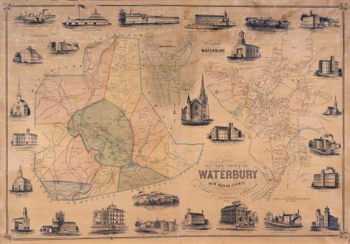
DescriptionMap of the town of Waterbury, Connecticut, with Watertown, Plymouth, and Wolcott to the north and east; Naugatuck, Prospect, and Cheshire to the south; and Middlebury and Watertown to the west. The town is divided into ten districts, including the central borough. Inset maps show the villages of Waterbury and Waterville. Rivers, including the Naugatuck River and the Mad River, are shown, along with brooks and ponds. Elevation is indicated by hachure marks. Names of property owners and businesses are indicated. The Naugatuck Railroad parallels the Naugatuck River. Vignettes depict Abbott & Wardwell Manufacturing Company, Brown's Hotel, Warren & Newton Manufacturing Company, American Pin Company, the High School, Waterbury Knittinig Company, St. Paul's Chapel, Wm. R. Hitchcock & Co. Button Factory, Mattatuck Manufacturing Company, Brown & Elton Brass Rolling Mill, Waterbury Brass Company, Unionville Factory, Scovill Manufacturing Company, Scovill House, the Baptist Church, the Methodist Church, Waterbury Hook & Eye Company, Lane Manufacturing Company, Benedict & Burnham Manufacturing Company, the Roman Catholic Church, Hotchkiss & Merriman Manufacturing Company, the Congregational Church, the new Church of St. John's, Manhan Manufacturing Company, Waterville Manufacturing Company, and Brown Brothers Brass Rolling Mill.
Label TextThe numerous images of factories that surround the central map are an indication of Waterbury's booming industry economy at the midpoint of the nineteenth century. Most businesses were engaged in some aspect of the brass industry. In addition to the factories, most of the other vignettes depict churches of many different denominations, suggesting the ethnic diversity of the workers in the brass mills. By the early 1850s, mapmaking had become big business, and most large town and county maps were being printed and published in Philadelphia. This map is an early example of the large town and county maps produced by the Philadelphia map publisher Richard Clark.
NotesCartographic Note: Four inches equals one mileStatus
Not on view