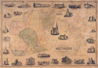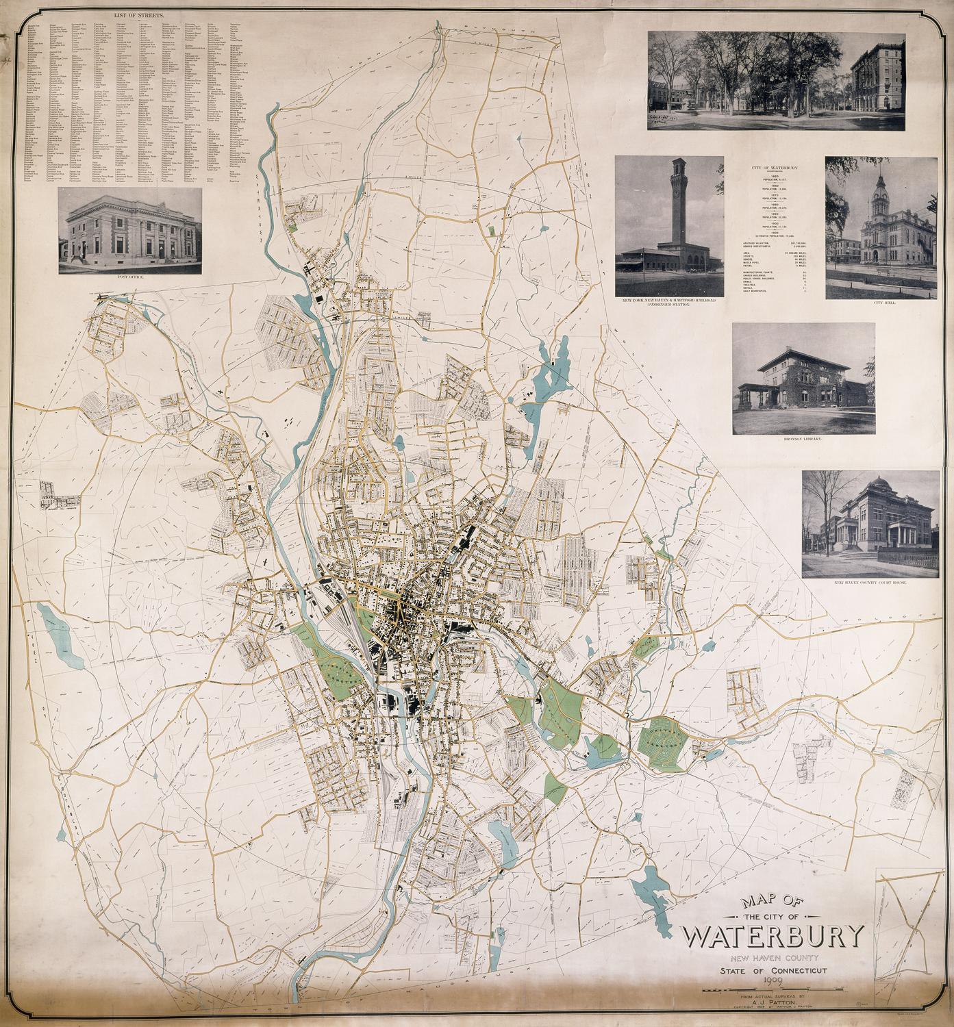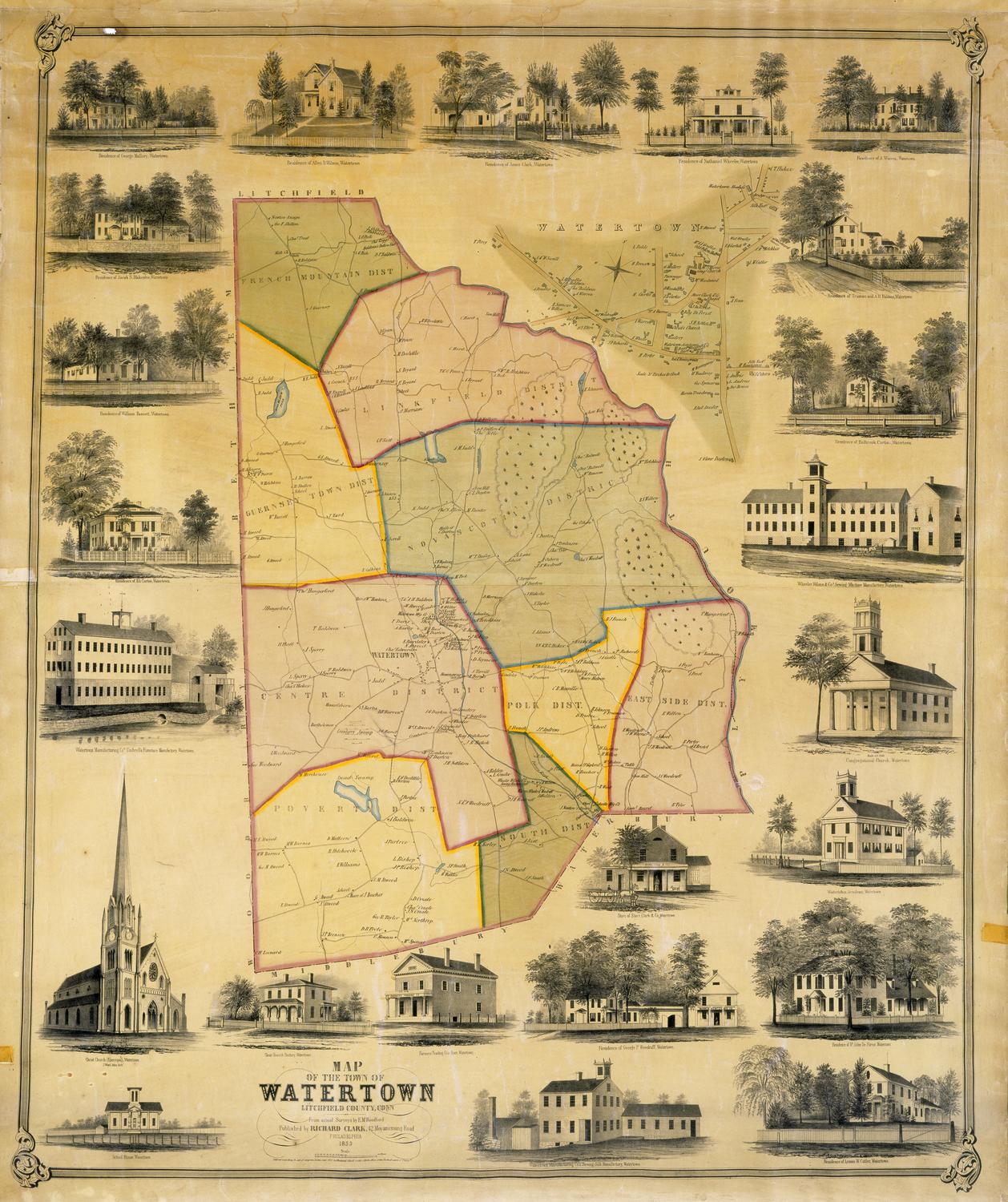
Map of the Town of Watertown, Litchfield County, Conn.
SurveyorSurveyed by
E. M. Woodford
(American, 1824 - 1862)
PublisherPublished by
Richard Clark
(American)
Date1853
MediumLithography; black printer's ink and watercolor on wove paper mounted on fabric
DimensionsPrimary Dimensions (image height x width): 46 x 38in. (116.8 x 96.5cm)
Sheet (height x width): 49 x 41in. (124.5 x 104.1cm)
Sheet (height x width): 49 x 41in. (124.5 x 104.1cm)
ClassificationsGraphics
Credit LineMuseum purchase
DescriptionMap of the town of Watertown, Connecticut, with Litchfield to the north, Plymouth to the east, Waterbury and Middlebury to the south, and Southbury and Bethlehem to the west. The town is divided into nine districts. Streams and ponds are shown. Elevation is indicated by hachure marks; wooded areas by small trees. Roads, houses, and businesses are shown; names of property owners are included. An inset map at upper right shows the center of Watertown. The two maps are surrounded by vignettes depicting the residences of George Mallory, William Bassett, Eli Curtiss, Allen B. Wilson, George P. Woodruff, Dr. John DeForest, Leman W. Cutler, Holbrook Curtis, Truman and A. H. Baldwin, A. Warren, Nathaniel Wheeler, and Amos Clark; the Watertown Manufacturing Company's Umbrella Furniture Manufactory and Silk Manufactory; Wheeler, Wilson and Company's Sewing Machine Manufactory; the store of Starr, Clark and Company; the Farmer Trading Company's store; the schoolhouse; Watertown Academy; the Congregational Church; Christ Church (Episcopal); and Christ Church Rectory.
Object number1956.95.4
NotesCartographic Note: Approximately 1 1/4 inches equals 200 rodsOn View
Not on view