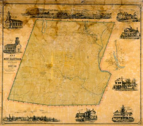
Map of the Town of New Hartford, Litchfield County, Connecticut
SurveyorSurveyed by
Lawrence Fagan
(American, born about 1825)
PrintmakerLithographed by
Friend & Aub
(American, founded 1852)
PrinterPrinted by
Wagner & McGuigan
(American, 1845 - 1859)
PublisherPublished by
Richard Clark
(American)
Date1852
MediumLithography; black printer's ink and watercolor on wove paper mounted on fabric
DimensionsPrimary Dimensions (image height x width): 34 3/4 x 40in. (88.3 x 101.6cm)
Sheet (height x width): 37 3/4 x 42 3/8in. (95.9 x 107.6cm)
ClassificationsGraphics
Credit LineMuseum purchase
Object number1956.95.2
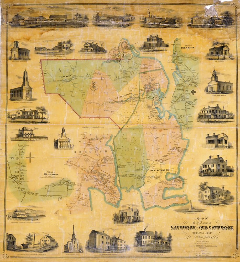
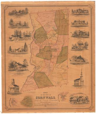
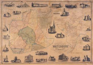
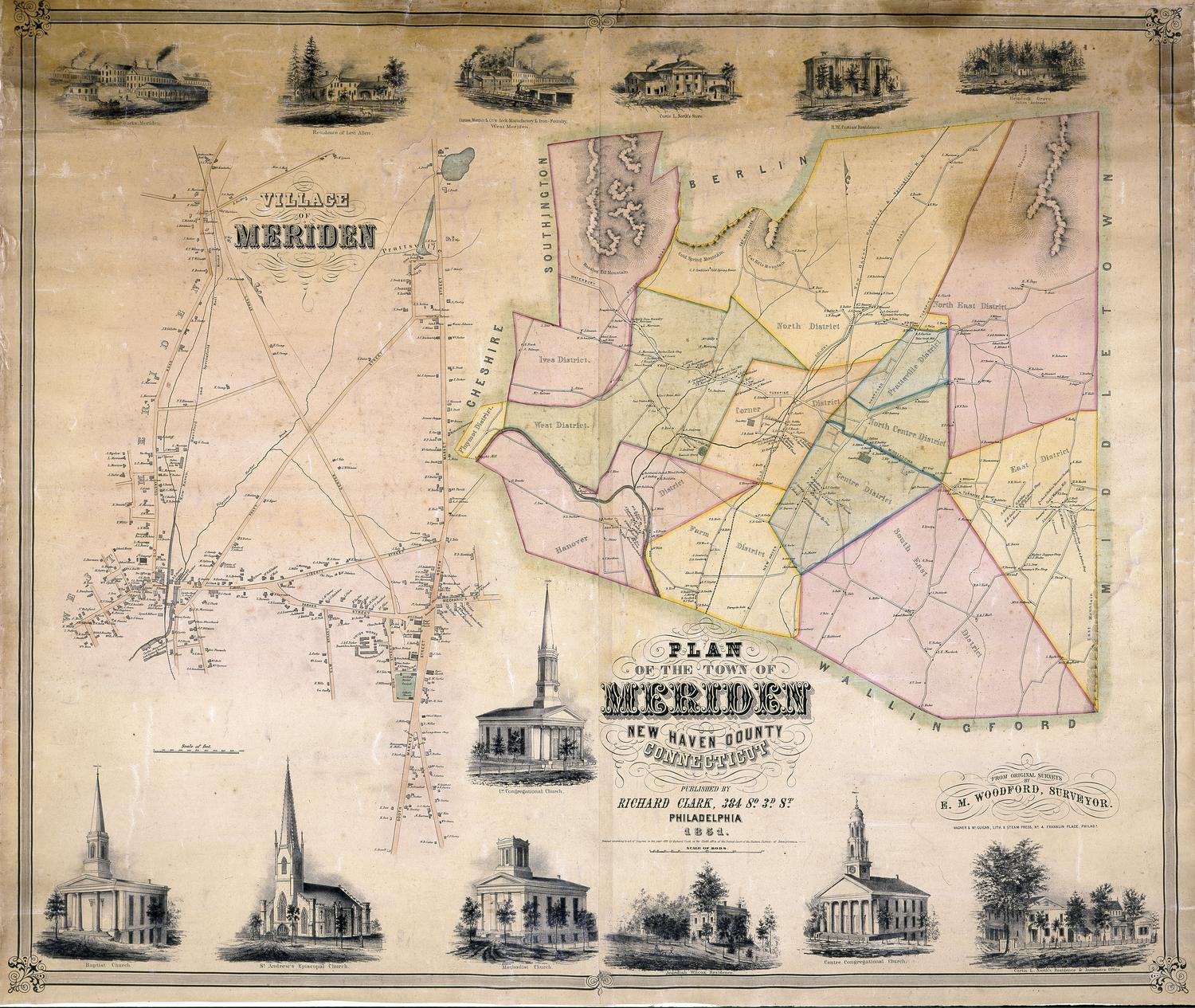
DescriptionMap of New Hartford, Connecticut, with Barkhamsted to the north, Canton to the east, Harwinton and Burlington to the south, and Torrington to the west. The villages of Bakerville, Nepaug, New Hartford Center, Pine Meadow, and Town HIll are shown with their houses, businesses, and property owners. The Farmington River and the Nepaug River are shown in blue. Elevation is indicated by hachure marks. A separate inset map at right provides detail for the center of New Hartford. Vignettes surrounding the map include the North Congregational Church, the South Congregational Church, Smith and Brown's Manufactory, the Green Woods Manufacturing Company, the New Hartford Centre Hotel, and the residences of J. C. Smith, D. B. Smith, and Major S. Brown.
Label TextLike many Connecticut towns, New Hartford is composed of several small community centers. In 1852, these villages included Bakerville, Nepaug, New Hartford Center, Pine Meadow, and Town Hill. Though most of these names endured into the twenty-first century, the center of New Hartford moved north to a location on the Farmington River, just west of Pine Meadow. Part of the southern portion of the town would be flooded when the Nepaug Dam was built in the early twentieth century, and much of the farmland shown on this map would later become part of the Nepaug State Forest. Like most of the large town maps of the early 1850s, this map of New Hartford was printed and published in Philadelphia.
NotesCartographic Note: Four inches equal one mileStatus
Not on view