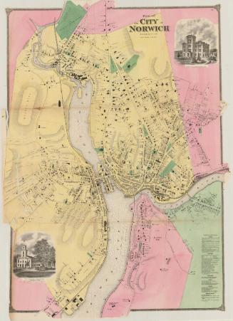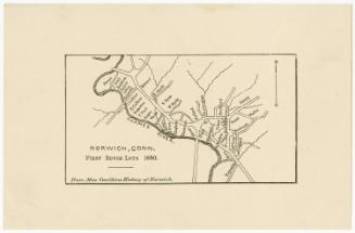
City of Norwich, New London County, Connecticut
SurveyorSurveyed by
George Stevens
(American, active 1857 - 1858)
PrinterPrinted by
W. H. Rease's Lithographic Establishment
(American, 1844 - 1860)
PublisherCopyrighted by
George Stevens
(American, active 1857 - 1858)
Date1858
MediumLithography; black printer's ink and watercolor on wove paper mounted on fabric
DimensionsPrimary Dimensions (image height x width): 46 x 39 1/4in. (116.8 x 99.7cm)
Sheet (height x width): 49 x 41in. (124.5 x 104.1cm)
Sheet (height x width): 49 x 41in. (124.5 x 104.1cm)
ClassificationsGraphics
Credit LineMuseum purchase
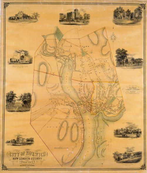
DescriptionMap of the city of Norwich, Connecticut, located on the Thames River at the confluence of the Yantic and Shetucket Rivers. Several bridges span the rivers. A large body of water above the Central Wharf and below Yantic Falls is identified as the Cove. The locations of several springs are shown. The city is divided into three wards. Streets are identified and houses and buildings are identified by street number. The New London, Willimantic and Palmer Railroad runs along the west bank of the Thames; the Norwich and Worcester Railroad runs along the right bank. Cemeteries, churches, parks, and some businesses are identified, including the town poor house, a ropewalk, a papermill, a gristmill, a coal yard, H. Bill's Laurel Hill Farm, and the Falls Manufacturing Company. Vignettes at the left, top, and right of the map depict the Norwich Free Academy, the premises of Myers and Bailey, Architects and Builders, and the residences of C. C. Brand, J. Hunt Adams, William W. Coit, Joseph Backus, Dr. J. V. Wilson, Charles N. Farnum, and General W. Williams.
Object number1947.21.2
NotesCartographic Note: Approximately three and five/eighths inches equals 500 feetOn View
Not on view