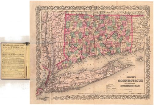
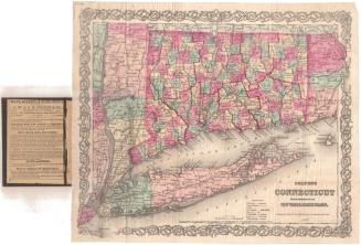
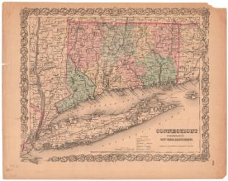
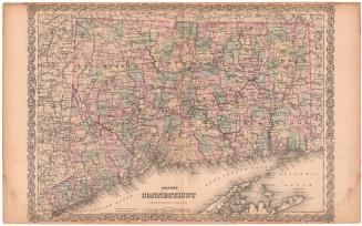
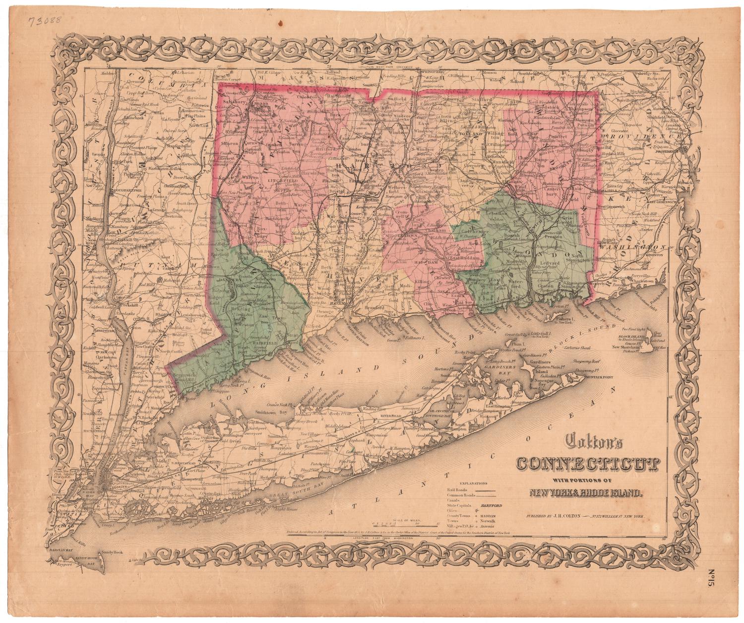
Colton's Connecticut, with portions of New York and Rhode Island
PublisherPublished by
G.W. & C.B. Colton & Co.
(American, founded 1865)
After a work byAfter a work by
J. H. Colton & Co.
(American, founded 1831)
Date1877
MediumLithography; black printer's ink and watercolor on wove paper, in cardboard covers
DimensionsPrimary Dimensions (image height x width): 12 3/4 x 15 1/4in. (32.4 x 38.7cm)
Sheet (height x width): 14 x 16 1/2in. (35.6 x 41.9cm)
ClassificationsGraphics
Credit LineGift of the estate of Miss Florence Crofut
Object number1975.106.1
DescriptionPocket map of Connecticut, with western Rhode Island, Long Island and eastern New York. State boundaries are outlined in red, and Connecticut's counties are also outlined in red. The state is further divided into towns, colored pink, green, or yellow. Railroads and common roads are depicted on the map. Railroad lines include New York and New Haven; Danbury and Norwalk; Housatonic; Naugatuck; New Haven and Northampton; Hartford, Providence and Fishkill; New Haven, Hartford and Springfield; New Haven and New London; Norwich and Worcester; and New London and Palmer. Cities are depicted with clusters of dots, and county towns, towns and villages are represented with different circles. Physical features include elevation, conveyed with hachures marks; rivers; and ponds and lakes.
Label TextA business traveler looking for Thomaston or Beacon Falls would have been unable to locate those cities on this 1877 map of Connecticut even though Thomaston was incorporated in 1875 and Beacon Falls in 1871. Colton's Connecticut was first issued in 1855 and frequently reissued afterwards, but it wasn't always updated to reflect recent changes. This certainly would have limited its usefulness and could have proved frustrating to purchasers. An advertisement inside the front cover of this map makes it clear that such folding pocket maps were specifically intended for tourists and travelers.
NotesCartographic Note: Scale: 1 inch equals 10 milesStatus
Not on view


Kellogg & Bulkeley
1910-1915