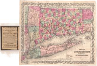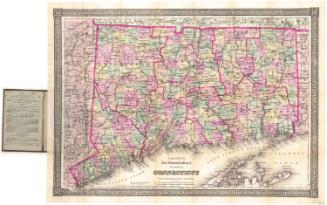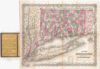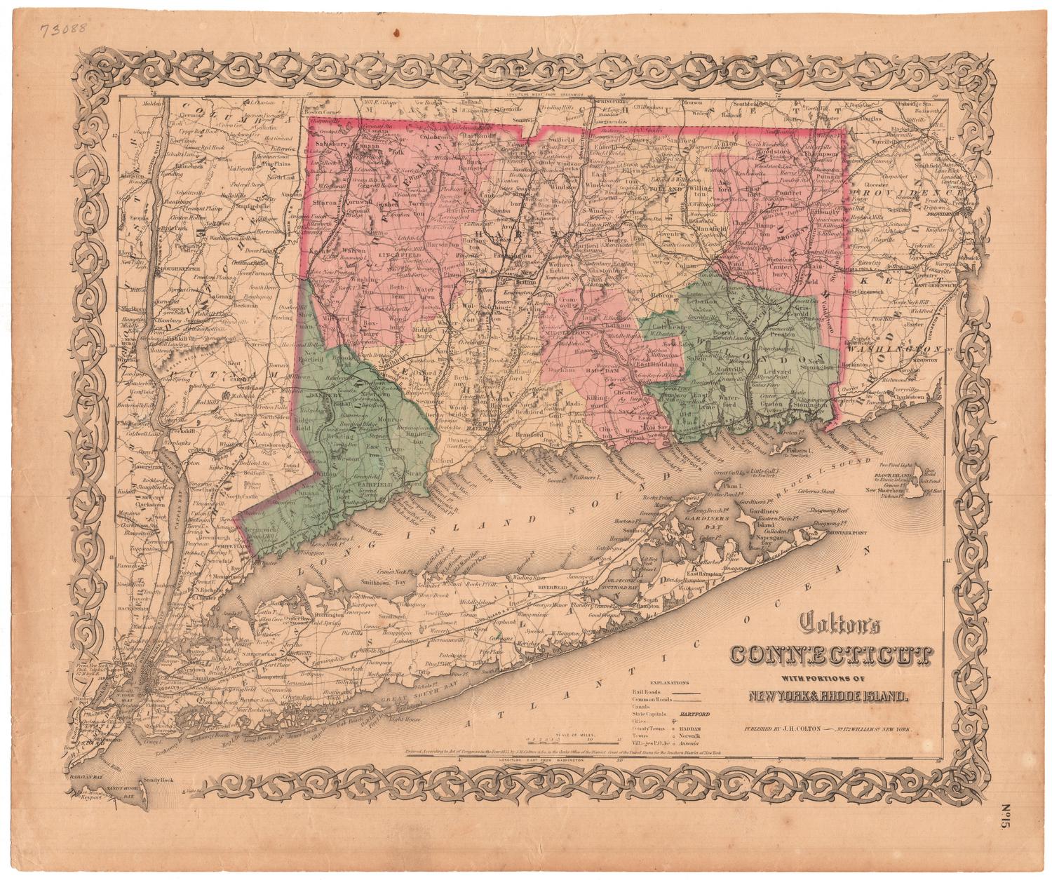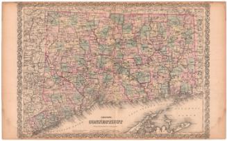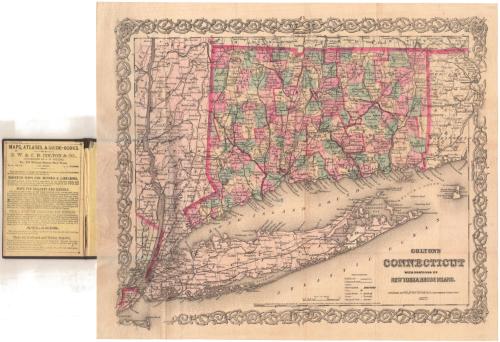
Colton's Connecticut, with portions of New York and Rhode Island
PublisherPublished by
G.W. & C.B. Colton & Co.
(American, founded 1865)
After a work byAfter a work by
J. H. Colton & Co.
(American, founded 1831)
Date1877
MediumLithography; black printer's ink and watercolor on wove paper, in cardboard covers
DimensionsPrimary Dimensions (image height x width): 12 3/4 x 15 1/4in. (32.4 x 38.7cm)
Sheet (height x width): 14 x 16 1/2in. (35.6 x 41.9cm)
Sheet (height x width): 14 x 16 1/2in. (35.6 x 41.9cm)
ClassificationsGraphics
Credit LineGift of the estate of Miss Florence Crofut
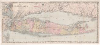
DescriptionPocket map of Connecticut, with western Rhode Island, Long Island and eastern New York. State boundaries are outlined in red, and Connecticut's counties are also outlined in red. The state is further divided into towns, colored pink, green, or yellow. Railroads and common roads are depicted on the map. Railroad lines include New York and New Haven; Danbury and Norwalk; Housatonic; Naugatuck; New Haven and Northampton; Hartford, Providence and Fishkill; New Haven, Hartford and Springfield; New Haven and New London; Norwich and Worcester; and New London and Palmer. Cities are depicted with clusters of dots, and county towns, towns and villages are represented with different circles. Physical features include elevation, conveyed with hachures marks; rivers; and ponds and lakes.
Object number1975.106.1
NotesCartographic Note: Scale: 1 inch equals 10 milesOn View
Not on view