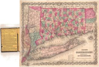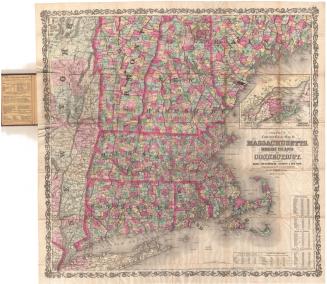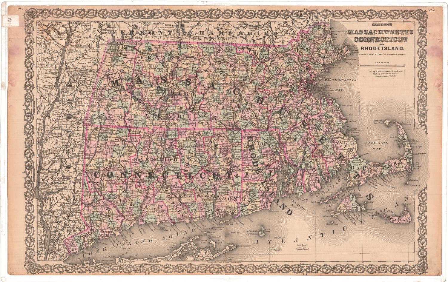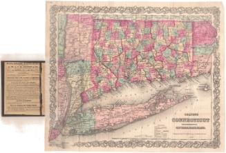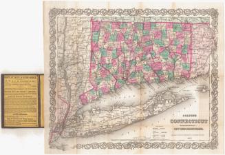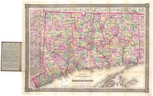
Colton's New Township Map of the State of Connecticut
PublisherPublished by
G.W. & C.B. Colton & Co.
(American, founded 1865)
Date1886
MediumLithography; black printer's ink and watercolor on wove paper, in cardboard covers
DimensionsPrimary Dimensions (image height x width): 17 5/8 x 24 1/8in. (44.8 x 61.3cm)
Sheet (height x width): 18 3/4 x 25 1/4in. (47.6 x 64.1cm)
ClassificationsGraphics
Credit LineMuseum purchase
Object number1976.131.5
DescriptionPocket map of Connecticut, with part of Massachusetts to the north, part of Rhode Island to the east, part of Long Island and the Long Island Sound to the south, and part of New York to the west. The state is outlined in a thick bright pink line, with counties outlined in thinner pink lines. It is further divided into towns, colored pink, green, yellow, or peach. Railroad lines are depicted, including New York and New Haven; Housatonic; Shepaug; New York, New Haven and Hartford; New Haven and Northampton; Hartford and Harlem; Connecticut Western; Boston and New York Air Line; New York and New England; and New York and New England Worcester Division. Physical features include rivers and lakes/ponds.
Label TextColton's New Township Map of the State of Connecticut follows basically the same format as the other maps of Connecticut which J. B. Colton and his sons had been issuing since the 1860s, In all of the individual towns are brightly colored and the map has an elaboborate decorative border. Perhaps the new title was an attempt to attract a different audience. Colton's earlier maps were often notoriously out-of-date, but this 1886 map includes all of the towns incorporated as of that date--perhaps because the last town to be incorporated was Thomaston, incorporated in 1875, eleven years earlier.
NotesCartographic Note: Scale: 1:300,000Status
Not on view