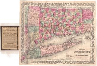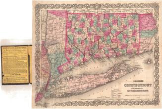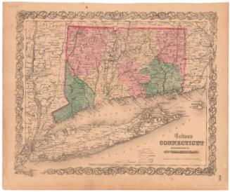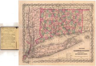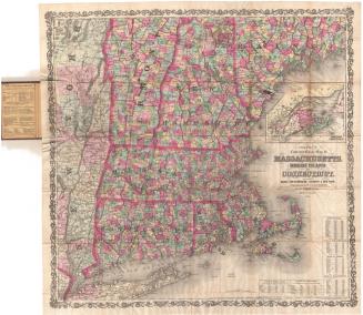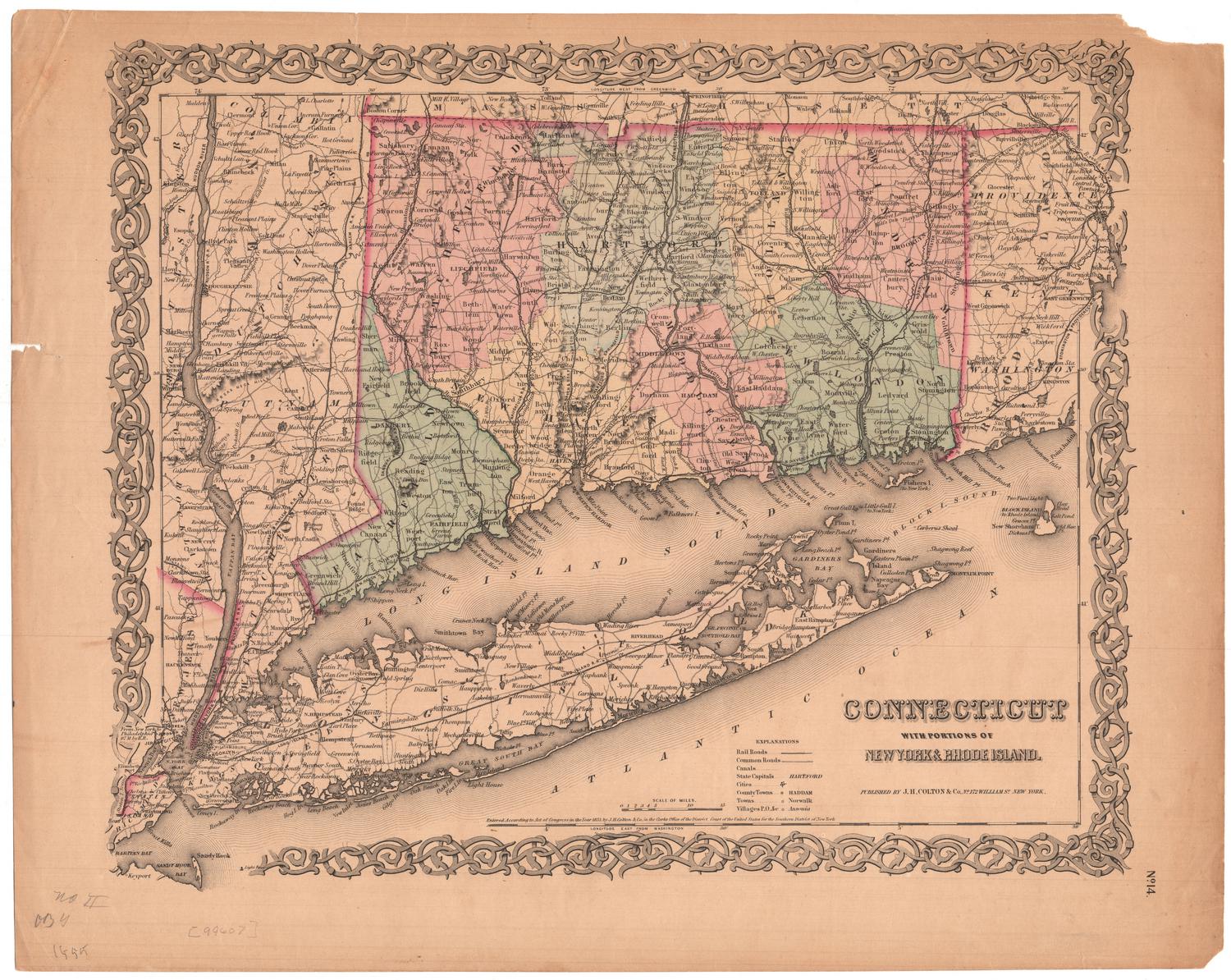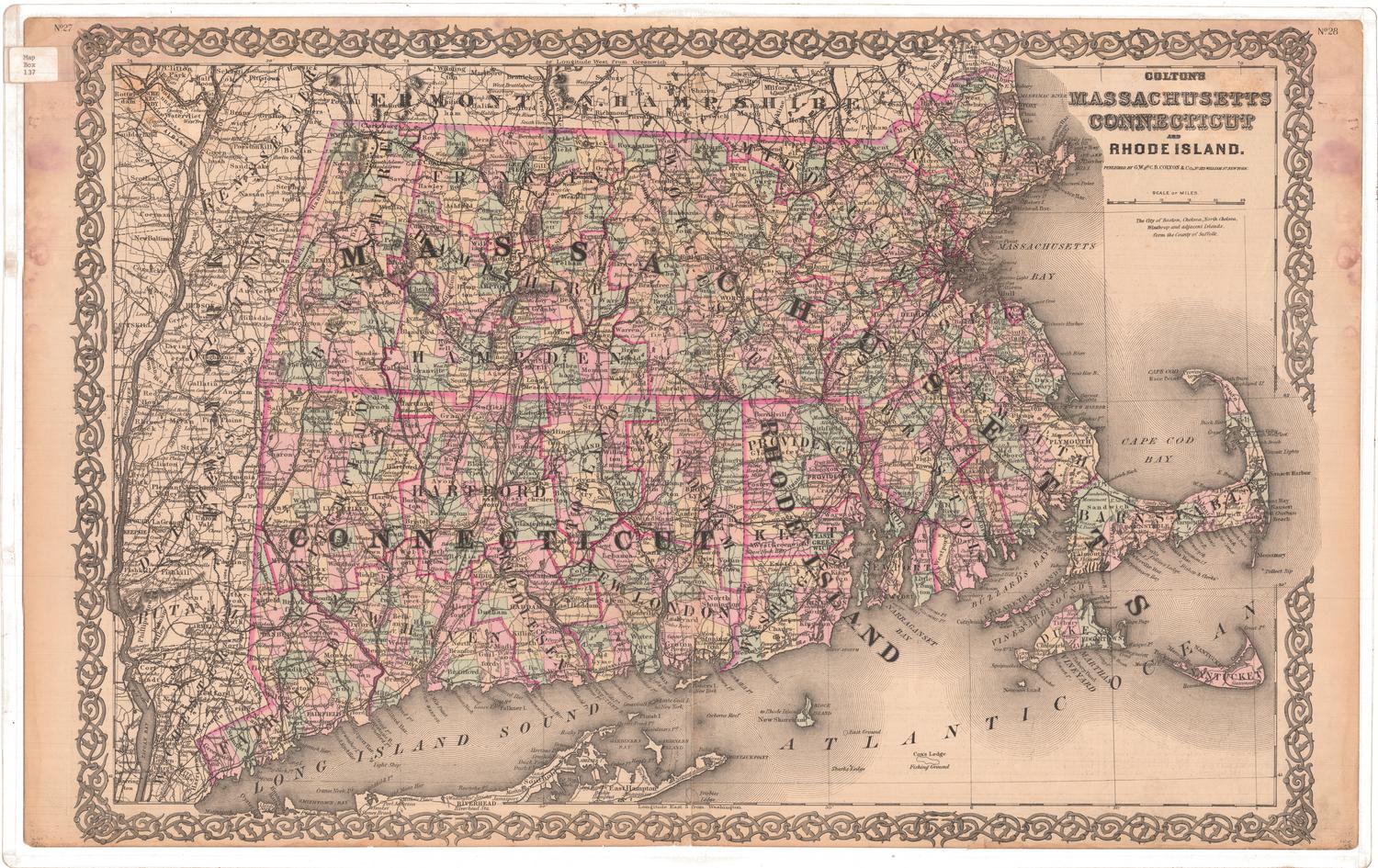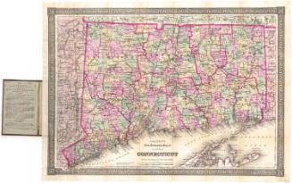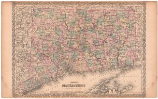
Colton's Connecticut, with portions of New York and Rhode Island
After a work byAfter a work by
J. H. Colton & Co.
(American, founded 1831)
PublisherPublished by
G.W. & C.B. Colton & Co.
(American, founded 1865)
Date1869
MediumLithography; black printer's ink and watercolor on wove paper, in cardboard covers
DimensionsPrimary Dimensions (image height x width): 12 5/8 x 15 1/8in. (32.1 x 38.4cm)
Sheet (height x width): 13 3/4 x 16 3/16in. (34.9 x 41.1cm)
ClassificationsGraphics
Credit LineMuseum purchase
Object number1976.131.3
DescriptionMap of the state of Connecticut, with part of Massachusetts to the north, part of Rhode Island to the east, Long Island and the Long Island Sound to the south, and part of New York to the west. The state is divided into counties, outlined in red, and towns, colored pink, green, or yellow. Railroads are depicted on the map, include the New York and New Haven; Danbury and Norwalk; Naugatuck; Housatonic; Hartford, Providence and Fishkill; New Haven and New London; Norwich and Worcester; Stonington and Providence; and New York and Boston Air Line. Physical features include elevation, conveyed with hachure marks; rivers; and lakes/ponds. On the inside of the front cover is an advertisement for maps and atlases sold by G.W. & C.B. Colton & Co.
Label TextThis map of Connecticut first appeared in Colton's Atlas of the World in 1855, published in New York by J. H. Colton & Co. in 1855. Colton and his sons continued to re-issue this map for the next twenty years, and though they occasionally revised it to reflect new towns that were being added, the new editions were often badly out of date. This 1869 edition, published by G. W. & C. B. Colton & Co., does not include the towns of Sprague, Middlefield, and Plainville, which were added between 1861 and 1869. The most recent town to appear is Morris, which was incorporated in 1859, ten years before the map was published.
NotesCartographic Note: Scale: 1 inch equals 10 milesStatus
Not on view