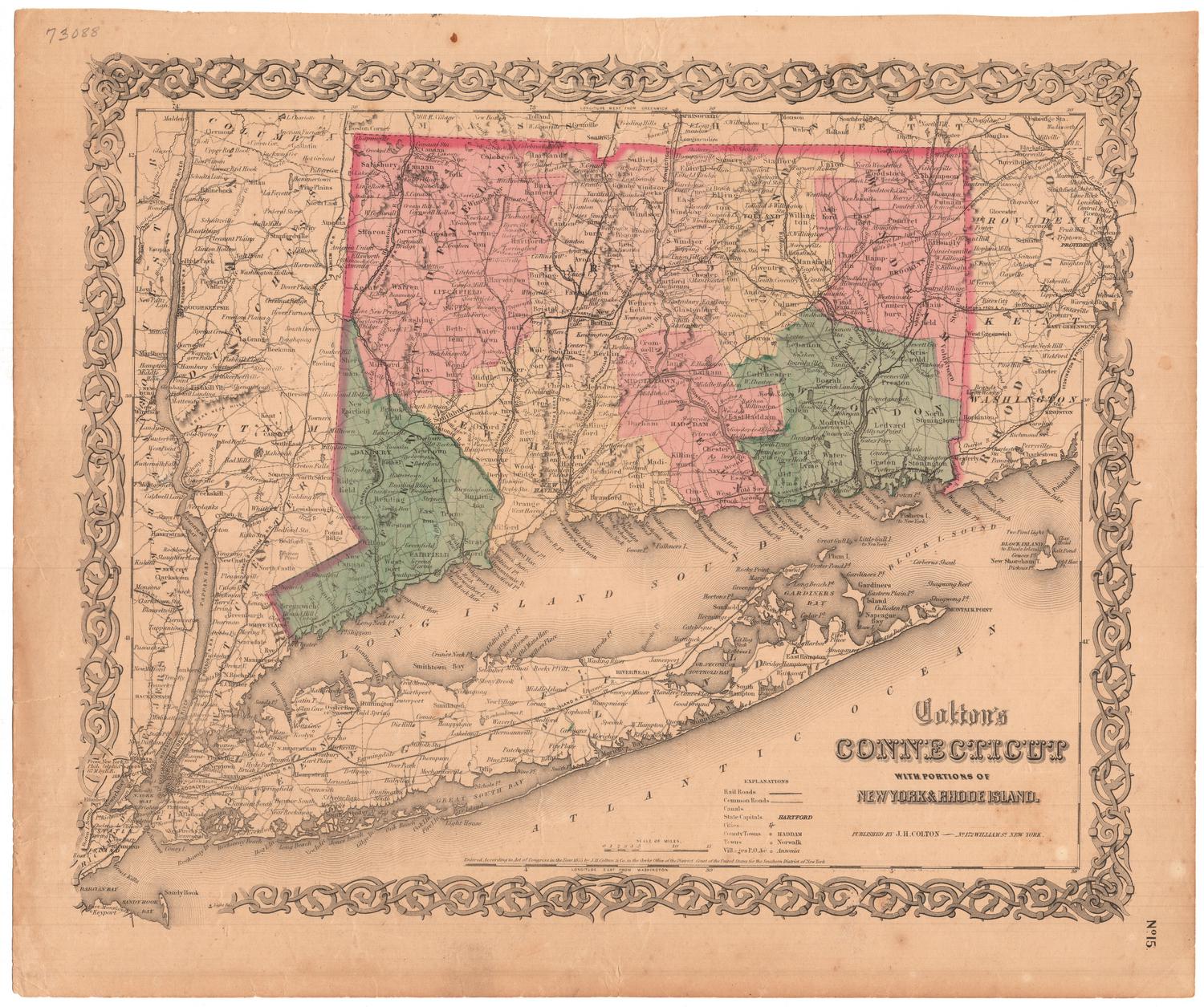
Connecticut
PublisherPublished by
John Warner Barber
(American, 1798 - 1885)
DateProbably 1852
MediumEngraving; black printer's ink and watercolor on wove paper, in cardboard covers
DimensionsPrimary Dimensions (image height x width): 7 3/8 x 9 1/8in. (18.7 x 23.2cm)
Platemark (height x width): 8 7/8 x 10 5/8in. (22.5 x 27cm)
Sheet (height x width): 9 1/4 x 11 3/4in. (23.5 x 29.8cm)
Platemark (height x width): 8 7/8 x 10 5/8in. (22.5 x 27cm)
Sheet (height x width): 9 1/4 x 11 3/4in. (23.5 x 29.8cm)
ClassificationsGraphics
Credit LineMuseum purchase
DescriptionPocket map of Connecticut, with the border of Massachusetts to the north, the border of Rhode Island to the east, part of Long Island and the Long Island Sound to the south, and part of New York State to the west. The state is divided into counties, colored yellow, pink or green. Physical features depicted include elevation, conveyed with hachure marks; rivers; and lakes/ponds. Roads are marked with parallel lines. Railroads depicted include the New York and New Haven; Naugatuck; New Haven and Northampton; and Hartford and Providence. There are also several unnamed lines, including the Danbury and Norwalk; Housatonic; what is probably New Haven and Hartford; what is probably New London, Willimantic and Palmer; and Norwich and Worcester. The New York and Boston Air Line is marked as "contemplated."
Object number1976.131.1
NotesCartographic Note: Scale: 7/8 inch equals 10 milesOn View
Not on view


Lucius Stebbins & Co.
1859