Massachusetts, Rhode-Island and Connecticut
PrintmakerEngraved by
N. & S. S. Jocelyn
(American, founded 1818)
MakerCopyrighted by
Sidney E. Morse
(American, 1794 - 1871)
PublisherPublished by
N. & S. S. Jocelyn
(American, founded 1818)
Date1827
MediumEngraving; black printer's ink and watercolor on wove paper, in cardboard covers
DimensionsPrimary Dimensions (image height x width): 7 3/4 x 9 3/4in. (19.7 x 24.8cm)
Platemark (height x width): 8 5/8 x 10 3/4in. (21.9 x 27.3cm)
Sheet (height x width): 18 x 11in. (45.7 x 27.9cm)
Mount (height x width): 18 x 11in. (45.7 x 27.9cm)
ClassificationsGraphics
Credit LineThe Conecticut Historical Society collection
Object number1978.110.1
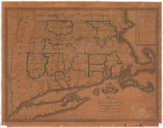
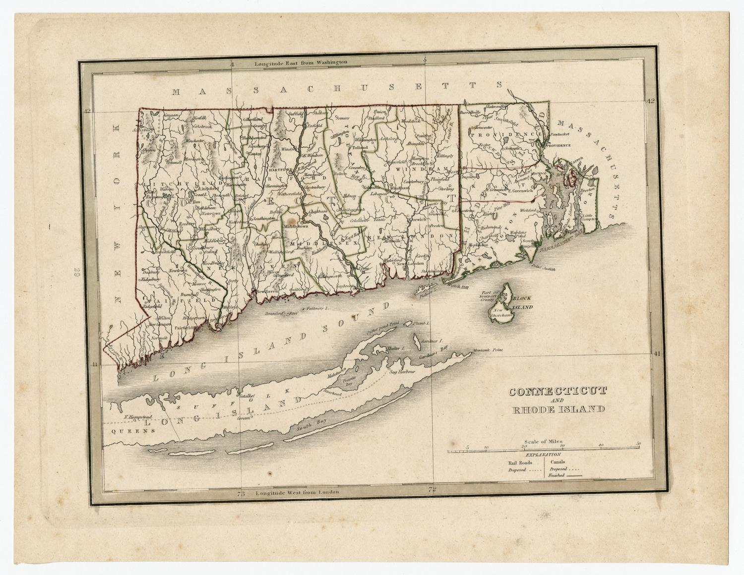
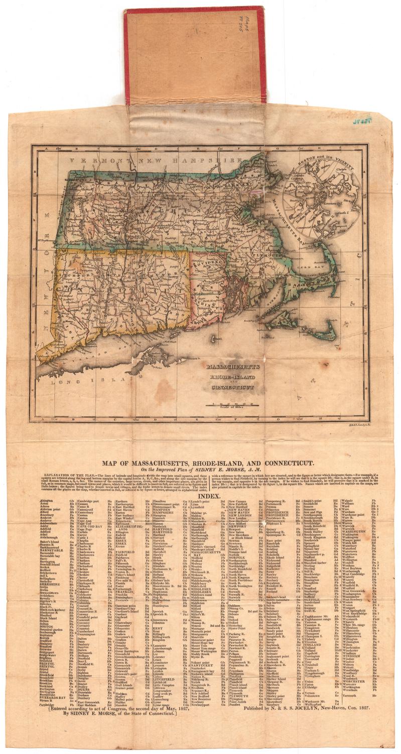
DescriptionPocket map of the states of Massachusetts, Connecticut and Rhode Island, with Vermont and New Hampshire to the north, the Atlantic Ocean to the east, Long Island and the Long Island Sound to the south, and New York to the west. Massachusetts is outlined in green, Connecticut in yellow, and Rhode Island in pink. Massachusetts' and Connecticut's counties are outlined in pink and Rhode Island's are outlined in green. Cities and villages are marked with circles and are labeled. Physical features depicted include elevation, conveyed with hachure marks; rivers; and lakes. In the top right is an inset map of Boston and its vicinity. At the bottom is a textual explanation of the map, including a description of its place names and how to use the index that appears at the very bottom of the sheet.
Label TextKeyed grids would become common in the twentieth century, especially on road maps, as a way to help users locate towns and geographical features. Sidney E. Morse's 1827 Map of Massachusetts, Rhode-Island, and Connecticut is an early example of a map with such a key. It required an elaborate explanation of how to use the letters along the top, bottom, and sides of the map as coordinates. It is also a good example of a folding pocket map. The map folded into a tiny cardboard folder that could be carried in a pocket. Like a modern road map, it had to be unfolded in order to be consulted by its owner.
NotesCartographic Note: Scale: 1 inch equals about 24 milesStatus
Not on view