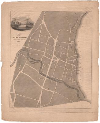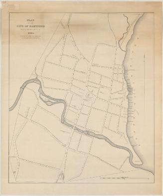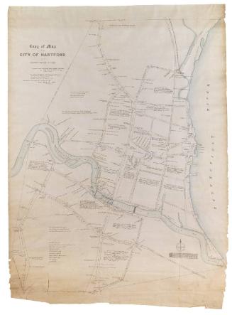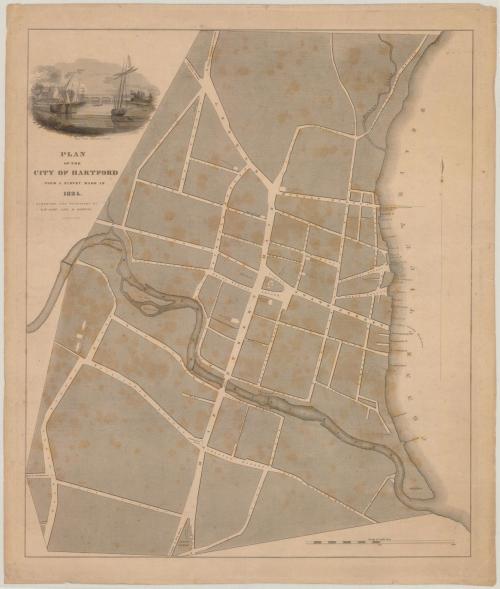
Plan of the City of Hartford from a Survey made in 1824
SurveyorSurveyed by
Nathaniel Goodwin
(American, 1782 - 1855)
SurveyorSurveyed by
Daniel Saint John
(American, 1761 - 1846)
PublisherPublished by
Nathaniel Goodwin
(American, 1782 - 1855)
PublisherPublished by
Daniel Saint John
(American, 1761 - 1846)
PrintmakerEngraved by
Asaph Willard
(1786 - 1880)
Date1824
MediumEngraving; black printer's ink on wove paper
DimensionsPrimary Dimensions (image height x width): 21 5/16 x 18 1/4in. (54.1 x 46.4cm)
Platemark (height x width): 22 3/4 x 18 1/2in. (57.8 x 47cm)
Sheet (height x width): 23 1/4 x 19 7/8in. (59.1 x 50.5cm)
Platemark (height x width): 22 3/4 x 18 1/2in. (57.8 x 47cm)
Sheet (height x width): 23 1/4 x 19 7/8in. (59.1 x 50.5cm)
ClassificationsGraphics
Credit LineConnecticut Museum of Culture and History collection
DescriptionMap of Hartford, Connecticut, from Meadow Creek to the north, the Connecticut River to the east, the South Green to the south, and the Little or Mill (Park) River to the west. The streets are labeled and the few buildings shown are churches, schools, and the State House. Todd's Mills, Wadsworth's Clothing Works, Wards Woollen Factory, and a saw mill are shown along the Little River. The locations and names of wharves along the Connecticut River are shown. At the intersection of Bliss Street and Buckingham Street are the buildings of Washington College, later known as Trinity College. The cartouche depicts "The view from Seymour's Wharf," complete with sailboats, buildings, a bridge and an island.
Object number2012.312.278
NotesCartographic Note: Three inches equals 1000 feetOn View
Not on view