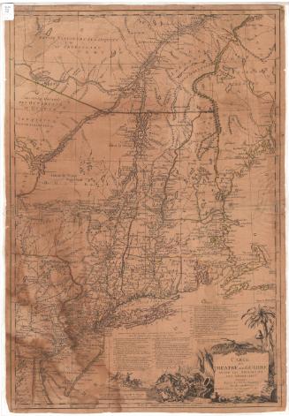
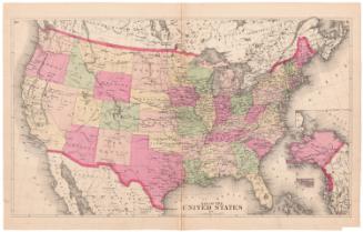
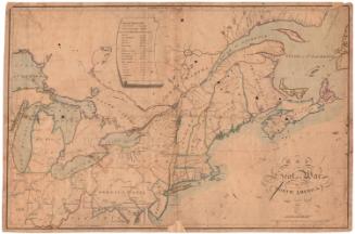
Carte de la partie septentrionale des Etats Unis
PrintmakerEngraved by
Pierre Francois Tardieu
(French, 1757 - 1822)
Datelate 18th century
MediumEngraving; black printer's ink and wataercolor on laid paper
DimensionsPrimary Dimensions (image height x width): 12 3/4 x 16 3/4in. (32.4 x 42.5cm)
Platemark (height x width): 13 1/4 x 17 5/16in. (33.7 x 44cm)
Sheet (height x width): 17 3/4 x 22 3/4in. (45.1 x 57.8cm)
Platemark (height x width): 13 1/4 x 17 5/16in. (33.7 x 44cm)
Sheet (height x width): 17 3/4 x 22 3/4in. (45.1 x 57.8cm)
ClassificationsGraphics
Credit LineConnecticut Museum of Culture and History collection
DescriptionMap of portions of Canada and the northern United States extending from Philadelphia up the coast to the Gulf of Saint Lawrence and Newfoundland. George's Bank and other fishing grounds are shown. To the west, the map extends to Lake Ontario. Counties, cities, towns, villages, forts, roads, rivers, lakes, and mountains are shown. States are outlined in green. A table of distances from France and England is at upper left.
Object number2012.312.274
NotesCartographic Note: No scaleOn View
Not on view