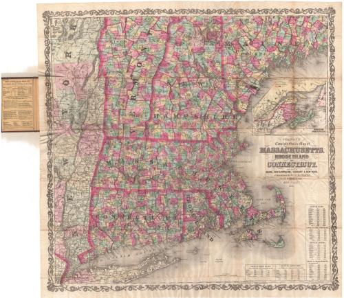
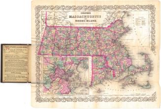
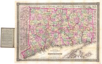
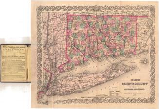
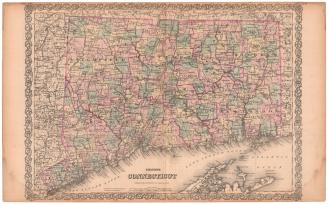
Colton's Tourist Guide Map of Massachusetts, Rhode Island and Connecticut, with Parts of Maine, New Hampshire, Vermont and New York
PublisherPublished by
G.W. & C.B. Colton & Co.
(American, founded 1865)
PublisherCopyrighted by
Joseph Hutchins Colton
(American, 1800 - 1893)
PrinterPrinted by
Lang & Laing
(American)
Date1866
MediumLithography; black printer's ink and watercolor on wove paper, in cardboard covers
DimensionsPrimary Dimensions (image height x width): 29 1/2 x 30 3/4in. (74.9 x 78.1cm)
Sheet (height x width): 31 x 32 1/8in. (78.7 x 81.6cm)
ClassificationsGraphics
Credit LineMuseum purchase
Object number1961.107.1
DescriptionPocket map of the northeastern United States, from the northern parts of Vermont and New Hampshire and western Maine to the north, the Atlantic Ocean to the east, Long Island to the south, and the eastern part of New York to the west. The states are outlined in thick pink lines and are divided into counties, also outlined in pink. They are further divided into towns, colored pink, green, blue, or yellow. The railroad lines depicted include New York and New Haven; Danbury and Norwalk; Housatonic; Naugatuck; New York and Boston Air Line; New Haven, Hartford and Springfield; New London, Willimantic and Palmer; Stonington; Norwich and WorcesterConnecticut; and Hartford, Providence and Fishkill. Roads are also shown. Physical features include elevation, conveyed through hachure marks; rivers; and lakes. In the top right is an inset map of Canada East, New Brunswick and Nova Scotia. In the bottom right corner are statistical tables for the populations of Rhode Island, Connecticut, Maine, New Hampshire, Vermont and Massachusetts for 1850 and 1860.
Label TextIn 1866, the Civil War was over, and people were once more free to pursue travel as a leisure activity. Tourism certainly had existed and tourist maps were not unknown prior to the war, but following the war, they became even more popular and numerous. Folding pocket maps were especially atrractive to travelers because they could literally be carried in ones pocket and unfolded for use, much like a latter-day road map. Railroads figure much more prominently than roads on most nineteenth-century tourist maps, since most travelers used the railroads to reach their destinations.
NotesCartographic Note: Scale: 1 inch equals about 8 milesStatus
Not on view
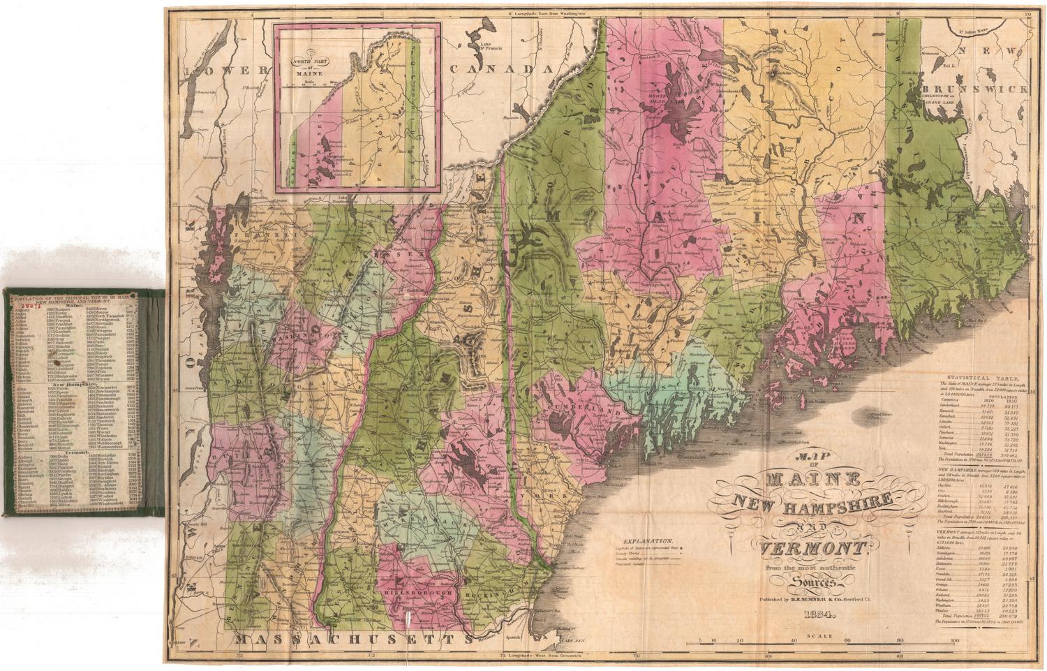


Matthews-Northrup Company
1913