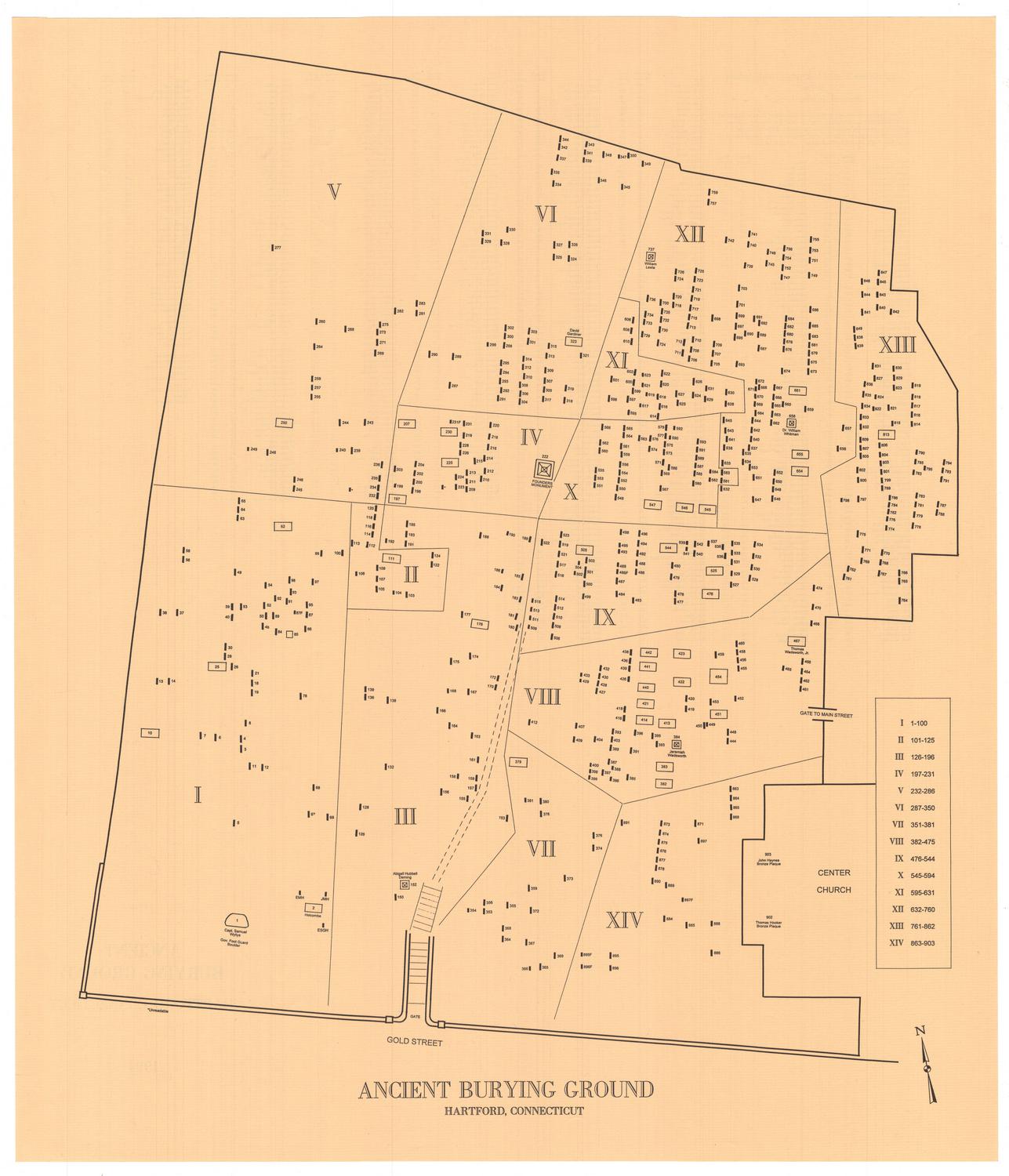
Ye Burying Place
DraftsmanCompiled by
Albert L. Washburn
(American, 1857 - 1948)
Date1899
MediumDrawing; graphite, black ink, and colored chalk on wove paper on fabric backing
DimensionsPrimary Dimensions (image height x width): 56 3/4 x 57 1/2in. (144.1 x 146.1cm)
Sheet (height x width): 58 x 60 7/8in. (147.3 x 154.6cm)
ClassificationsGraphics
Credit LineGift of Albert L. Washburn
Object number1899.18.0
DescriptionPlan of the Ancient Burying Ground in Hartford, Connecticut. The map is oriented with north to the right; Lewis Street is on the west, Main Street on the east, and Gold Street on the south. The maps shows when different parcels of land were acquired by the city of Hartford and gives the names of the previous owners and the dates of the transactions. The location of the first meeting house, an eighteenth century schoolhouse, and the nineteenth-century Waverly Building are shown. The map also shows the buildings that were torn down in the process of widening Gold Street in the 1890s.
Label TextAlbert L. Washburn donated this map of Hartford's Ancient Burying Ground to the Connecticut Historical Society in 1899, the same year in which he compiled it, basing his drawing on old land records, copies of which he donated at the same time. The map shows the many changes that took place in the property between the seventeenth century, when the land was first set aside for burial purposes, and the end of the nineteenth century, when Gold Street, which borders the Burying Ground on the south, was widened.
NotesCartographic Note: One inch equals 10 feetStatus
Not on view