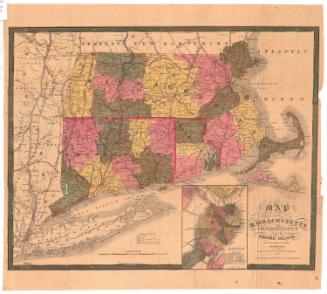
12,000 Square Miles around New York City from New Haven to Trenton, from Long Branch to the Catskills
PublisherPublished by
H. H. Lloyd & Co.
(American, 1860 - 1878)
Date1866
MediumLithography; black printer's ink and watercolor on wove paper, in cardboard covers
DimensionsPrimary Dimensions (section a, image height x width): 25 1/4 x 36in. (64.1 x 91.4cm)
Sheet (section a, height x width): 26 3/4 x 38 1/2in. (67.9 x 97.8cm)
Primary Dimensions (section b, image height x width): 25 x 36 1/4in. (63.5 x 92.1cm)
Sheet (section b, height x width): 26 1/2 x 38 1/2in. (67.3 x 97.8cm)
ClassificationsGraphics
Credit LineGift of Mrs. Ruth Newcombe
Object number1960.145.0a,b
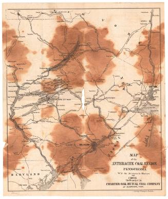
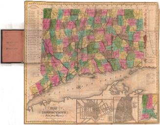
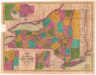
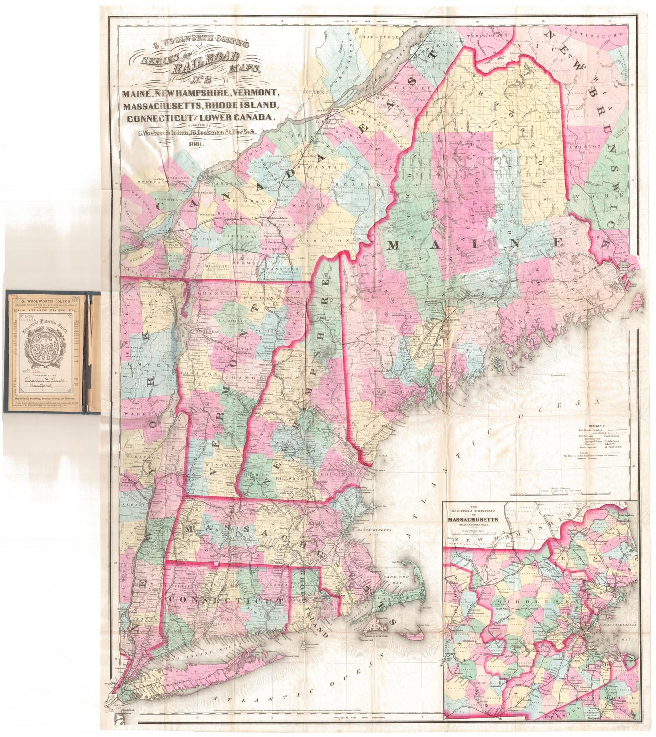
DescriptionPocket maps depicting the area 12,000 miles north and east of New York City, with Canaan, Connecticut to the north, the western edge of Hartford County to the east, Trenton, New Jersey to the south, and Port Jervis, New York to the west. The state boundaries are marked in thick pink lines, and county divisions are marked with thinner pink lines. The states are further divided into towns, which are colored pink, yellow, blue or green. Railroad lines are prominently depicted in black, including the New York and Erie; Hudson River; Camden and Amboy; Long Island; New York and Harlem; New York and New Haven; Danbury and Norwalk; Housatonic; Naugatuck; and Hartford, Providence and Fishkill. Canals or aqueducts, cemeteries, blacksmith shops, wheelwrights, and grist and saw mills are also represented on the map. Physical features include elevation, conveyed with hachure marks; swamps and marshes; rivers; and lakes and ponds.
Label TextMost pocket maps were meant for use by travelers, because of their convenient format, which allowed them to be carried in a pocket and unfolded for consultation as needed. Most pocket maps,however, assume a general audience. A traveler might purchase a map either before leaving home or after he reached his destination. This map published in New York City, was obviously intended primarily for use by New Yorkers, and would have been sold primarily in and very near that city. New York is at its center, and it clearly shows those cities such as New Haven and Trenton, and resorts such as the Catskills, and Long Branch, that lay within easy reach by railroad.
NotesCartographic Note: Scale: 1 inch equals 2 1/2 miles; 1:158400Status
Not on view