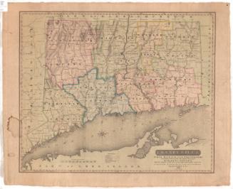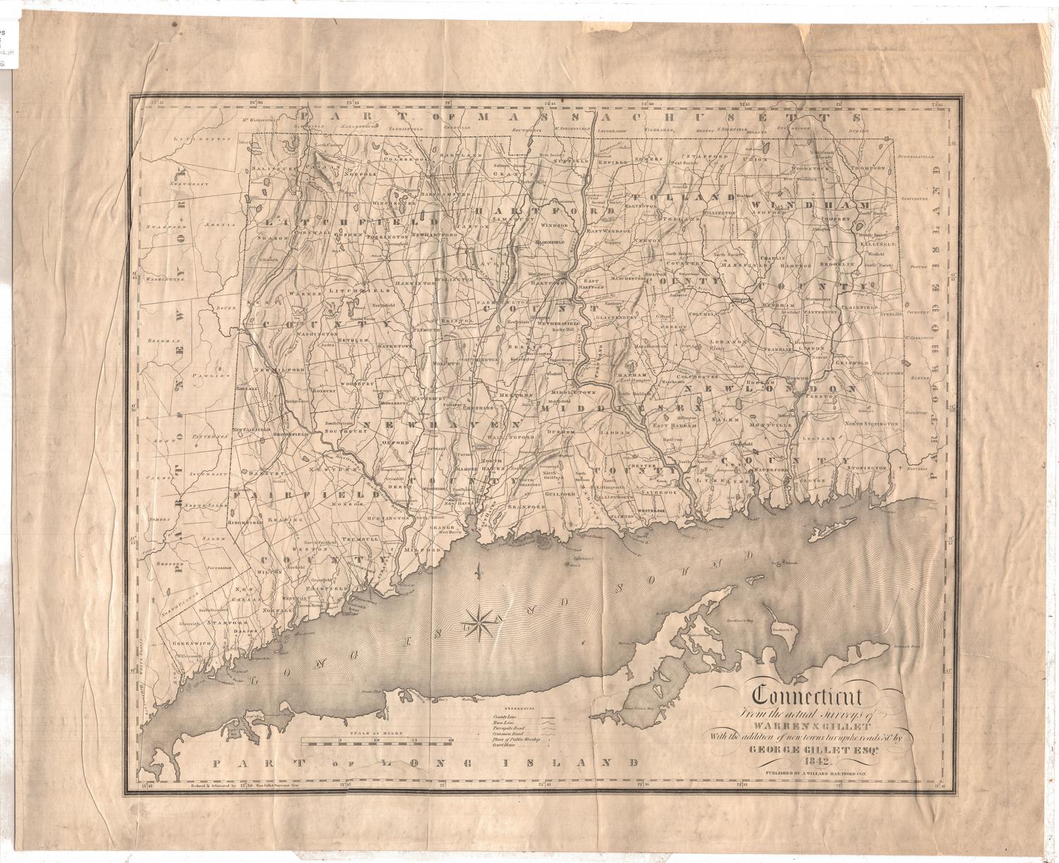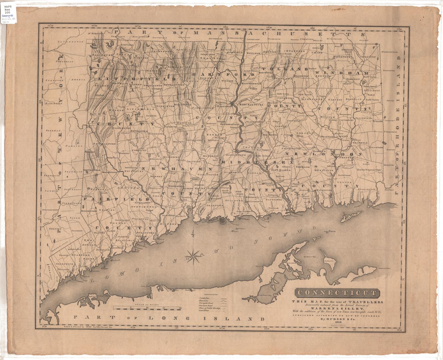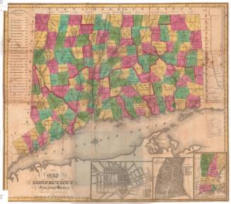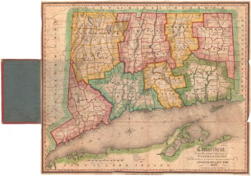
Connecticut from the Actual Surveys of Warren & Gillet
After a work byAfter a work by
Moses Warren Jr.
(1762 - 1835)
After a work byAfter a work by
George Gillet
(American, 1771 - 1853)
SurveyorSurveyed by
George Gillet
(American, 1771 - 1853)
DraftsmanDrawn by
George Gillet
(American, 1771 - 1853)
PublisherPublished by
Asaph Willard
(1786 - 1880)
Date1829
MediumEngraving; black printer's ink and watercolor on wove paper, in cardboard covers
DimensionsPrimary Dimensions (image height x width): 17 3/8 x 21 1/4in. (44.1 x 54cm)
Sheet (height x width): 17 5/8 x 21 1/2in. (44.8 x 54.6cm)
ClassificationsGraphics
Credit LineMuseum purchase
Object number1960.143.1
DescriptionMap of the state of Connecticut, with part of Massachusetts to the north, part of Rhode Island to the east, part of Long Island and the Long Island Sound to the south, and part of New York to the west. The state is divided into counties, outlined red, yellow, blue or green, and towns, outlined the same color as the county to which they belong. Physical features depicted include elevation, conveyed with hachure marks; rivers; and lakes/ponds. Turnpikes and local roads are shown, as are houses of worship and courthouses.
Label TextGeorge Gillet was the Connecticut State Surveyor General, and the various editions of Connecticut from the Actual Surveys which he continuously updated between the 1810s and the early 1840s are the closest thing to an "official" Connecticut state map. They are certainly the most authoritative maps of Connecticut produced during this period and they provided the basis for many other maps. It is rare to find such a large map issued as a folding pocket map, perhaps because large maps in this format rarely survived being folded and unfolded in the course of use.
NotesCartographic Note: Scale: 1 inch equals about 5 milesStatus
Not on view