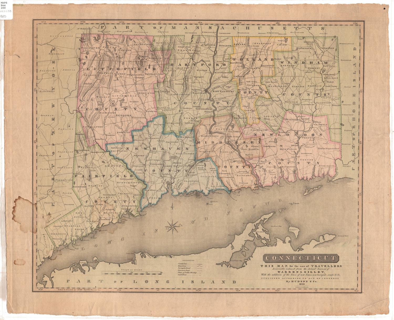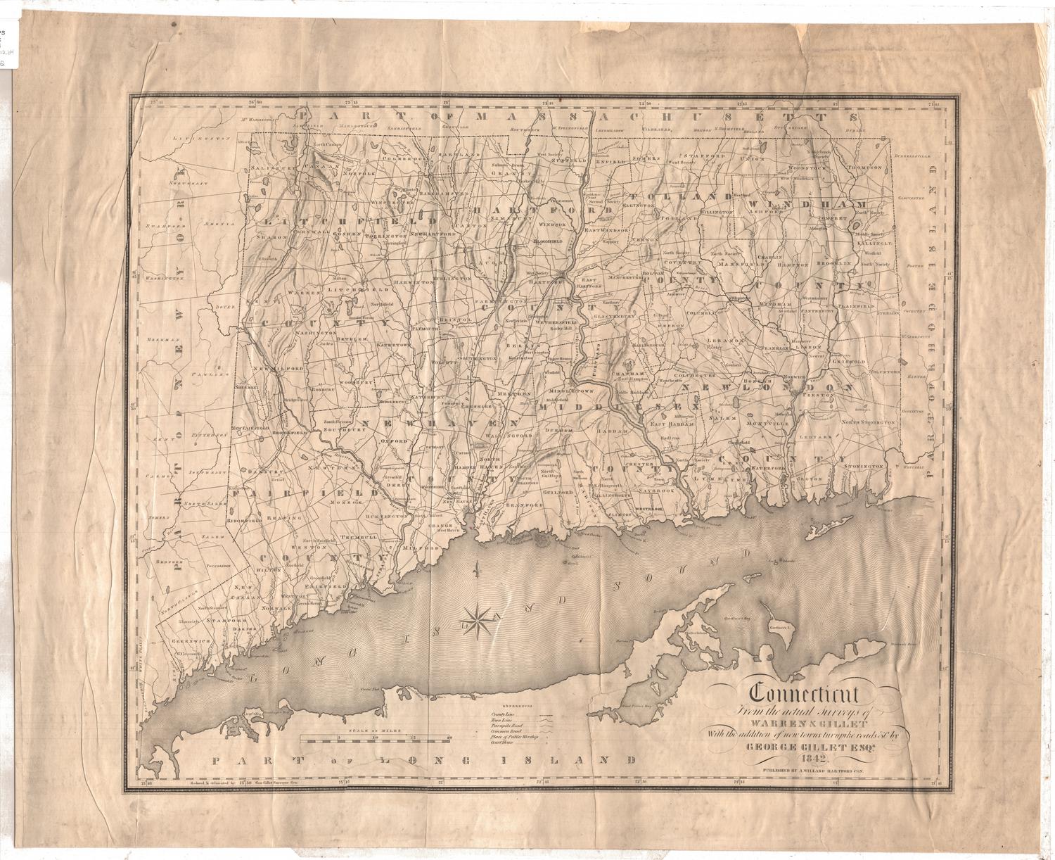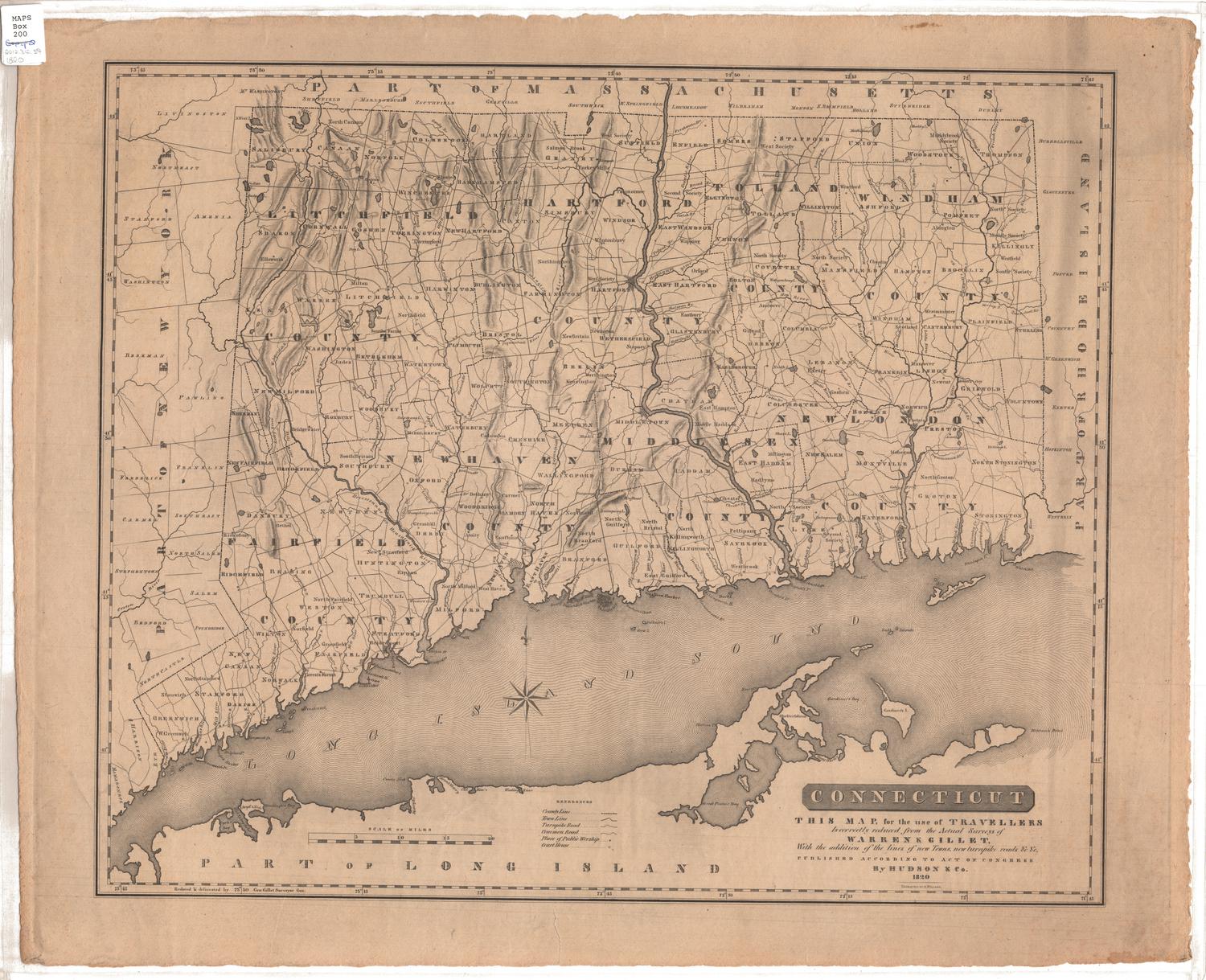
Connecticut from the Actual Surveys of Warren & Gillet
After a work byAfter a work by
Moses Warren Jr.
(1762 - 1835)
After a work byAfter a work by
George Gillet
(American, 1771 - 1853)
SurveyorSurveyed by
George Gillet
(American, 1771 - 1853)
DraftsmanDrawn by
George Gillet
(American, 1771 - 1853)
PublisherPublished by
Asaph Willard
(1786 - 1880)
Date1829
MediumEngraving; black printer's ink and watercolor on wove paper, in cardboard covers
DimensionsPrimary Dimensions (image height x width): 17 3/8 x 21 1/4in. (44.1 x 54cm)
Sheet (height x width): 17 5/8 x 21 1/2in. (44.8 x 54.6cm)
Sheet (height x width): 17 5/8 x 21 1/2in. (44.8 x 54.6cm)
ClassificationsGraphics
Credit LineMuseum purchase
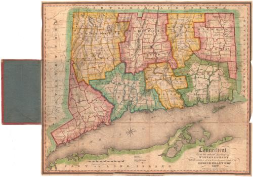
DescriptionMap of the state of Connecticut, with part of Massachusetts to the north, part of Rhode Island to the east, part of Long Island and the Long Island Sound to the south, and part of New York to the west. The state is divided into counties, outlined red, yellow, blue or green, and towns, outlined the same color as the county to which they belong. Physical features depicted include elevation, conveyed with hachure marks; rivers; and lakes/ponds. Turnpikes and local roads are shown, as are houses of worship and courthouses.
Object number1960.143.1
NotesCartographic Note: Scale: 1 inch equals about 5 milesOn View
Not on view