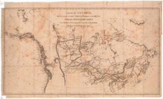
The World
PublisherPublished by
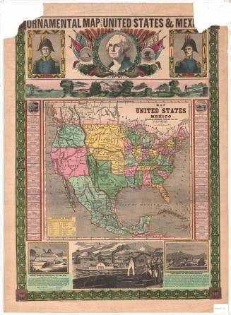
Joseph Hutchins Colton
(American, 1800 - 1893)
Date1851
MediumLithography; black printer's ink and watercolor on wove paper, lined with linen, in paper covers
DimensionsPrimary Dimensions: 22 1/4 x 27 1/8in. (56.5 x 68.9cm)
Sheet: 23 1/4 x 27 7/8in. (59.1 x 70.8cm)
Mount: 23 1/4 x 27 7/8in. (59.1 x 70.8cm)
ClassificationsGraphics
Credit LineConnecticut Museum of Culture and History collection
Object number1957.82.0
DescriptionPocket map of the world, with inset maps of the District of Columbia, Palestine, Monrovia, Liberia, Pitcairn Island, Juan Fernandez, Norfolk Island, and the Sandwich Islands. Countries are outlined in pink. Physical features are include elevation, conveyed with hachure marks; rivers; lakes; and islands. Exploration routes are shown in a variety of lines, and many of them are annotated with information about the explorer and his findings. Next to many of the islands in the South Pacific are notes about their land quality and/or whether they are inhabited. The borders are decorated with grapes and grape leaves.
Label TextJ. H. Colton worked briefly as a postal clerk in Hartford, Connecticut before moving to New York City, where he founded J. H, Colton & Co. about 1831. The Colton company published atlases, guidebooks, immigrant and tourist maps, and railroad maps. It is a little hard to imagine how one would have used a folding pocket map of the world, since such pocket maps were generally intended for travelers and were used to help them find their way. The map has the kind of elaborate decorative border for which the Colton firm was known.
NotesCartographic Note: No scaleStatus
Not on view