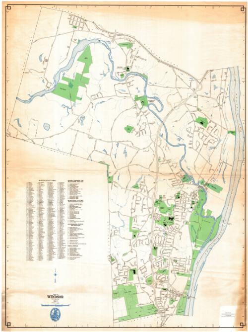
Town of Windsor, Connecticut
MakerPrepared by the
Metropolitan District Commission
(American, founded 1929)
Date1977
MediumLithography; colored printer's inks on wove paper
DimensionsPrimary Dimensions (image height x width): 47 x 35in. (119.4 x 88.9cm)
Sheet (height x width): 47 3/4 x 36in. (121.3 x 91.4cm)
Sheet (height x width): 47 3/4 x 36in. (121.3 x 91.4cm)
ClassificationsGraphics
Credit LineConnecticut Museum of Culture and History collection
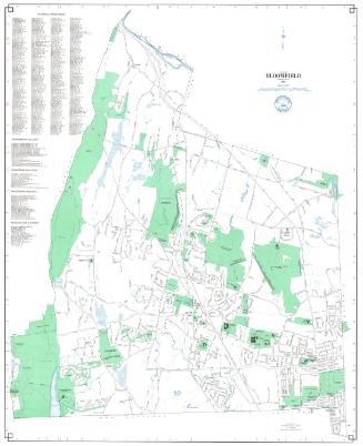
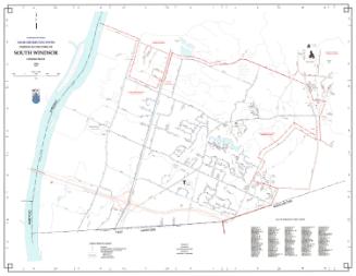
DescriptionMap of the town of Windsor, Connecticut with East Granby and Windsor Locks to the north, the Connecticut River to the east, Hartford to the south, and Bloomfield and East Granby to the west. Highways and local roads are shown and named. Cemeteries, historic sites, parks, and schools are shown. Open space is green. The Connecticut River, the Farmington River, and other streams and ponds are blue. The MDC Poquonock Water Pollution Control Plant and the Town of Windsor Sanitary Landfill are both shown. A street index and a key to educational facilities; recreational, cultural, and historic places; and government offices is at lower left. A compass is at upper right.
Object number1988.221.0
NotesCartographic Note: One inch equals 1000 feetOn View
Not on view